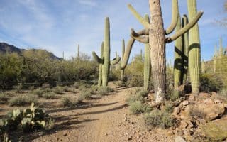
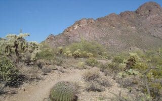
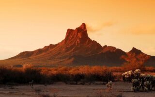
Saguaro National Park in Tuscon is a popular national park near Tucson featuring the largest cacti in the United States, mountains, and stunning desert scenery. Saguaro National Park is divided into two sections: Saguaro National Park East is 15 miles east of downtown, in the Rincon Mountain District; and Saguaro National Park West, in the Tuscon Mountains, is about 15 miles west of downtown. This post is focused on the best places to run in Park East. PRO TIP: Special in wildflower season!
Park East features a good choice of flatter, rolling hills, or challenging trail runs. All but the easiest trails have tougher footing.
Easier Trails For Running: Park East
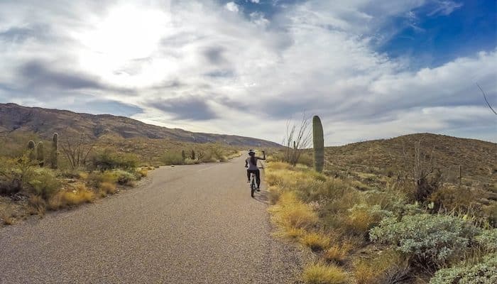
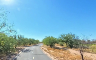
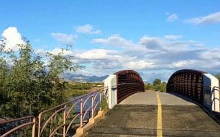
- Cactus Forest Drive. This is a paved ‘scenic drive’ that is also open to pedestrians. The road runs through the heart of the saguaro forest, with sweeping desert vistas in the foothills of the Rincon mountains. Start at the Visitor Center and run clockwise. Note that the road does not have a shoulder, though cars are limited to 15 mph. There are a couple of steep hills.
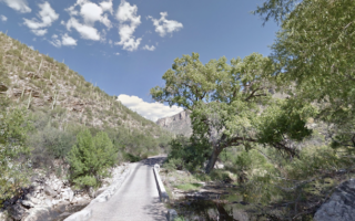
- Cactus Forest Trail: Located inside Cactus Forest Drive. Wind through sections of giant saguaro, with views of the desert and the Santa Catalina mountains. You’ll pass the remains of two lime kilns that date to the 18th century. The trail is relatively flat, with decent footing – though it is a trail run. It’s 5 miles out & back. The southern trailhead is near the Visitor Center.
- Combine Desert Ecology Trail & Micah View/Cactus Forest Trail, near the Visitor Center.
- Also: Freeman Homestead Trail (1 mile), Mica View Picnic Area Rd. (1 mile) Loma Verde Loop (3.8 miles), Hope Camp and Ridgeview Trail (2 miles).
Recommended Trail Run
A well-known ‘East Loop’ route of 8.3 miles, with several options for branching off to other trails, is highly recommended by employees at the TriSports shop, located in central Tucson. The route incorporates the Carillo, Three Tank, and Douglas Springs trails, around Mica Mountain, running through a forest of saguaros. With several steep hills, and one large 1.5 mile climb, this route is geared more towards advanced or experienced trail runners. NOTE: The park map in this post is what is available in digital format and combines Park East & West. A more detailed trail map is available in the Visitor Center.
Saguaro National Park in Tuscon is a popular national park near Tucson featuring the largest cacti in the United States, mountains, and stunning desert scenery. Saguaro National Park is divided into two sections: Saguaro National Park East is 15 miles east of downtown, in the Rincon Mountain District; and Saguaro National Park West, in the Tuscon Mountains, is about 15 miles west of downtown. This post is focused on the best places to run in Park East. PRO TIP: Special in wildflower season!
Park East features a good choice of flatter, rolling hills, or challenging trail runs. All but the easiest trails have tougher footing.
Easier Trails For Running: Park East
- Cactus Forest Drive. This is a paved ‘scenic drive’ that is also open to pedestrians. The road runs through the heart of the saguaro forest, with sweeping desert vistas in the foothills of the Rincon mountains. Start at the Visitor Center and run clockwise. Note that the road does not have a shoulder, though cars are limited to 15 mph. There are a couple of steep hills.
- Cactus Forest Trail: Located inside Cactus Forest Drive. Wind through sections of giant saguaro, with views of the desert and the Santa Catalina mountains. You’ll pass the remains of two lime kilns that date to the 18th century. The trail is relatively flat, with decent footing – though it is a trail run. It’s 5 miles out & back. The southern trailhead is near the Visitor Center.
- Combine Desert Ecology Trail & Micah View/Cactus Forest Trail, near the Visitor Center.
- Also: Freeman Homestead Trail (1 mile), Mica View Picnic Area Rd. (1 mile) Loma Verde Loop (3.8 miles), Hope Camp and Ridgeview Trail (2 miles).
Recommended Trail Run
A well-known ‘East Loop’ route of 8.3 miles, with several options for branching off to other trails, is highly recommended by employees at the TriSports shop, located in central Tucson. The route incorporates the Carillo, Three Tank, and Douglas Springs trails, around Mica Mountain, running through a forest of saguaros. With several steep hills, and one large 1.5 mile climb, this route is geared more towards advanced or experienced trail runners. NOTE: The park map in this post is what is available in digital format and combines Park East & West. A more detailed trail map is available in the Visitor Center.


Review or Comment on This Route/Share a Photo!
Share your feedback on this route and see that of other Great Runs users. Click on the image icon to upload a photo. And please let us know if there are notes or changes we should incorporate!