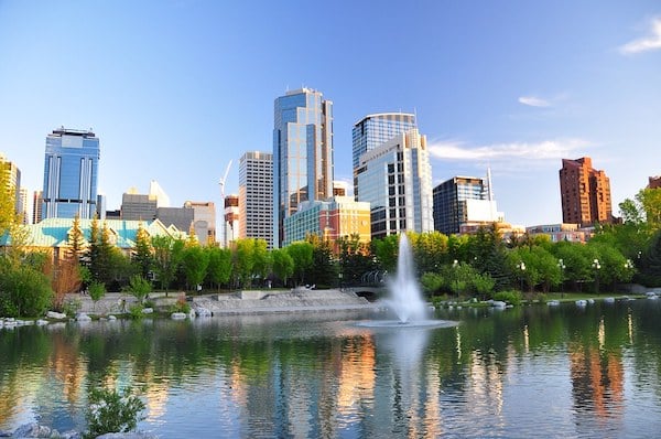
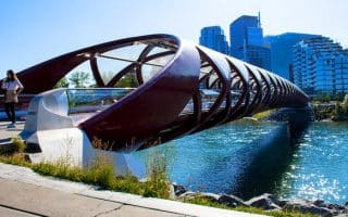
There are a wealth of running options accessible right from downtown Calgary. There are numerous parks, the Riverwalk, and the Bow and Elbow River pathways — all connected by numerous bridges. We’ve put together a few suggested loop options. For more, consult our Bow River and Elbow River routes.
Downtown Parks 10k. We’ve put together this route combining several parks in the downtown area, mainly west of Centre St. It’s neatly all on multi-use trails. From Centre St., head north across the bridge and take the path for 4 km, connecting Rotary Park, Sunnyside Park, the hill to McHugh Bluff, and Riley Park. Then head south on the path paralleling 9a St. NW toward the Bow River. Take the Bow River Pathway for 1 km through Poppy Plaza, cross the 14th St. NW bridge to the south bank of the river, and then run on the river path east for 3 km, passing through Eau Clair Park and then doing a loop around Prince’s Island Park.
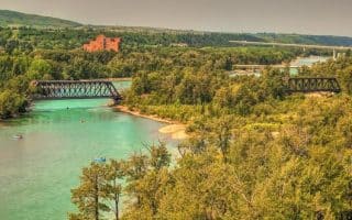
Tom Campbell’s Hill Natural Park. Creative Commons
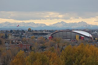
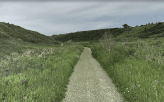
Downtown East 10k Loop. This route explores the parks and river paths east of Centre St. It’s up to 10k but can be shortened. From Centre St., head east on the Riverwalk path for 1.2 km. Take the George C. King pedestrian bridge across the Bow River, do a 1.3 loop around St. Patrick’s Island Park, and continue on the bridge to the north side of the river. Head east along the Bow River Pathway for 1 km, turning left at 12th St., and head into Tom Campbell’s Hill Natural Park. Enjoy a ~70m climb, with great skyline views as the reward! For the final section, take the Bow River Pathway west for 3 km to the Bow River Pathway Bridge at Memorial Dr., passing through Mount Pleasant and Sunnyside Bank Park. Cross through Prince’s Island Park back to Centre St.
Prince’s Island Park/Eau Claire Park 5k. A fun lunchtime loop! From Eau Claire Market, do a loop around Prince’s Island Park, then take the Bow River Pathway along the north side of the Bow River to the bridge that crosses back over the river to Eau Claire Park, returning east.
There are a wealth of running options accessible right from downtown Calgary. There are numerous parks, the Riverwalk, and the Bow and Elbow River pathways — all connected by numerous bridges. We’ve put together a few suggested loop options. For more, consult our Bow River and Elbow River routes.
Downtown Parks 10k. We’ve put together this route combining several parks in the downtown area, mainly west of Centre St. It’s neatly all on multi-use trails. From Centre St., head north across the bridge and take the path for 4 km, connecting Rotary Park, Sunnyside Park, the hill to McHugh Bluff, and Riley Park. Then head south on the path paralleling 9a St. NW toward the Bow River. Take the Bow River Pathway for 1 km through Poppy Plaza, cross the 14th St. NW bridge to the south bank of the river, and then run on the river path east for 3 km, passing through Eau Clair Park and then doing a loop around Prince’s Island Park.
Tom Campbell’s Hill Natural Park. Creative Commons
Downtown East 10k Loop. This route explores the parks and river paths east of Centre St. It’s up to 10k but can be shortened. From Centre St., head east on the Riverwalk path for 1.2 km. Take the George C. King pedestrian bridge across the Bow River, do a 1.3 loop around St. Patrick’s Island Park, and continue on the bridge to the north side of the river. Head east along the Bow River Pathway for 1 km, turning left at 12th St., and head into Tom Campbell’s Hill Natural Park. Enjoy a ~70m climb, with great skyline views as the reward! For the final section, take the Bow River Pathway west for 3 km to the Bow River Pathway Bridge at Memorial Dr., passing through Mount Pleasant and Sunnyside Bank Park. Cross through Prince’s Island Park back to Centre St.
Prince’s Island Park/Eau Claire Park 5k. A fun lunchtime loop! From Eau Claire Market, do a loop around Prince’s Island Park, then take the Bow River Pathway along the north side of the Bow River to the bridge that crosses back over the river to Eau Claire Park, returning east.
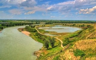
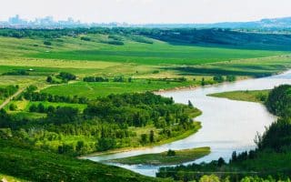
Paved, 48 km path along the Bow River is one of the signature running spots in Calgary. We've divided the route into two sections. Most of the trail passes though parks, and the terrain is quite open.
Another signature running spot in Calgary. Mainly paved, 11 km path between Fort Calgary and Glenmore Reservoir. A combination of parks, grassland/prairie, and some wooded sections. Some nice water views.
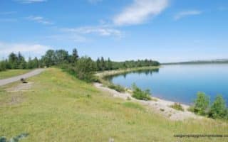
One of Calgary’s classic runs. A paved multi-use path follows the reservoir for a 14 km loop, passing through several parks. Mix of open & wooded terrain, and water views in sections. Can connect to the Elbow River paths at the north end.
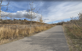
Among the largest urban parks in Canada, stretching 20 km from west to east. There 30 km of paved trails and 50 km of unpaved trails. The west side trails are more shaded, and the east side more prairie-like. Beautiful in fall!
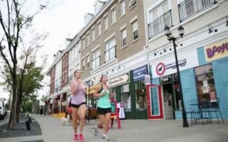
Marda Loop is one of Calgary’s most popular outdoor shopping venues. This is a great city run with lots of sights and good people watching, restaurants, coffee houses, and businesses.
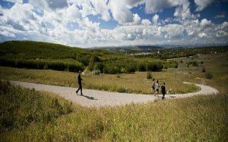
Extensive trail system in this hilly park 5 miles north of downtown. One of the most significant examples of the grassland ecosystem left on the Canadian prairies with great vistas from the plateau.
Scenic running through grassland/prairie just west of Calgary Airport along the Nose Creek Parkway, through several parks. Another option is the Nose Creek Pathway, which runs between the Telus Center and Confluence Park.
In northwest Calgary, enjoy scenic paths through several attractive parks: Bowness Park, Bownont Park, & Twelve Mile Coulee, connected by the Bow River Pathway.
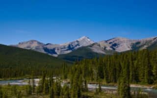
3200 acres or ranch land 30 miles west of Calgary, with gorgeous views of the snow-covered Rocky Mountains, the Calgary skyline, and an active ranch with cows and horses. 15+ miles of well marked trails.
Situated in the foothills of the Rocky Mountains, Bragg Creek is a charming hamlet about 30 minutes west of downtown Calgary. Extensive trail network with many running options.
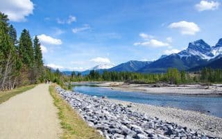
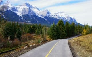
Located between Calgary and Banff, Canmore is an outdoor recreation mecca. Best bets for running are the 6.7 km Three Sisters Pathway, the Bow River Loop Trail, and the Rocky Mountain Legacy Trail. Good options for more challenging trail running as well.
Paralleling the Trans Canada Highway, built in honor of Banff National Park’s 125th Anniversary. A gorgeous, relatively flat trail with fabulous views, popular with runners and cyclists. The southern terminus of the trail is at the Alberta Visitors’ Center in Canmore.
Share your feedback on this route and see that of other Great Runs users. Click on the image icon to upload a photo. And please let us know if there are notes or changes we should incorporate!
Subscribe
0 Comments
Oldest
Newest
Inline Feedbacks
View all comments
Essentials
Depends on route chosen
Generally Flat
Centre St. or Eau Claire Market are two good start points


Review or Comment on This Route/Share a Photo!
Share your feedback on this route and see that of other Great Runs users. Click on the image icon to upload a photo. And please let us know if there are notes or changes we should incorporate!