There are some wonderful opportunities to run among the redwoods in the Crescent City area. Del Norte Coast Redwoods State Park & Jedediah Smith Redwoods State Park, part of the massive Redwood National & State Parks system, are located near Crescent City. The running options are a mix of easier and more challenging trails, plus some old forest roads that are good for running. Here are our recommendations. For more in the area, see our Redwoods National Park post. NOTE: Some trails are summer only — you’ll see on the park brochure bridges that are installed in summer.
Del Norte Coast Redwoods State Park
- Mill Area Logging Roads. From the Former Mill Site Parking Area off Hamilton Road, there are numerous old logging roads that make for some of the easier running options in Del Norte SP. Shown as purple ‘multi-use trails’ on the park map.
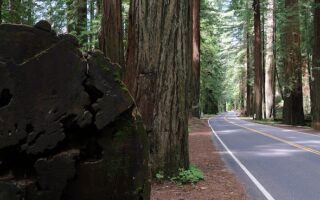
- Coastal Trail. Also steep & strenuous. Beautiful coastal trail. A good section for running is from Milepost 16 (intersection with Damnation Creek Trail) headed south.
- Damnation Creek Trail is steep and strenuous. Intersects with Coastal Trail at Milepost 16 headed south
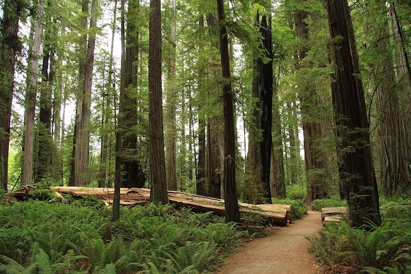
Jedediah Smith Redwoods State Park
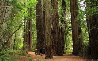
- Howland Hill Rd. This 10-mile unpaved road passes through the center of Jedediah Smith Redwoods and is one of the world’s best redwood drives. From the south, the road climbs steeply into the park.
- Boy Scout Tree Trail (Jedediah Smith SP). 5.5 miles out and back. Moderate trail with good surface featuring old-growth redwoods, riparian corridor, Fern Falls. Can combine with a section of the 10-mile Howland Hill Rd.
- Mill Creek Trail. 4.8 mile trail, 300 foot gain. A nice trail for running, connecting Jedediah Smith’s best groves, Stout Grove and the Grove of Titans. Renovated in 2022, making it wider & easier for running. NOTE: Summer only.
Coastal Trail
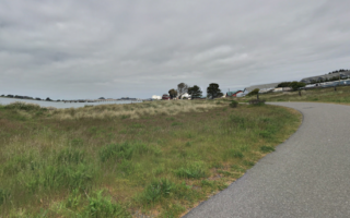
South of Endert Beach, trail runners can enjoy the scenic, hilly Coastal Trail, part of Jedediah Smith Redwoods State Park. It’s up to 20.5 miles south to Klamath. The trail alternates between sections with coastal views and more interior sections. This is challenging trail running, with areas of difficult footing. A good section for running is from Milepost 16 (intersection with Damnation Creek Trail) headed south. ROUTE MAP (north to south).


Review or Comment on This Route/Share a Photo!
Share your feedback on this route and see that of other Great Runs users. Click on the image icon to upload a photo. And please let us know if there are notes or changes we should incorporate!