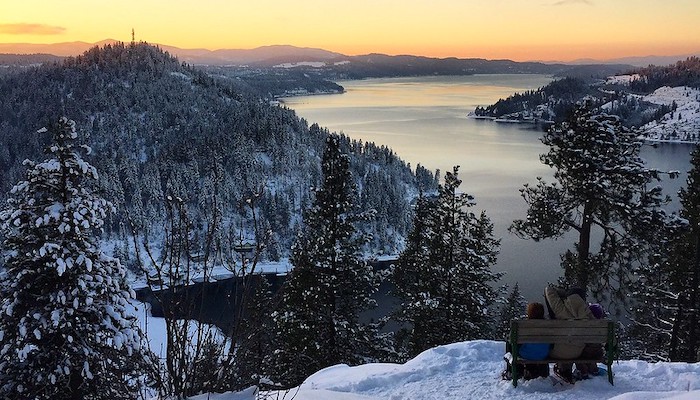
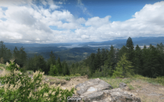
Mineral Ridge is one of the go-to trail runs near Coeur d’Alene. The trail leads to the top of a ridgeline, offering spectacur views of Lake Coeur d’Alene. The trailhead is located just off Rt. 97 about 11 miles east of Coeur d’Alene. Though it’s only about 2 miles round-trip, the moderate elevation gain makes this trail quite the workout. There are also interpretive signs scattered along the trail to keep your run interesting and educational. Most runners access the trail from the trailhead at a parking are off Route 97, near Beauty Bay. However, the Wilson and Lost Man Trails also meet the Mineral Ridge Trail from the west side.
BLM Idaho
Features:
Scroll Down For Route Maps
More Coeur d'Alene, ID Routes BelowCurrent Weather & Forecast

Coeur d'Alene, US
12:52 pm,
Jul 8, 2026
L: 27°
H: 29°
Daily ForecastHourly Forecast
Today
2:00 pm
27° / 29°°C
0 mm
0%
11 mph
62 %
1018 mb
0 mm/h
Tomorrow
2:00 pm
23° / 33°°C
0.53 mm
53%
11 mph
82 %
1021 mb
0 mm/h
Friday
2:00 pm
25° / 34°°C
0.96 mm
96%
10 mph
87 %
1020 mb
0 mm/h
Saturday
2:00 pm
25° / 33°°C
1 mm
100%
16 mph
81 %
1021 mb
0 mm/h
Sunday
2:00 pm
24° / 33°°C
1 mm
100%
12 mph
91 %
1020 mb
0 mm/h
Today
2:00 pm
33° / 34°°C
0 mm
0%
11 mph
62 %
1018 mb
0 mm/h
Today
5:00 pm
30° / 33°°C
0 mm
0%
10 mph
64 %
1018 mb
0 mm/h
Today
8:00 pm
26° / 28°°C
0.38 mm
38%
3 mph
68 %
1019 mb
0 mm/h
Today
11:00 pm
23° / 23°°C
0.53 mm
53%
7 mph
82 %
1018 mb
0 mm/h
Tomorrow
2:00 am
24° / 24°°C
0 mm
0%
4 mph
82 %
1018 mb
0 mm/h
Tomorrow
5:00 am
26° / 26°°C
0 mm
0%
4 mph
76 %
1020 mb
0 mm/h
Tomorrow
8:00 am
30° / 30°°C
0 mm
0%
8 mph
61 %
1021 mb
0 mm/h
Other Routes in Coeur d'Alene, ID
The cornerstone of running in Coeur d’Alene. This paved multi-use path wraps around the lakeside for great views, stretching west into Washington. Floating Boardwalk is a highlight! We've mapped 10.5 miles of 24 miles, can add w/Prairie Trail.
A great easy trail running option close to the center of the city. This ~2 mile loop on a gravel path wraps around the lakeside. More extension opportunities throughout the park. For a challenge, tackle the summit!
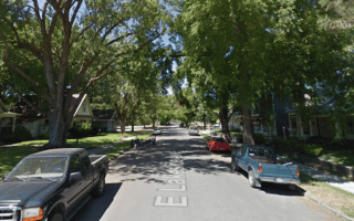
It's fun to explore Coeur d'Alene's downtown area with a run. Sherman Ave. is the main commercial drag. Adjacent to downtown, we've pointed out some of the more attractive residential streets for running. Avenues run E-W and numbered streets N-S.

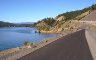
Paved, 73-mile multi-use trail following a former rail line from Plummer to Mulan. Very scenic, meandering through the historic Silver Valley, along the Coeur d’Alene River past scenic Lake Coeur d’Alene and through rolling farmlands. The Chatcolet Bridge is a highlight!
There are lots of trail running options around the Idaho Panhandle National Forest, but Canfield Mountain is one of the most popular. We’ve mapped a gentle 5.4 mile route to “The Island” and back. A hilly route, climbing 1,000+ feet!
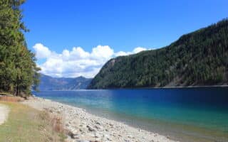
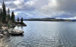
This beautiful state park to the northeast of Coeur d’Alene is a popular camping and recreation destination. There are over 45 miles of runnable trails, including The Buggy Trail and The Beaver Bay Shoreline Trail.
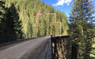
One of the most scenic rail trails in the United States, the route is along a former rail line that's now 15-mile gravel path, featuring 10 train tunnels and 7 sky-high trestles. It's set up so bikers (or ambitious runners!) can do the route one way and take a shuttle back!
User Ratings
Leave A Review or Comment
Review or Comment on This Route/Share a Photo!
Share your feedback on this route and see that of other Great Runs users. Click on the image icon to upload a photo. And please let us know if there are notes or changes we should incorporate!