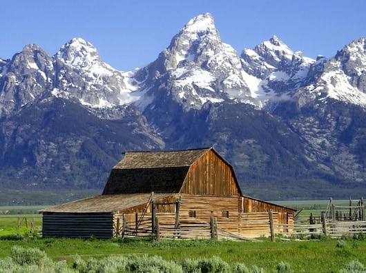
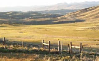
Showcasing the major peaks of the 40-mile-long Teton Range as well as most of the northern sections of the valley known as Jackson Hole, Grand Teton National Park is located 10 miles south of Yellowstone in northwestern Wyoming. Grand Teton National Park is named for the tallest mountain in the Teton Range. At 13,775 feet, Grand Teton abruptly rises more than 7,000 feet above Jackson Hole. The park includes over 200 miles of hiking trails and is world-renowned for trout fishing. Here are some of the best options for running in the park. There’s also the paved,
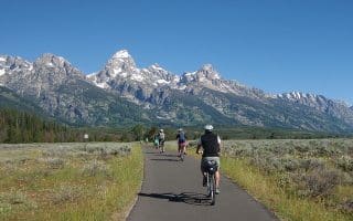
Multi-Use Path from Jackson to Jenny Lake — see separate post. Nearly 20 mile paved path.
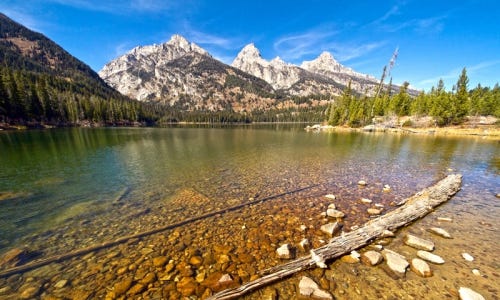
Jenny Lake Loop. A moderate trail run. The Jenny Lake Loop is a 7.1 mi (11.4 km) loop hike with 1,040 ft (320 m) of elevation gain with an average slope of 6%. The trail is dirt, narrow in sections, and features obstacles such as roots, exposed rock, and slight elevation change. Beautiful lake & mountain views. Map of area.
Phelps Lake. About 4 miles north of Teton Village, Phelps Lake is part of the Laurance S. Rockefeller Preserve. Take Moose Wilson Rd. (parts closed Nov.-May), and from the road, walk/run 0.75 miles to the trailhead. It’s 4.25 miles around the lake on a fairly well worn trail. Hilly, with elevation gain of 500 feet. Some good lake and mountain views. It’s recommended to run counter-clockwise, and it’s prettiest in the mornings. The adventurous can hike/walk/run to Phelps Lake on a trail from Teton Village. Additional info from Teton Trails.
The Taggart Lake Trail is a relatively easy route with great views of the Tetons. The well-packed dirt surface and minimal elevation gain (400 ft.) make it a great run. From the trailhead parking lot, the first 1.5 miles are flat and lead you through an open alpine meadow to Taggart Lake. As you continue, the path gains some elevation as it enters a forested areas, with colorful aspens and evergreen trees. When you see a turn off for Valley trail, you have completed all of your elevation gain. Continue on the Taggart Lake Trail to loop around back to the start.
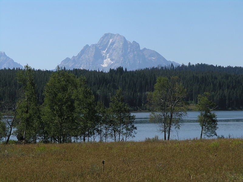
Away from some of the more crowded areas in Grand Teton National Park, lies a 6 mile loop around Two Ocean Lake. The path is well-packed dirt and rock with rolling terrain. As you begin, pass through a large field that offers good views of Grand Teton and Mt. Moran in the far off distance. Along the route, there are openings along the lakeshore, with great mountain views. Pass several sagebrush, grassy meadows, aspen groves, and keep an eye out for common loons, osprey, and trumpeter swans.
Just before the 3.5 mile mark, the trail reaches the South Two Ocean Lake Trail junction, which branches off to the left. Here, there is a highly recommended side trip (about 1 mile one-way climbing 635 ft) from the west end of the lake to Grand View Point, with great views of the surrounding area.
The loop continues through some dense forest. Throughout this section remember your bear safety and make noise to announce your presence. Toward the end of the run is a large meadow that arguably offers the best views of Two Ocean Lake from its southern shore. Note: This route is known for high bear activity. Make sure you are prepared!
Showcasing the major peaks of the 40-mile-long Teton Range as well as most of the northern sections of the valley known as Jackson Hole, Grand Teton National Park is located 10 miles south of Yellowstone in northwestern Wyoming. Grand Teton National Park is named for the tallest mountain in the Teton Range. At 13,775 feet, Grand Teton abruptly rises more than 7,000 feet above Jackson Hole. The park includes over 200 miles of hiking trails and is world-renowned for trout fishing. Here are some of the best options for running in the park. There’s also the paved,
Multi-Use Path from Jackson to Jenny Lake — see separate post. Nearly 20 mile paved path.
Jenny Lake Loop. A moderate trail run. The Jenny Lake Loop is a 7.1 mi (11.4 km) loop hike with 1,040 ft (320 m) of elevation gain with an average slope of 6%. The trail is dirt, narrow in sections, and features obstacles such as roots, exposed rock, and slight elevation change. Beautiful lake & mountain views. Map of area.
Phelps Lake. About 4 miles north of Teton Village, Phelps Lake is part of the Laurance S. Rockefeller Preserve. Take Moose Wilson Rd. (parts closed Nov.-May), and from the road, walk/run 0.75 miles to the trailhead. It’s 4.25 miles around the lake on a fairly well worn trail. Hilly, with elevation gain of 500 feet. Some good lake and mountain views. It’s recommended to run counter-clockwise, and it’s prettiest in the mornings. The adventurous can hike/walk/run to Phelps Lake on a trail from Teton Village. Additional info from Teton Trails.
The Taggart Lake Trail is a relatively easy route with great views of the Tetons. The well-packed dirt surface and minimal elevation gain (400 ft.) make it a great run. From the trailhead parking lot, the first 1.5 miles are flat and lead you through an open alpine meadow to Taggart Lake. As you continue, the path gains some elevation as it enters a forested areas, with colorful aspens and evergreen trees. When you see a turn off for Valley trail, you have completed all of your elevation gain. Continue on the Taggart Lake Trail to loop around back to the start.
Away from some of the more crowded areas in Grand Teton National Park, lies a 6 mile loop around Two Ocean Lake. The path is well-packed dirt and rock with rolling terrain. As you begin, pass through a large field that offers good views of Grand Teton and Mt. Moran in the far off distance. Along the route, there are openings along the lakeshore, with great mountain views. Pass several sagebrush, grassy meadows, aspen groves, and keep an eye out for common loons, osprey, and trumpeter swans.
Just before the 3.5 mile mark, the trail reaches the South Two Ocean Lake Trail junction, which branches off to the left. Here, there is a highly recommended side trip (about 1 mile one-way climbing 635 ft) from the west end of the lake to Grand View Point, with great views of the surrounding area.
The loop continues through some dense forest. Throughout this section remember your bear safety and make noise to announce your presence. Toward the end of the run is a large meadow that arguably offers the best views of Two Ocean Lake from its southern shore. Note: This route is known for high bear activity. Make sure you are prepared!
A wonderful paved multi-use path that stretches 20 miles from Jackson to the Jenny Lake Visitor Center in Grand Teton National Park. National Elk Refuge, town of Moose, and scenic overlooks of the National Park.
The Jackson area has an extensive system of multi-use paths. We've included links to some excellent maps, and point out some of the best for running. Many of the trails are even plowed in winter!
Our guide to some of the prettier, quieter road running options in the area -- all accessible from town. Our recommendations are are Elk Refuge Rd., Spring Gulch Rd., and the hilly Cache Creek Dr.
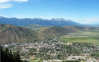
The hub for visitors to the area's extensive recreational activities. One can create a pleasant route around the town's historic streets, take a jaunt through the Elk Refuge, or get onto one of the many multi-use paths that run from town.
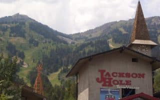
Teton Village lies at the base of Jackson Hole Ski Resort and is an area center for lodging, dining, and shopping. Best running is a 2-mile loop of the main roads, some of the hillier side roads, or the Community Pathway toward Wilson.
Share your feedback on this route and see that of other Great Runs users. Click on the image icon to upload a photo. And please let us know if there are notes or changes we should incorporate!


Review or Comment on This Route/Share a Photo!
Share your feedback on this route and see that of other Great Runs users. Click on the image icon to upload a photo. And please let us know if there are notes or changes we should incorporate!