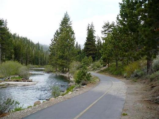
The Truckee River Bike Trail is one of the better off-road running options in the Tahoe area. The paved trail runs for just over 5 miles, between Squaw Valley and Tahoe City. It parallels River Rd. (RT. 89), but runs below the highway and right along the Truckee River, with shade and nice water views. At the Squaw Valley end, the trail starts, inspirationally enough, at the 1960 Winter Olympics Torches (Squaw Valley Rd. & River Rd.). The Tahoe City terminus is at Fairway Rd., at the Chevron station, right near the trailhead for the Tahoe Rim Trail – a 170 mile hiking loop through pine forests and meadows, which is is also popular for trail running. The trail is fairly flat, more of a gradual uphill headed southward (upstream).
Wikimedia Commons
Features:
Categories:
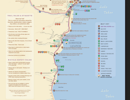
Scroll Down For Route Maps
Essentials
- 5.1 miles (8.2 km) one-way, or 10.2 miles out and back
- 275 feet (one-way)
- Squaw Valley End: Squaw Valley Rd. & River Rd.; Tahoe City End: Fairway Rd. near Chevron station
- Parking at either end. In Tahoe City, best option is the large lot at 64 Acre park.
Current Weather & Forecast
Location Weather
Please set your valid city name and country code.
Other Routes in Lake Tahoe, CA
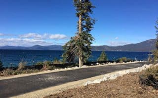
An 11-mile path from Meeks Bay north to Tahoe City along the western shore of Lake Tahoe is a great option for running. The nicest section is the ~6 miles from Homewood to Sunnyside -- right along the lake and quite flat. Connects to other trails in Tahoe City.
Best running options in the Tahoe City area are the the Truckee River Trail to Squaw Valley, a golf course loop involving Fairway Dr., and a paved path along the marina and paralleling N. Lake Blvd. for 2.7 miles, the last mile of which is a steep climb.

On Lake Tahoe's north shore, the recently completed East Shore Trail run for 3 miles between Incline Village and Sand Harbor. Great lake views and six bridges! Also in Incline Village is the 3-mile 'Joggers' Trail'.
Our recommendations on some of the best spots to run in the South Lake Tahoe area. The Rubicon Trail is a fantastic trail run around Emerald Bay. Also some bike paths, meadow paths, and quiet residential streets near Heavenly Ski Resort.
Pleasant gravel path along the Truckee River, from Truckee north to Union Mills. 4.4 miles one-way, mostly flat except for one steep climb. Fairly shaded, with nice views of the river much of the way.
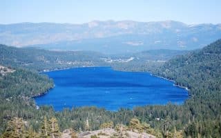
An easy-to-follow 7-mile loop around Donner Lake, which is at the northern end of Lake Tahoe, near Truckee. Donner Pass Rd. on the northern side, has a bike lane and nice lake views, while S. Shore Rd. on the southern side is quieter but lacks water views.
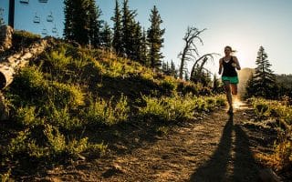
Lake Tahoe is a trail runner's dream. Here, our recommendations for easy-to-moderate trail runs that are accessible and appropriate for the everyday runner. There are TONS of resources for more challenging, technical trail running in Tahoe.
User Ratings
Leave A Review or Comment
Review or Comment on This Route/Share a Photo!
Share your feedback on this route and see that of other Great Runs users. Click on the image icon to upload a photo. And please let us know if there are notes or changes we should incorporate!