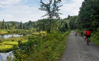
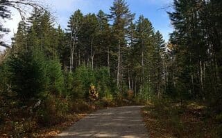
For an enjoyable riverside multi-use trail, we love running on the Chemin (trail) de la Rivière-du-Nord. This gravel path is in the Saint-Jérôme area and runs along the Rivière-du-Nord (river), making for a nearly 10k out and back. The trail is mainly wooded, though there are some water views. This path/linear park is squeezed between the Laurentian Autoroute and Highway 117. A good start point at the north end is in the center of Shawbridge.
There are numerous additional spur trails, some of them more challenging. There’s also a south section in further toward Saint-Jérôme with some additional trails. The trail maps have good info on trail distances, sights, and facilities.
Loop Option: One fun option is to take the Rivière-du-Nord trail one way and the P’tit Train trail the other. Use Rue Shaw/Rue de la Station to connect the two.


Review or Comment on This Route/Share a Photo!
Share your feedback on this route and see that of other Great Runs users. Click on the image icon to upload a photo. And please let us know if there are notes or changes we should incorporate!