In Novato and just west of Highway 101 is a series of parks and preserves that combine for thousands of acres of open space. There are wonderful running options in the mountains here, especially on the extensive fire roads that feature good good footing as they pass through grasslands, meadows, scrub, and some forested sections. Note the terrain is generally hilly — hard to find a level route! There are so many options in this area it’s hard to map specific routes. But here are a few recommendations.
Loma Verde, Ignacio Valley, Pacheco Valle, and Indian Valley form 3,000 acres of contiguous open space. Best bets for running:
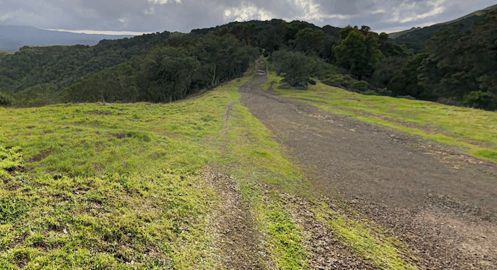
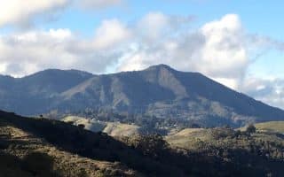
Pacheco Valle: Chicken Shack Fire Road (narrower) is a 3.2 mile, 700-foot, steep uphill climb to Big Rock Ridge, through oak woodlands with views of Mount Burdell and Mount Tam. You can continue along Big Rock Fire Ridge Rd. (wider) for another 3.5 miles, climbing another 1,000 feet, through Loma Verde, Ignacio Valley, and Lucas Valley. ROUTE MAP
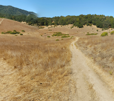
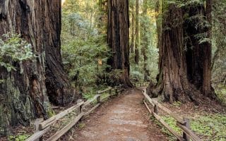
Indian Valley Preserve. More shaded, gentle terrain here. A nice route is to combine the Ad and Gloria Schwindt Trail with the Indian Valley Fire Rd. and the Pacheco Pond Trail (~3.5 miles one-way). TRAIL MAP
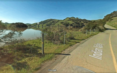
Indian Valley Rd. Google Street View
Little Mountain Open Space Preserve/Verissimo Hills/Stafford Lake. Located a few miles west of Indian Valley, there are several hundred acres of trails, plus a multi-use path and some decent roads for running. It’s one of the better spots for a more level route. Here’s a scenic run of up to 11 miles, divided into a few sections. Park at the end of Kathleen Drive. ROUTE MAP (Up to 11 miles, 680 foot gain):
1 mile along Doe Hill Fire Rd., for a 2-mile out and back
Then, take the path through Ohair Park for 0,5 miles to Novato Blvd.
Multi-use path paralleling Novato Blvd. for 2.5 miles to Stafford Lake Park
Option: from Novato Blvd., take Indian Valley Rd. to the Indian Valley Golf Club. 2.6 miles out and back on a quiet, scenic road, with views of the lake and surrounding mountains.
Alternatively, park at Stafford Lake Park and combine a few miles of the multi-use path and Indian Valley Rd.
For more challenge, there are hundreds of acres of additional fire roads in the adjacent Verissimo Hills, and also just south of Little Mountain Preserve at the Big Trees hiking area into the Indian Tree Open Space Preserve, where hilly trails lead through grasslands & redwood groves.
Fire Road in Indian Valley. Google Street View
In Novato and just west of Highway 101 is a series of parks and preserves that combine for thousands of acres of open space. There are wonderful running options in the mountains here, especially on the extensive fire roads that feature good good footing as they pass through grasslands, meadows, scrub, and some forested sections. Note the terrain is generally hilly — hard to find a level route! There are so many options in this area it’s hard to map specific routes. But here are a few recommendations.
Loma Verde, Ignacio Valley, Pacheco Valle, and Indian Valley form 3,000 acres of contiguous open space. Best bets for running:
Pacheco Valle: Chicken Shack Fire Road (narrower) is a 3.2 mile, 700-foot, steep uphill climb to Big Rock Ridge, through oak woodlands with views of Mount Burdell and Mount Tam. You can continue along Big Rock Fire Ridge Rd. (wider) for another 3.5 miles, climbing another 1,000 feet, through Loma Verde, Ignacio Valley, and Lucas Valley. ROUTE MAP
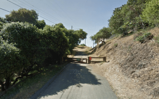
Indian Valley Preserve. More shaded, gentle terrain here. A nice route is to combine the Ad and Gloria Schwindt Trail with the Indian Valley Fire Rd. and the Pacheco Pond Trail (~3.5 miles one-way). TRAIL MAP
Indian Valley Rd. Google Street View
Little Mountain Open Space Preserve/Verissimo Hills/Stafford Lake. Located a few miles west of Indian Valley, there are several hundred acres of trails, plus a multi-use path and some decent roads for running. It’s one of the better spots for a more level route. Here’s a scenic run of up to 11 miles, divided into a few sections. Park at the end of Kathleen Drive. ROUTE MAP (Up to 11 miles, 680 foot gain):
1 mile along Doe Hill Fire Rd., for a 2-mile out and back
Then, take the path through Ohair Park for 0,5 miles to Novato Blvd.
Multi-use path paralleling Novato Blvd. for 2.5 miles to Stafford Lake Park
Option: from Novato Blvd., take Indian Valley Rd. to the Indian Valley Golf Club. 2.6 miles out and back on a quiet, scenic road, with views of the lake and surrounding mountains.
Alternatively, park at Stafford Lake Park and combine a few miles of the multi-use path and Indian Valley Rd.
For more challenge, there are hundreds of acres of additional fire roads in the adjacent Verissimo Hills, and also just south of Little Mountain Preserve at the Big Trees hiking area into the Indian Tree Open Space Preserve, where hilly trails lead through grasslands & redwood groves.
Scroll Down For Route Maps
Essentials
The area is just west of Highway 101. Numerous access points and traileads.
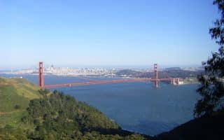
One of the most spectacular areas for running close to a city. Fantastic views of the GG Bridge, Bay, city. Run the 5 miles to Rodeo Beach or do loop options involving Bunker Rd. in the valley. Great trail running options.
Iconic area just north of the GG Bridge. Incredible panoramas from its 2,571 summit. 60+ miles of trails and fire roads, with options for all abilities, through canyons, redwood forests, oak woodlands, open grasslands, and sturdy chaparral. Be prepared for hills!
Experience old growth coastal redwoods in this National Monument area just 20 minutes from San Francisco. Easier trails through the redwoods, and longer, more challenging trails through canyons and grasslands. Deer Park Fire Rd. also a good option.
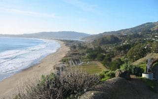
Some decent running options in this area 20 miles north of SF off the Shoreline Highway: 2.75-mile beach, quiet roads above the highway with nice views, and some gorgeous (but hilly) trail running.
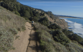
Just north of Salinas. Some nice road running around Bolinas Park and the Quail Refuge. Rugged beach running on Agate Beach. Coastal Trail is a great trail run - first 1.5 miles from Palomarin Trailhead is fairly flat.
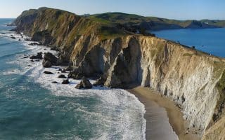
This National Seashore is a fantastic 'destination run', 90 minutes north of San Francisco. There are spectacular coastal trails, open ranch lands, & historic sites. Best trail: Coast Trail; Great Beach for running: Limantour Beach.
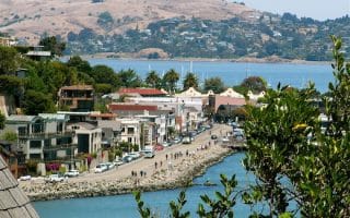
Lovely waterfront run in the tony town of Sausalito, located in Marin County across the Golden Gate Strait from San Francisco. Up to 5 miles one-way to Bayfront Park, mainly on the Mill Valley-Sausalito multi-use path. Great water & skyline views.
Nice waterfront running in Belvedere and Tiburon. Our 4-mile out and back features attractive homes, water views, and parks. Add-on with the 3-mile loop around Belvedere Island, or get the lungs going in the hilly residential streets above the harbor.
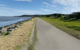
Nice running options in San Rafael. Enjoy great SF Bay views from the shoreline San Francisco Bay Trail, 5 miles out and back. China Camp State Park is another favorite, with 15 miles of trails through tidal wetlands, forests, meadows, and grasslands.
A scenic but hilly 5-miler, incorporating the pretty, residential streets near downtown, the Gerstle Park estate, and the Robert Dollar Trail through Boyd Memorial Park. Note this includes a 550-foot climb over 1 mile!
Share your feedback on this route and see that of other Great Runs users. Click on the image icon to upload a photo. And please let us know if there are notes or changes we should incorporate!
Subscribe
0 Comments
Oldest
Newest
Inline Feedbacks
View all comments
Essentials
The area is just west of Highway 101. Numerous access points and traileads.
Review or Comment on This Route/Share a Photo!
Share your feedback on this route and see that of other Great Runs users. Click on the image icon to upload a photo. And please let us know if there are notes or changes we should incorporate!