This is a great opportunity for a long off-road waterfront run in Pohang. It combines 3.5 km through Hyeongsangang Park with 4.5 km of additional paths along the Hyeongsan River headed west to the Yugang Bridge. We’ve mapped the whole route, but there are a couple of options:
Hyeongsan River Loop from Pohang Stadium: There are paved, dedicated pedestrian paths along both sides of the river between Pohang Stadium and a pedestrian bridge just before Yugang Bridge (Hwy 31). This longer loop is 9 km. There are nice water views the whole way. For a shorter loop, it’s 4.5 km between Seoman Big Bridge @Pohang Stadium and Yeonil Bridge. There’s a running track at the Stadium. The path along the south bank is more scenic & more developed.
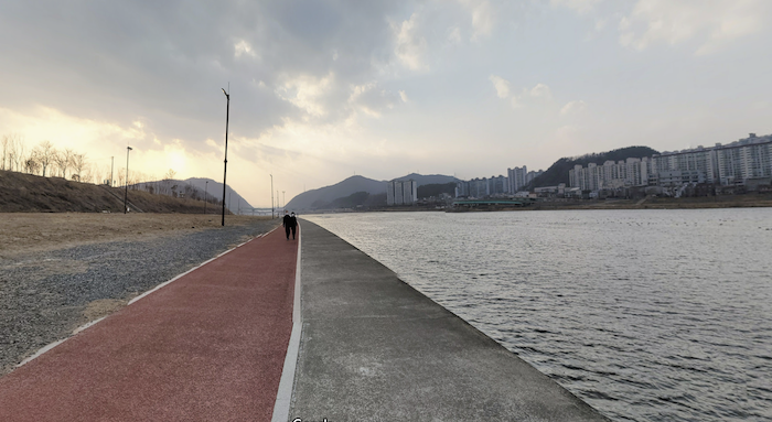
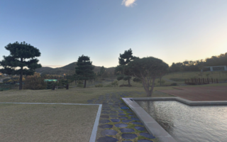
Hyeongsangang Park. For more riverfront running, enjoy the wide paved pedestrian path along the river between the Stadium and Coast Guard Station, where the Hyeongsan River runs into the Sea of Japan. It’s a bit industrial, and not as scenic as the river loop above. But it’s easy running. This path is also part of our Songdo Loop.
The full route, including the long river loop and the park out & back is 17 km!
Hyeongsangang Park. Google Street View
This is a great opportunity for a long off-road waterfront run in Pohang. It combines 3.5 km through Hyeongsangang Park with 4.5 km of additional paths along the Hyeongsan River headed west to the Yugang Bridge. We’ve mapped the whole route, but there are a couple of options:
Hyeongsan River Loop from Pohang Stadium: There are paved, dedicated pedestrian paths along both sides of the river between Pohang Stadium and a pedestrian bridge just before Yugang Bridge (Hwy 31). This longer loop is 9 km. There are nice water views the whole way. For a shorter loop, it’s 4.5 km between Seoman Big Bridge @Pohang Stadium and Yeonil Bridge. There’s a running track at the Stadium. The path along the south bank is more scenic & more developed.
Hyeongsangang Park. For more riverfront running, enjoy the wide paved pedestrian path along the river between the Stadium and Coast Guard Station, where the Hyeongsan River runs into the Sea of Japan. It’s a bit industrial, and not as scenic as the river loop above. But it’s easy running. This path is also part of our Songdo Loop.
The full route, including the long river loop and the park out & back is 17 km!
Hyeongsangang Park. Google Street View
Scroll Down For Route Maps
Essentials
Full route is 17 km (10.6 miles). River Loop from the Stadium is 9 km
Fairly flat
Seoman Big Bridge near Pohang Stadium is a good start point
One of three routes in Pohang showcasing its location on the Hyeongsan River & the Sea of Japan. This is a 6 km loop of Songdo, easily accessible from the center, mainly on waterfront roads and paths. Some nice water views & good add-on options.
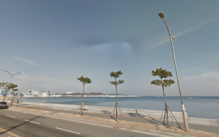
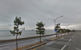
Nice waterfront run on a wide sidewalk with great views of the Sea of Japan. Up to 6 km one-way from the Ferry Terminal north to Hwanho Sunrise Park, with additional paths there. Can combine w/Songdo & Hyeongsan River routes.
Completed in 2022, this paved, 6.6 km multi-use trail runs along a former rail line. Linear park route featuring separate pedestrian and cycle paths, seating areas, outdoor gym stations, and cultural features. Lit at night!
In this beach area north of Pohand, there's ~4 km of running on a quieter coastal road, featuring nice sea views. Add with modern Sabang Memorial Park, which has paths leading to a hilltop with nice views.
Centrally located Yeongildae Beach and Pohang Songdo Beach are runnable and can be part of our Songdo & Hyeongsan River routes. Just north of the city, Wolpo Beach stretches for 2 km and is runnable.
Share your feedback on this route and see that of other Great Runs users. Click on the image icon to upload a photo. And please let us know if there are notes or changes we should incorporate!
Subscribe
0 Comments
Oldest
Newest
Inline Feedbacks
View all comments
Essentials
Full route is 17 km (10.6 miles). River Loop from the Stadium is 9 km
Fairly flat
Seoman Big Bridge near Pohang Stadium is a good start point


Review or Comment on This Route/Share a Photo!
Share your feedback on this route and see that of other Great Runs users. Click on the image icon to upload a photo. And please let us know if there are notes or changes we should incorporate!