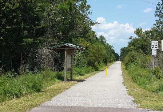
The Palatka to St. Augustine State Trail is one of the best bets for a long, completely off-road run in the St. Augustine area. Located 9 miles southwest of St. Augustine, the wide, paved, multi-use path stretches for 19 miles southwest to East Palatka on the St. John’s River. The trail mainly parallels SR 207, and much of the terrain is wooded. There are five distinct trailheads, each with some parking and an information kiosk with map.
Approximate distances, from the Vermont Blvd. Trailhead, heading south (Notes: the trail goes north of the Vermont Blvd. Trailhead for 1.5 miles toward I-95; and the trail is not shown on Google Maps south of Armstrong Park).
Vermont Heights: 1 mile Armstrong Park: 5 miles Cora C. Harrison Preserve, near Hastings: 9 miles East River Road Trailhead: 16 miles
Courtesy: floridastateparks.org
The Palatka to St. Augustine State Trail is one of the best bets for a long, completely off-road run in the St. Augustine area. Located 9 miles southwest of St. Augustine, the wide, paved, multi-use path stretches for 19 miles southwest to East Palatka on the St. John’s River. The trail mainly parallels SR 207, and much of the terrain is wooded. There are five distinct trailheads, each with some parking and an information kiosk with map.
Approximate distances, from the Vermont Blvd. Trailhead, heading south (Notes: the trail goes north of the Vermont Blvd. Trailhead for 1.5 miles toward I-95; and the trail is not shown on Google Maps south of Armstrong Park).
Vermont Heights: 1 mile Armstrong Park: 5 miles Cora C. Harrison Preserve, near Hastings: 9 miles East River Road Trailhead: 16 miles
Scroll Down For Route Maps
Essentials
Total trail is 19 miles one-way
Generally flat
For Fitness Trails, see map; Nature Preserve Trailhead is off Davis Park Rd. near the Ponte Vedra High School
There are 5 distinct trailheads. The one closest to St. Augustine is the Vermont Blvd. trailhead
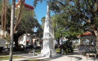
The most scenic run in St. Augustine, featuring nearly 2 miles along the water. Includes the Castillo Fort and bayfront path. It's a 4 mile out and back. For a longer run, incorporate the Mission and the beautifully canopied Magnolia Ave.
A 'runseeing' tour of St. Augustin's Historic district, the area between the Vilano Bridge and Bridge of Lions. Take a jaunt around the grounds of West Lawn, historic streets, Castillo Fort, The Mission, and the waterfront. Good add-on opportunities.
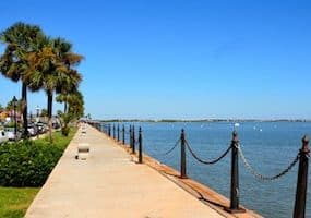
Two notable bridges in St. Augustine cross over the Matanzas River: the historic Bridge of Lions, which accesses Anastasia Island, and the longer Vilano Causeway/Usina Bridge. They're 1.2 miles apart. It's a minimum 7.5 mile run, particularly nice at sunrise.
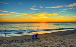
Miles and miles of great beach running on either St. Augustine Beach or Vilano Beach. Each of these beaches is long and flat, with fairly reliable compact sand good for running.
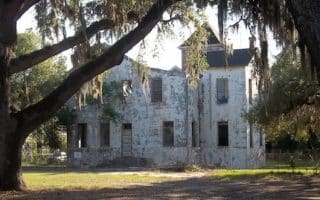
A guide to some of the nicer neighborhoods for running in the St. Augustine area. Historic District, Lincolnville, Davis Shores/Anastasia, Camachee Cove/Lands End Dr. These areas feature mainly quiet roads, with some lovely homes and a pretty canopy.
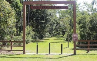
A master planned community, between St. Augustine and Jacksonville. Great running on the 10+ miles of 'fitness trails' around the 5,000 acres of village-like neighborhoods. Or run on the lovely 3.5-mile Nature Trail of the nearby Nocatee Nature Preserve.
Share your feedback on this route and see that of other Great Runs users. Click on the image icon to upload a photo. And please let us know if there are notes or changes we should incorporate!
Subscribe
0 Comments
Oldest
Newest
Inline Feedbacks
View all comments
Essentials
Total trail is 19 miles one-way
Generally flat
For Fitness Trails, see map; Nature Preserve Trailhead is off Davis Park Rd. near the Ponte Vedra High School
There are 5 distinct trailheads. The one closest to St. Augustine is the Vermont Blvd. trailhead


Review or Comment on This Route/Share a Photo!
Share your feedback on this route and see that of other Great Runs users. Click on the image icon to upload a photo. And please let us know if there are notes or changes we should incorporate!