This is a pleasant run in Valladolid exploring two parks: Alamendros Park (Parque de los Almendros) and the nearby Contiendas Park (Parque urbano de las Contiendas). They’re hilly parks with wide paths, open terrain, and nice viewpoints. Use our mapped ~9k route as a guideline to create your own route exploring the trails of these parks.
We start in the area of the Science Museum with an 0.7 km there and back along the fantastic pedestrian bridge (Pasarela Peatonal Del Museo de La Ciencia) across the river. Then, explore the trails of Alamendros Park, which is is located near the museum on the west side of the river. It’s a nice space with tree-lined gravel walkways and several scenic viewpoints (Mirador) of the city. A loop of the park is ~2.2 km, climbing ~100m.
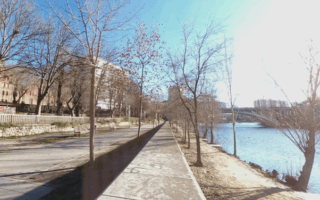
Contiendas Park. Google Street View
The next section is exploring additional adjacent parks. Take the trail crossing Calle del Dr. Villacián, passing the Iglesia del Monasterio de Nuestra Señora de Prado. Cross C. Padre José Acosta into Contiendas Park. This is a large, open park with wide gravel trails and roads. Also quite hilly! You could do a 2-3 km loop of the park.
Add-Ons: Additional trails in the parks. From the pedestrian bridge, you can also explore the Río Pisuerga trails, mainly headed north.
This is a pleasant run in Valladolid exploring two parks: Alamendros Park (Parque de los Almendros) and the nearby Contiendas Park (Parque urbano de las Contiendas). They’re hilly parks with wide paths, open terrain, and nice viewpoints. Use our mapped ~9k route as a guideline to create your own route exploring the trails of these parks.
We start in the area of the Science Museum with an 0.7 km there and back along the fantastic pedestrian bridge (Pasarela Peatonal Del Museo de La Ciencia) across the river. Then, explore the trails of Alamendros Park, which is is located near the museum on the west side of the river. It’s a nice space with tree-lined gravel walkways and several scenic viewpoints (Mirador) of the city. A loop of the park is ~2.2 km, climbing ~100m.
Contiendas Park. Google Street View
The next section is exploring additional adjacent parks. Take the trail crossing Calle del Dr. Villacián, passing the Iglesia del Monasterio de Nuestra Señora de Prado. Cross C. Padre José Acosta into Contiendas Park. This is a large, open park with wide gravel trails and roads. Also quite hilly! You could do a 2-3 km loop of the park.
Add-Ons: Additional trails in the parks. From the pedestrian bridge, you can also explore the Río Pisuerga trails, mainly headed north.
There are 5 km of pleasant paths along the Pisuerga River, passing through several riverside parks. A linear park feel, with nice green spaces and river views. Can combine with our Parque de los Almendros & 'runseeing' routes.
A 'Runseeing' tour of Valladolid, featuring the key sites of the historic center, including the Parque Campo Grande. It's just over 5 km, with good add-on opportunities.
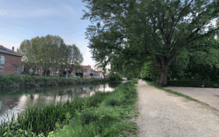
Pleasant gravel paths on both sides of the Canal de Castilla, with the option to take an adjacent path through the Jardín Botánico. An easy, flat, ~7 km loop!
Share your feedback on this route and see that of other Great Runs users. Click on the image icon to upload a photo. And please let us know if there are notes or changes we should incorporate!


Review or Comment on This Route/Share a Photo!
Share your feedback on this route and see that of other Great Runs users. Click on the image icon to upload a photo. And please let us know if there are notes or changes we should incorporate!