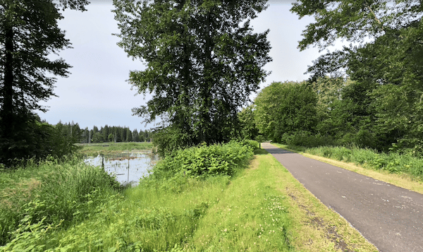
The Woodland (Lacey) Trail is a paved multi-use path in the eastern section of Olympia that provides a nice opportunity for an off-road run. Closest to Olympia, this rails-to-trails path starts at the north end of Watershed Park, paralleling I-5 for the first 2.5 miles headed east, intersecting with the Chehalis Western Trail. Then, the trail heads southeast away from I-5 for another 2 miles through the Lacey area, ending at Woodland Creek Community Park. The terrain is a combination of wooded sections and suburban communities. The Lacey part of the trail does run alongside busy Pacific Ave.
Add-Ons: The Chehalis Western Trail intersects with the Woodland (Lacey) trail just south of I-5/Pacific Ave. At the southern end of the Chehalis Western Trail, is the Yelm-Tenino Trail, another rails-to-trails multi-use path.


Review or Comment on This Route/Share a Photo!
Share your feedback on this route and see that of other Great Runs users. Click on the image icon to upload a photo. And please let us know if there are notes or changes we should incorporate!