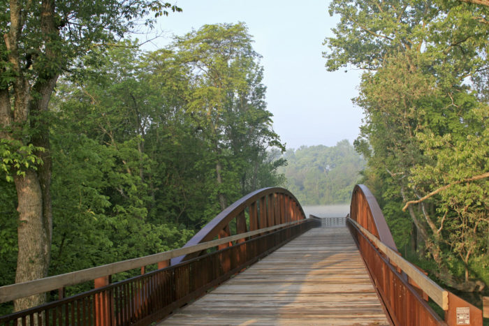
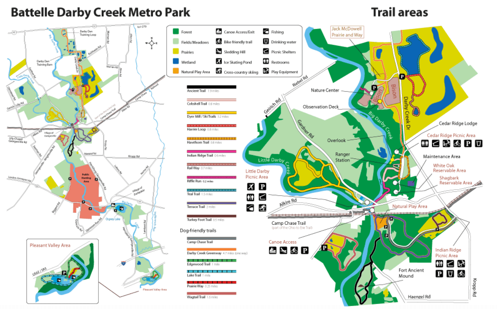
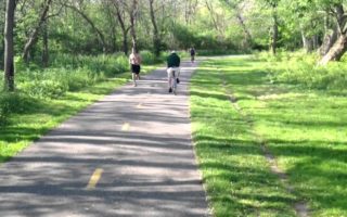
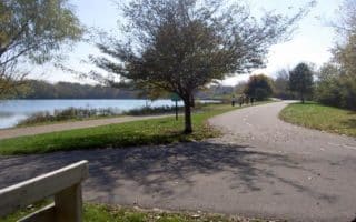
Stretching almost 13 miles, Battelle Darby Creek Metro Park runs along the Big and Little Darby Creek and features more than 7,000 acres of forest, prairies, and wetlands. The park caters to a diverse set of activities including biking, kayaking, cross country skiing, fishing, hunting, ice skating, picnicking, sledding, walking, and of course, running. Bison are also known to roam freely in the park, within two enclosed pastures.
For running, there’s an extensive series of trails, with something for everyone. Easier running is on the 4.7 mile Darby Creek Greenway and the 2.3 mile Edgewood, Lake, & Prairie Way trail within the park. There’s also a connection to the Camp Chase Trail, which runs for nearly 11 miles east to the Scioto River in Columbus.
There are also several miles of moderately rugged trails that are great for trail running.
A very popular route among runners in Columbus. The trail runs east-west along the Scioto River, serving as the spine of the famous Scioto Mile, a string of prominent parks, civic landmarks, and promenades.
Stretching along the downtown Columbus Riverfront from the Arena District to the Whittier Peninsula, the Scioto Mile is the city’s premier downtown destination.
Longer distance multi-use trail extends west from Columbus. Good way to clock in some miles. East end is more residential, west end is more agricultural. Connections to Scioto Trail, Battelle Darby Creek Park.
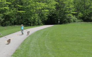
One of the most popular multi-use paths in all of Ohio, the Olentangy Trail runs for 13 miles along the Olentangy River. It's sort of a linear park trail, with parks along much of the way, also passing through the OSU Campus.
A 22-mile trail along one of the city's most scenic river corridors, from Three Creeks Park to Westerville. Most of it is paved, but some sections are unpaved and a little more challenging/technical. Many parks and trail heads along the way.
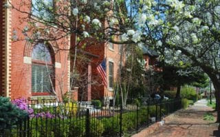
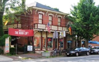
Historic area just south of downtown, with Italianate architecture, brick sidewalks, and alleys. Lovely Schiller Park is at the center. Nice place for a run, do it leisurely and randomly, rather than proscribed route. Combine with downtown run!
Third largest university campus in the country. Miles of wonderful paths for running, with classic red brick buildings. Central and Southern Oval are large grassy areas. Olentangy River Trail runs through the campus. Leafy, pleasant, adjacent streets.
1150 acre park, 17 miles north of downtown, offering great options for trail running with lots of variety. Most trails are in the northern section of the park. There are some gentler, paved options too.
Located 10 miles north of downtown, Antrim Park offers a beautiful 1.2 mile, gravel path around a tranquil lake. A nice option as part of the Olentangy Trail.
Columbus has some wonderful residential neighborhoods for running, all of them in proximity to some of the longer multi-use trails in the city. Create your own route in German Village, Grandview Heights, or Worthington!
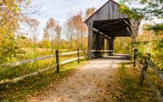
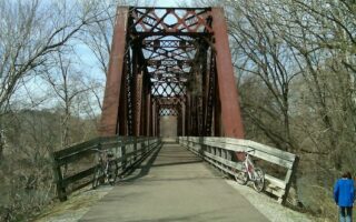
The Kokusing Gap Trail is a great destination run in Mt. Vernon, an hour's drive from Columbus. Old rail cars, a historic stone arch, public art, railroad bridge, & tunnels, and a mix of open farmland & wooded ravines. Can add w/section of Heart of Ohio Trail.
Share your feedback on this route and see that of other Great Runs users. Click on the image icon to upload a photo. And please let us know if there are notes or changes we should incorporate!


Review or Comment on This Route/Share a Photo!
Share your feedback on this route and see that of other Great Runs users. Click on the image icon to upload a photo. And please let us know if there are notes or changes we should incorporate!