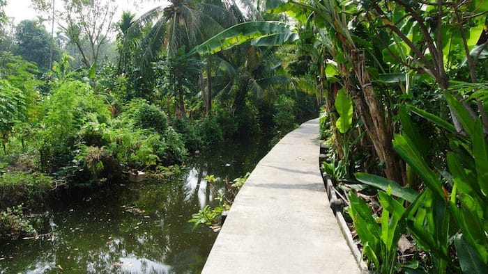
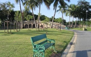
Bang Kachao is an island oasis in Bangkok, referred to as the city’s ‘green lung’. Located in the Chao Phraya river, there are little villages, jungle, Buddhist temples and a lots of lovely vegetation. There is little traffic or commercial development.
The park consists of walkways, alleys, and roads which are large enough to run and allow for traffic. There’s also a series of elevated, wooden, tree-lined paths that are great for cycling and running. If running on these paths, be wary of bikes as the paths are narrow. It’s recommended to run “clockwise” around the park and botanical garden. A run from the pier to the floating market, and a tour of the park is about 15 km (10 miles) total. The run can be prolonged by going further south or exploring the different walkways.
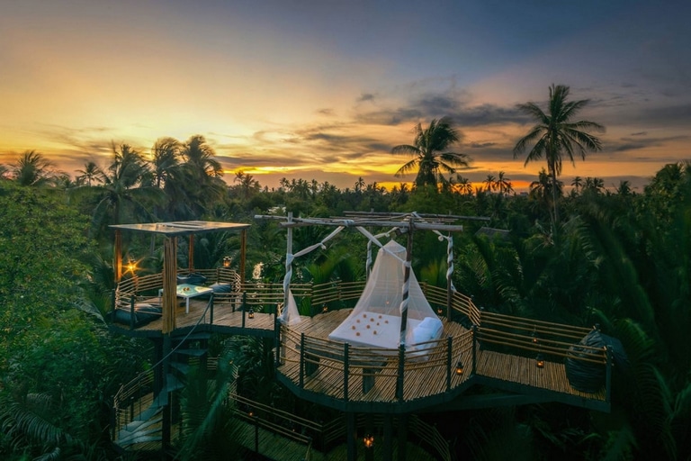
Interesting sites on the island include a floating market, tree house, and several temples. To get there, take BTS Skytrain to Bang Na station. From there, get a quick ฿20 (US$0.60) motorbike taxi to the pier. The boat to the island costs only ฿6 (US$0.18).
Video Highlights: Lumpini Park, Bang Krachao, Other Bangkok Sites (24 min.)
Bang Kachao is an island oasis in Bangkok, referred to as the city’s ‘green lung’. Located in the Chao Phraya river, there are little villages, jungle, Buddhist temples and a lots of lovely vegetation. There is little traffic or commercial development.
The park consists of walkways, alleys, and roads which are large enough to run and allow for traffic. There’s also a series of elevated, wooden, tree-lined paths that are great for cycling and running. If running on these paths, be wary of bikes as the paths are narrow. It’s recommended to run “clockwise” around the park and botanical garden. A run from the pier to the floating market, and a tour of the park is about 15 km (10 miles) total. The run can be prolonged by going further south or exploring the different walkways.
Interesting sites on the island include a floating market, tree house, and several temples. To get there, take BTS Skytrain to Bang Na station. From there, get a quick ฿20 (US$0.60) motorbike taxi to the pier. The boat to the island costs only ฿6 (US$0.18).
Video Highlights: Lumpini Park, Bang Krachao, Other Bangkok Sites (24 min.)
Scroll Down For Route Maps
Essentials
Full tour is ~15 km (10 miles), with opportunities for more
Fish Pier or other spot depending on what boat you take
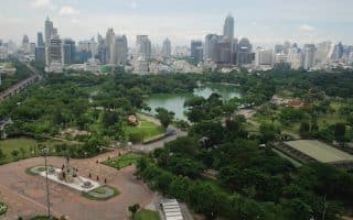
Bangkok's "Central Park" is one of the most popular running spots in the city. A 2.5 km track with distance markers. There are lovely gardens and decent shade. Video Highlights! Combine with Benchakitti Park for a longer run.
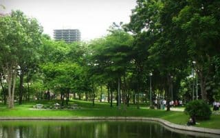
Located in a busy neighborhood next to the Convention Center, this is another popular place to run in Bangkok. ~2 km paved path around an artificial lake, and another 3 km of paths in newly expanded section. An elevated path connects to Lumphini Park!
Opened in 1998, Santiphap Park ("Peace Park") features pleasantly shaded paths, which are good for running. It's about 1 km around the park, so runners will have to do some laps to get in some distance.
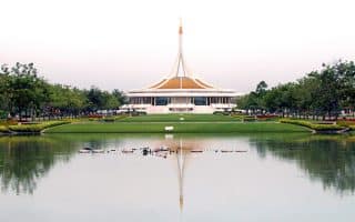
Four co-located parks and gardens make for one of the most extensive off-road running opportunities in Bangkok. Some 6+ km of non-overlapping paths and roads pleasant for running. Butterfly garden, insectarium, botanical gardens.
The largest park in Bangkok, with gardens, a lake, and a series of bike and running paths. Some 8 km of paths, including Nong Bon Lake Park. A bit tough to get to, but worth the journey.
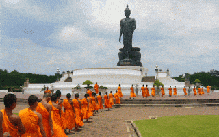
This park located 30 km west of Bangkok features possibly the tallest free-standing Buddha statue in the world. Popular for running, as there's a 2.5 km path, which has trees and good views.
Share your feedback on this route and see that of other Great Runs users. Click on the image icon to upload a photo. And please let us know if there are notes or changes we should incorporate!
Subscribe
1 Comment
Oldest
Newest
Inline Feedbacks
View all comments
Essentials
Full tour is ~15 km (10 miles), with opportunities for more
Fish Pier or other spot depending on what boat you take
 The park consists of walkways, alleys, and roads which are large enough to run and allow for traffic. There’s also a series of elevated, wooden, tree-lined paths that are great for cycling and running. If running on these paths, be wary of bikes as the paths are narrow. It’s recommended to run “clockwise” around the park and botanical garden. A run from the pier to the floating market, and a tour of the park is about 15 km (10 miles) total. The run can be prolonged by going further south or exploring the different walkways.


Review or Comment on This Route/Share a Photo!
Share your feedback on this route and see that of other Great Runs users. Click on the image icon to upload a photo. And please let us know if there are notes or changes we should incorporate!