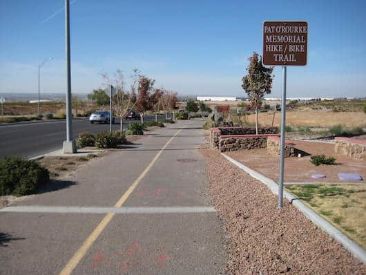
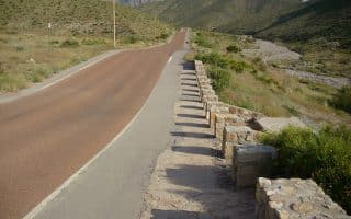
The Pat O’Rourke Memorial Trail is a good opportunity for an off-road run just north of cental El Paso. It’s a multi-use path that runs adjacent, but separate from N. Resler Dr. from Helen of Troy Dr., north to Transmountain (SR375). It’s 4.4 miles out and back. With its setting alongside a busy secondary road and just east of I-10, this won’t be the prettiest run you’ll ever do. Heading northward, it’s a gradual, but not a steep climb. Note: No water or restrooms, so plan accordingly.
Courtesy: destinationelpaso.com
Features:
Categories:
Scroll Down For Route Maps
Essentials
- 4.4 miles (7 km) out and back
- 223 feet (68m) - it's gradual uohill heading north
- Anywhere convenient
- Parking at businesses at either end
Current Weather & Forecast

El Paso, US
11:17 am,
Jun 19, 2026
L: 29°
H: 30°
Daily ForecastHourly Forecast
Today
3:00 pm
29° / 30°°C
0 mm
0%
9 mph
43 %
1010 mb
0 mm/h
Tomorrow
3:00 pm
20° / 34°°C
0 mm
0%
14 mph
51 %
1012 mb
0 mm/h
Sunday
3:00 pm
19° / 33°°C
0 mm
0%
13 mph
54 %
1014 mb
0 mm/h
Monday
3:00 pm
18° / 31°°C
0 mm
0%
13 mph
56 %
1013 mb
0 mm/h
Tuesday
3:00 pm
18° / 32°°C
0 mm
0%
12 mph
59 %
1014 mb
0 mm/h
Today
12:00 pm
24° / 24°°C
0 mm
0%
8 mph
42 %
1010 mb
0 mm/h
Today
3:00 pm
21° / 23°°C
0 mm
0%
9 mph
43 %
1010 mb
0 mm/h
Today
6:00 pm
20° / 21°°C
0 mm
0%
6 mph
46 %
1011 mb
0 mm/h
Today
9:00 pm
21° / 21°°C
0 mm
0%
6 mph
51 %
1012 mb
0 mm/h
Tomorrow
12:00 am
27° / 27°°C
0 mm
0%
4 mph
36 %
1011 mb
0 mm/h
Tomorrow
3:00 am
32° / 32°°C
0 mm
0%
5 mph
24 %
1010 mb
0 mm/h
Tomorrow
6:00 am
34° / 34°°C
0 mm
0%
3 mph
17 %
1008 mb
0 mm/h
Other Routes in El Paso, TX
A road in El Paso popular for great city and mountain views. For runners, it's a scenic and somewhat hilly challenge. The Drive itself is 2 miles one-way, can be combined with the Arroyo or a longer run from the Up and Running store.
Create your own route in El Paso's poshest neighborhood. The quiet, long, wide streets, feature good sidewalks and some nice homes. Memorial Park has some nice trails and there's a great track at Austin High School.
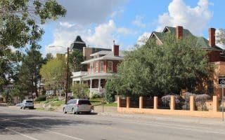
A historic area of El Paso, and a decent bet running near downtown. One can put together ~3-4 miles around the area's hilly streets, which feature some nicer, older homes. Add Tom Lea Upper Park, Billy Rogers Arroyo, and the University for a longer run.
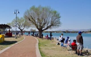
Popular option for runners is to do loops around Ascarate Lake on the 1.4 mile gravel path. It's located within 400-acre Ascarate Park, which features numerous sports fields, two pools, and a golf course. Bonus: Lit at night!
A steady climb along McKelligon Canyon Rd.. with good views of the canyon and surrounding desert. It's 5 miles out and back from the parking lot to the trailhead (trails are rocky and challenging), with a 700 foot gain and grades of 5-6%. Exposed!
Located in the Three Hills Recreation Area, there's nice desert scenery along dirt trails in an open preserve. It's about 3.5 miles around the full perimeter, along gentle, rolling hill terrain. Especially pretty at sunset. Park has rec center with facilities.
The best long, fairly flat off-road option in El Paso. Part of the Rio Grande Riverpark Trail System, the dirt/gravel trail runs for 10.6 miles from Country Club Rd., north to the New Mexico Border. Note the riverbed is often dry.
Nice running on three interconnected multi-use paths in Las Cruces. The La Llorona Trail, which runs along the Rio Grande, is the most scenic. Connects to the Outfall Channel Trail and the Triviz Trail.
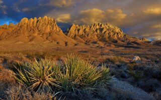
There's spectacular trail running in the area, with trails along the Chihuahua desert floor & surrounding Organ Mountains: Sierra Vista Trail, Organ Mountains National Desert Peaks Monument, Picacho Peak, Franklin Mountains State Park, & more!
User Ratings
Leave A Review or Comment
Review or Comment on This Route/Share a Photo!
Share your feedback on this route and see that of other Great Runs users. Click on the image icon to upload a photo. And please let us know if there are notes or changes we should incorporate!