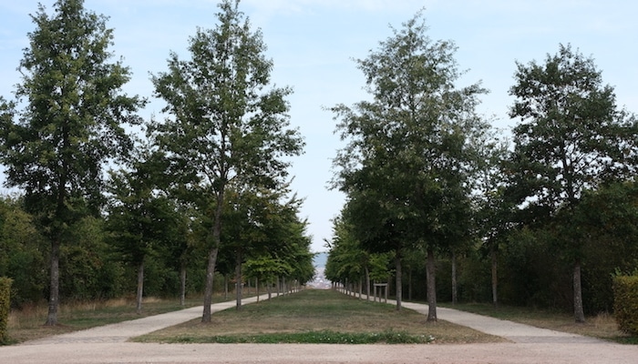
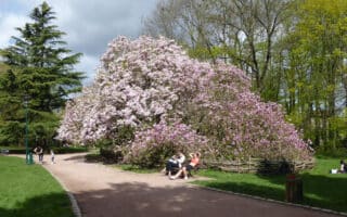
On the far southwest border of Nancy, the sprawling Parc de Brabois offers many miles of wide gravel paths. There’s a lovely network of straight-shot tree-lined alleé paths, as well as some meandering dirt and grass trails through the woods. A loop around the perimeter is 2.5 km, although there are numerous cross-paths. Runners can also use the surrounding streets to connect to Jardin Botanique Jean-Marie Pelt (botanical gardens). Here, there are more gravel paths stretching through manicured gardens and some short but intense hills. Adding a loop around the gardens makes for a route of up to 6.3 km.
Features:
Categories:
Scroll Down For Route Maps
Essentials
- 2.5 km (1.5 mile) or 6.3 km (4 mile) options
- 42-148 meters (138-484 feet)
- Camping Le Brabois
- Camping Bus Stop
Current Weather & Forecast

Arrondissement de Nancy, FR
4:35 pm,
Jun 3, 2026
L: 19°
H: 19°
Daily ForecastHourly Forecast
Today
11:00 pm
28° / 28°°C
0.23 mm
23%
4 mph
91 %
1004 mb
0 mm/h
Tomorrow
11:00 pm
28° / 35°°C
1 mm
100%
8 mph
89 %
1004 mb
0 mm/h
Friday
11:00 pm
27° / 32°°C
1 mm
100%
8 mph
91 %
1004 mb
0 mm/h
Saturday
11:00 pm
28° / 33°°C
1 mm
100%
9 mph
90 %
1004 mb
0 mm/h
Sunday
11:00 pm
28° / 34°°C
1 mm
100%
10 mph
91 %
1002 mb
0 mm/h
Today
5:00 pm
28° / 28°°C
0 mm
0%
2 mph
87 %
1004 mb
0 mm/h
Today
8:00 pm
28° / 28°°C
0.23 mm
23%
4 mph
88 %
1003 mb
0 mm/h
Today
11:00 pm
28° / 28°°C
0 mm
0%
4 mph
91 %
1003 mb
0 mm/h
Tomorrow
2:00 am
30° / 30°°C
0.2 mm
20%
7 mph
82 %
1003 mb
0 mm/h
Tomorrow
5:00 am
33° / 33°°C
0 mm
0%
8 mph
68 %
1003 mb
0 mm/h
Tomorrow
8:00 am
35° / 35°°C
0 mm
0%
8 mph
60 %
1001 mb
0 mm/h
Tomorrow
11:00 am
33° / 33°°C
0.39 mm
39%
7 mph
67 %
1000 mb
0 mm/h
Other Routes in Nancy, France
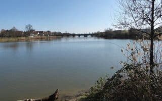
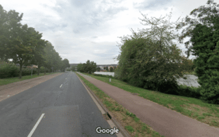
There are paved paths along a good deal of the Meurthe River where it flows through Nancy. We’ve mapped a centralized 3.6 km tour, with an extension to Champigneulles. Nice water views a good part of the way.
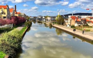
More waterfront running can be found along the canal that runs through Nancy parallel to the Meurthe River. The marina/Jardin d'Eau is the best section. Extend for 4 km north of Nancy, or for as much as 15 km southwest to Messein on paved paths.

Beautiful square park in the center of Nancy. Run the 1.8 km perimeter path, explore the interior Allees, or venture through the city to see historic and tourist sights.
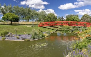
Sprawling green park with rose gardens and asphalt paths, located in Vandœuvre-lès-Nancy south of the city. A perimeter loop is 2 km.
A small park in the Haussonville - Blandan - Donop area southwest of Nancy center. Runners can do laps on this 1 km circuit.
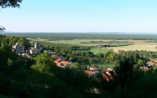
Forêt Domaniale de Haye (west of Nancy) and Forêt Domaniale de la Reine/Lorraine Regional Nature Reserve (northwest of Nancy) are large public forests with a number of running routes to choose from.
Use any of these bike paths to connect to our routes, or run them as out and back options. Most are more utilitarian than scenic.
User Ratings
Leave A Review or Comment
Review or Comment on This Route/Share a Photo!
Share your feedback on this route and see that of other Great Runs users. Click on the image icon to upload a photo. And please let us know if there are notes or changes we should incorporate!