The Provo River Parkway Trail is the best bet for long, off-road run in Provo. Overall, the paved trail runs for 15 miles from Utah Lake to Provo Canyon. We’ve divided the route into two sections.
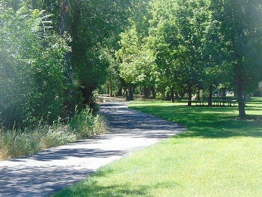
Utah Lake to BYU. This section of the trail is in the heart of Provo, running for 5.7 flat miles along the Provo River on the north side of Provo, from near the BYU campus south to Utah Lake State Park on Utah Lake. The trail is a nice mix, passing through numerous parks and residential areas, with views of the surrounding mountains and glimpses of the river. Some sections are wooded, and others are more open. Pick up the trail at any point! A good parking/access point is at Fort Utah State Park at Geneva Rd. & 350 N.
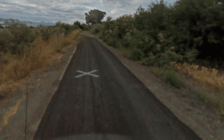
Northern Section of Trail. Google Street View.
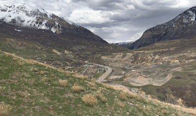
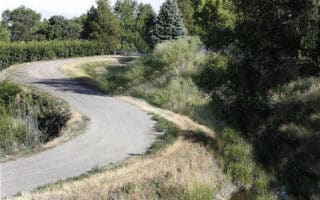
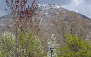
BYU to Provo Canyon. After a brief break at W 2230 N, pick up the trail at the BYU North Athletic Fields. The path continues north alongside N University Ave. for 3.5 miles through the Riverside residential suburbs to a trailhead at 800 N. From there, the trail continues for another 5.9 miles alongside Provo Canyon Rd. This section is hillier, passing through open, more remote and scenic terrain. Key segments (from start at BYU):
3.5 miles: Provo Canyon Trailhead at 800 N
4.5 miles: Mt. Timpanogos Park
6.2 miles: Glen Canyon Park
6.7 miles: Nunn’s Park
7.4 miles: Bridal Veil Falls
9.4 miles: Vivian Park (Provo Canyon)
The Provo River Parkway Trail is the best bet for long, off-road run in Provo. Overall, the paved trail runs for 15 miles from Utah Lake to Provo Canyon. We’ve divided the route into two sections.
Utah Lake to BYU. This section of the trail is in the heart of Provo, running for 5.7 flat miles along the Provo River on the north side of Provo, from near the BYU campus south to Utah Lake State Park on Utah Lake. The trail is a nice mix, passing through numerous parks and residential areas, with views of the surrounding mountains and glimpses of the river. Some sections are wooded, and others are more open. Pick up the trail at any point! A good parking/access point is at Fort Utah State Park at Geneva Rd. & 350 N.
Northern Section of Trail. Google Street View.
BYU to Provo Canyon. After a brief break at W 2230 N, pick up the trail at the BYU North Athletic Fields. The path continues north alongside N University Ave. for 3.5 miles through the Riverside residential suburbs to a trailhead at 800 N. From there, the trail continues for another 5.9 miles alongside Provo Canyon Rd. This section is hillier, passing through open, more remote and scenic terrain. Key segments (from start at BYU):
3.5 miles: Provo Canyon Trailhead at 800 N
4.5 miles: Mt. Timpanogos Park
6.2 miles: Glen Canyon Park
6.7 miles: Nunn’s Park
7.4 miles: Bridal Veil Falls
9.4 miles: Vivian Park (Provo Canyon)
Scroll Down For Route Maps
Essentials
Overall: 15 miles (25 km). It's 5.7 miles from Utah Lake to BYU, and 9.4 miles from BYU to Provo Canyon
Utah Lake to BYU is flat; BYU to Provo Canyon is 929 feet (283m) - the section north of 800 N is steeper
Depends on section chosen
Numerous Trailheads & Access Points - See Description
Another great opportunity for a scenic off-road run. The paved multi-use path travels for 18 miles between Orem and Lehi. There are views of the mountains and occasional glimpses of Utah Lake. Connects at eastern end with the Provo River Parkway Trail.
A long-distance hiking trail with several sections on the Provo/Orem area. Generally less steep and easier footing than some of the canyon trails. We've mapped a 10.6 mile section from Springville to Rock Canyon, and a couple of sections in Orem.
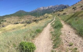
Rock Canyon is the go-to hiking and trail running spot in the Provo area. This tends to be more hilly and fairly challenging trail running. The hike/run up Y Mountain is popular. The footing is easier on the Rock Canyon Trail.
A good, flat 7 mile loop on a mainly gravel strip between the airport and Utah Lake. Views of surrounding mountains and occasional glimpses of the lake. Can be combined with our Utah Lake and Provo River Parkway routes.
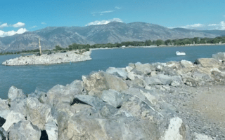
Several good running options around Utah's largest freshwater lake. Jetties and a bike path at Utah Lake State Park, a 3-mile Shore Line Trail north of there, and some decent running along Lincoln Beach Rd. between Lincoln Beach and Tower View Point.
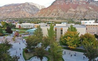
Attractive campus for running, with mountains all around, nice pedestrian paths, and numerous fields/athletic facilities. A campus 'tour' is 3-4 miles. Can add with Provo River Parkway Trail right near campus or paved path along N University Ave.
Share your feedback on this route and see that of other Great Runs users. Click on the image icon to upload a photo. And please let us know if there are notes or changes we should incorporate!
Subscribe
0 Comments
Oldest
Newest
Inline Feedbacks
View all comments
Essentials
Overall: 15 miles (25 km). It's 5.7 miles from Utah Lake to BYU, and 9.4 miles from BYU to Provo Canyon
Utah Lake to BYU is flat; BYU to Provo Canyon is 929 feet (283m) - the section north of 800 N is steeper
Depends on section chosen
Numerous Trailheads & Access Points - See Description

Review or Comment on This Route/Share a Photo!
Share your feedback on this route and see that of other Great Runs users. Click on the image icon to upload a photo. And please let us know if there are notes or changes we should incorporate!