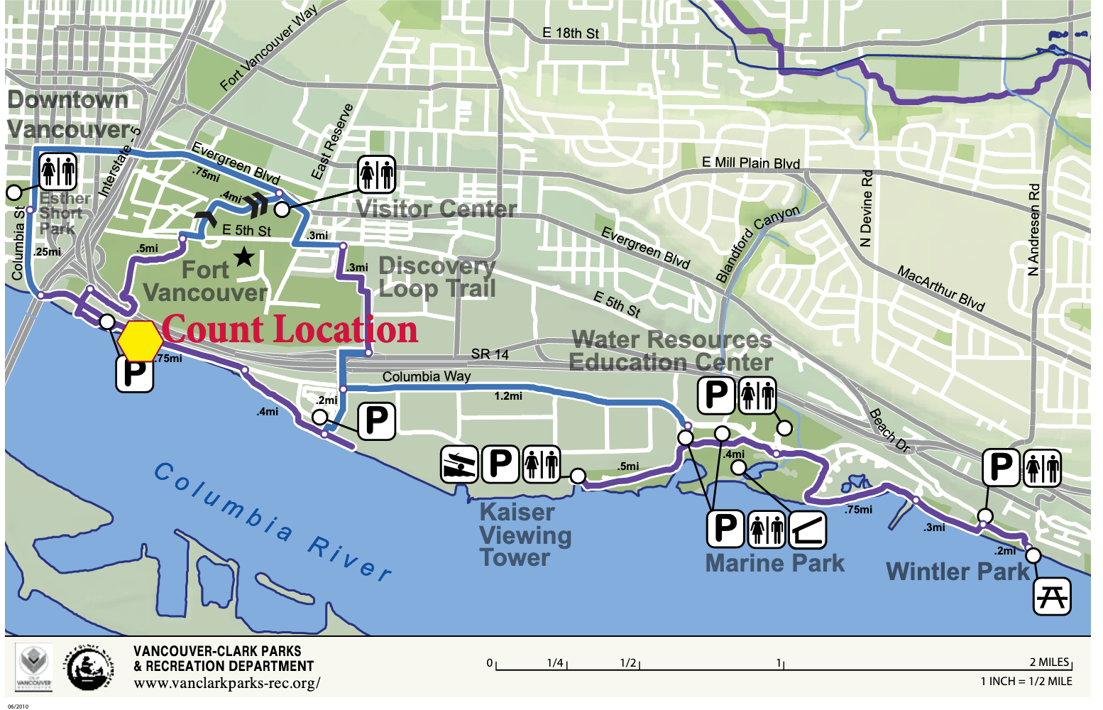
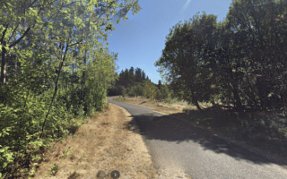
The Columbia River Renaissance Trail is one of the signature runs in Vancouver. This ~5 mile trail — a combination on and off-road path — has great views of the Columbia River and Mount Hood. It’s also fun to combine with a loop around Fort Vancouver, other historic spots downtown, or with the Oregon-Washington Bridge to Hayden Island for an even longer run. Bonus: much of the trail is lit at night!
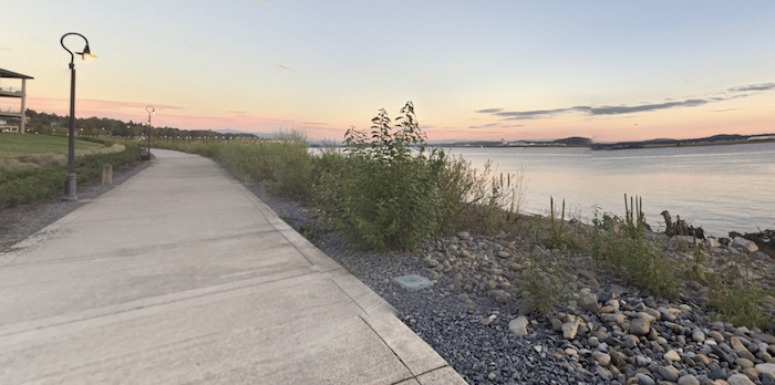
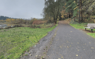
Riverfront Trail. This paved multi-use trail runs between Vancouver Waterfront Park, just west of the Oregon-Washington Bridge, and runs east for nearly 5 miles to Wintler Community Park. There’s a 1.5 mile section along SE Columbia Way (still part of the path). There are great views of the river, bridge, and Mt. Hood for most of the route. Note: good access from downtown — use the path from Esther Short Park, paralleling Columbia St.
Fort Vancouver. CC: Visitor7
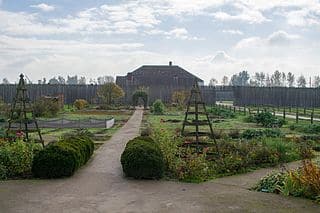
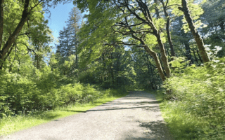
Fort Vancouver. This route can be done separately or as an add-on to the riverfront trail. We’ve mapped a 3.8 mile loop around the fort, from the river path using the iconic Vancouver Land Bridge (pedestrian bridge). The city of Vancouver also has a marked 2.3-mile Discovery Historic Loop at Fort Vancouver, which includes the Fort and other historic/downtown sites: Fort Vancouver, Pearson Air Museum, Providence Academy, Esther Short Park and the Old Apple Tree.
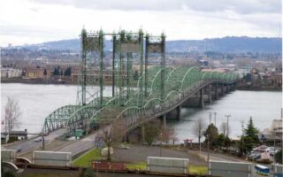
Bridge to Hayden Island. Can connect to the Oregon-Washington Bridge, which connects to Hayden Island and Portland. See our route there.
The Columbia River Renaissance Trail is one of the signature runs in Vancouver. This ~5 mile trail — a combination on and off-road path — has great views of the Columbia River and Mount Hood. It’s also fun to combine with a loop around Fort Vancouver, other historic spots downtown, or with the Oregon-Washington Bridge to Hayden Island for an even longer run. Bonus: much of the trail is lit at night!
Riverfront Trail. This paved multi-use trail runs between Vancouver Waterfront Park, just west of the Oregon-Washington Bridge, and runs east for nearly 5 miles to Wintler Community Park. There’s a 1.5 mile section along SE Columbia Way (still part of the path). There are great views of the river, bridge, and Mt. Hood for most of the route. Note: good access from downtown — use the path from Esther Short Park, paralleling Columbia St.
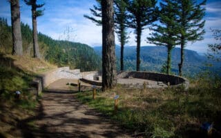
Fort Vancouver. CC: Visitor7
Fort Vancouver. This route can be done separately or as an add-on to the riverfront trail. We’ve mapped a 3.8 mile loop around the fort, from the river path using the iconic Vancouver Land Bridge (pedestrian bridge). The city of Vancouver also has a marked 2.3-mile Discovery Historic Loop at Fort Vancouver, which includes the Fort and other historic/downtown sites: Fort Vancouver, Pearson Air Museum, Providence Academy, Esther Short Park and the Old Apple Tree.
Bridge to Hayden Island. Can connect to the Oregon-Washington Bridge, which connects to Hayden Island and Portland. See our route there.
Scroll Down For Route Maps
Essentials
River Trail: 4.8 miles (7.7 km) one-way; Fort: 3-4 miles, or use the 2.3 mile Discovery Historic Loop
River Trail: 98 feet (30m) one-way; Fort Vancuver Loop is 114 feet (34m)
Any point along river trail. Downtown start: use the path from Esther Short Park, paralleling Columbia St.
Run between two states, enjoying views of the Columbia River, plus additional waterfront paths on Hayden Island and in Portland east of the Expo Center.
A great spot for a longer off-road run near Vancouver. The paved multi-use path runs from Meadowbrook Marsh Park for 8 miles west to Vancouver Lake in Stewart Glen. It's a mix of grassland, parks, and wooded sections.
A fun 10k out and back, a few miles north of the city. The paved multi-use path runs for 3.2 miles between Klineline Pond (a popular swimming spot) and NW 36th Ave., featuring a nice combination of open and wooded sections.
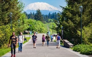
Washington State University, located 10 miles north of Vancouver, is a great campus for running, with six miles of paths. Combines a 'campus tour' with some more wooded sections. Great views of Mt. St. Helens!
A worth-it destination run, 20 minutes east of Vancouver. 3.5 mile gravel multi-use path along Lacamas Lake, and 6 miles of trails in Lacamas Park. Something for everyone. Catch the April bloom of Camas Lilies!
A popular trail run, located 25 miles east of Vancouver, known for its undulating wooded sections and great views of the Columbia River. The full loop is 6.4 mile. Video excerpts!
A worth-it destination for those looking for a longer, scenic off-road run. The 31-mile gravel multi-use path is in two sections. The first 13 miles, from Lyle to Klickitat, is more scenic & runnable. following the Klickitat River.
Share your feedback on this route and see that of other Great Runs users. Click on the image icon to upload a photo. And please let us know if there are notes or changes we should incorporate!
Subscribe
0 Comments
Oldest
Newest
Inline Feedbacks
View all comments
Essentials
River Trail: 4.8 miles (7.7 km) one-way; Fort: 3-4 miles, or use the 2.3 mile Discovery Historic Loop
River Trail: 98 feet (30m) one-way; Fort Vancuver Loop is 114 feet (34m)
Any point along river trail. Downtown start: use the path from Esther Short Park, paralleling Columbia St.

Review or Comment on This Route/Share a Photo!
Share your feedback on this route and see that of other Great Runs users. Click on the image icon to upload a photo. And please let us know if there are notes or changes we should incorporate!