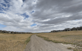
In Littleton, just south of Englewood and Lakewood, the best bets for running are a series of trails and greenways. The anchor is the Mary Carter Greenway. At its south end, there some good multi-use paths and trails in the Chatfield State Park/Reservoir area.
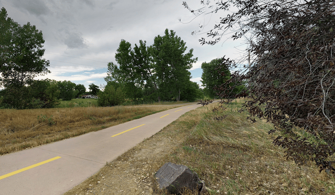
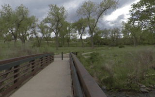
Mary Carter Greenway. This paved multi-use path runs for 7.3 miles from Englewood south to Chatfield State Park, mainly along the South Platte River. It’s a pleasant run, with some water views and connecting other trails and parks along the way. For the first 4 miles to Bowles Grove Park, there are paths on both sides of the river. South of Reynolds Landing (5 mile mark), the area becomes less suburban, passing a series of lakes and reservoirs, ending at Chatfield State Park, where there are other paths and trails.
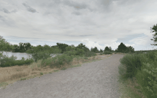
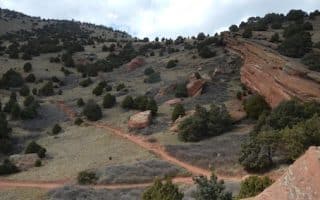
Chatfield State Park. This is a popular park for its water activities on the Chatfield Reservoir, plus wonderful running opportunities on its 26 miles of trails (10 miles paved, 16 miles non-paved). The trails range from easy multi-use paths to more moderate trail running. It’s a really nice mix of park, paths along the Reservoir, and some hillier terrain, with views of the foothills and the Platte River valley. Scenic easier options include the 2.7 mile Dam Trail and the 3.2 mile Equestrian Trail. A good challenge is the 10-mile Perimeter Loop. TRAIL MAP
Add-Ons:The northern end of the park connects to the Mary Carter Greenway, which heads north for 7.3 miles to Littleton & Englewood.
Flickr: Kent Kanouse
Hildebrand Ranch Park. There’s wide open trail running in this park west of Chatfield State Park, with terrain ranging from plains to hogback. The best bet for running is the Two Brands Trail, a 5-mile loop with gentle grades. TRAIL MAP. There are some additional trails at the Chatfield Farms section of the Denver Botanical Gardens.
In Littleton, just south of Englewood and Lakewood, the best bets for running are a series of trails and greenways. The anchor is the Mary Carter Greenway. At its south end, there some good multi-use paths and trails in the Chatfield State Park/Reservoir area.
Mary Carter Greenway. This paved multi-use path runs for 7.3 miles from Englewood south to Chatfield State Park, mainly along the South Platte River. It’s a pleasant run, with some water views and connecting other trails and parks along the way. For the first 4 miles to Bowles Grove Park, there are paths on both sides of the river. South of Reynolds Landing (5 mile mark), the area becomes less suburban, passing a series of lakes and reservoirs, ending at Chatfield State Park, where there are other paths and trails.
Chatfield State Park. This is a popular park for its water activities on the Chatfield Reservoir, plus wonderful running opportunities on its 26 miles of trails (10 miles paved, 16 miles non-paved). The trails range from easy multi-use paths to more moderate trail running. It’s a really nice mix of park, paths along the Reservoir, and some hillier terrain, with views of the foothills and the Platte River valley. Scenic easier options include the 2.7 mile Dam Trail and the 3.2 mile Equestrian Trail. A good challenge is the 10-mile Perimeter Loop. TRAIL MAP
Add-Ons:The northern end of the park connects to the Mary Carter Greenway, which heads north for 7.3 miles to Littleton & Englewood.
Flickr: Kent Kanouse
Hildebrand Ranch Park. There’s wide open trail running in this park west of Chatfield State Park, with terrain ranging from plains to hogback. The best bet for running is the Two Brands Trail, a 5-mile loop with gentle grades. TRAIL MAP. There are some additional trails at the Chatfield Farms section of the Denver Botanical Gardens.
Scroll Down For Route Maps
Essentials
Mary Carter Greenway: 7.3 miles (13.8 km) one-way; Chatfield State Park: 26 miles of trails; Hildebrand Ranch Park: 5-mile loop
Greenway: 137 feet (41m), one-way; At Chatfield SP, there more moderate trails are rolling hills
Greenway: North end is off River Point Parkway in Englewood. Numerous other start/access points along the way
The Greenway has numerous access points & parking areas; Ample parking at Chatfield State Park (fee required)
Some wonderful running options in Lakewood, a suburb 20 miles west of Denver. Hilly trails in William Hayden Green Mountain Park, prairie and reservoir trails in Bear Creek Lake Park, and iconic trails through red rocks in Red Rocks Park.
Belmar Park is the anchor of a route of up to 13.5 miles connecting several parks & reservoirs in Lakewood. Most of the route is off-road on a series of paths & trails.
The Bear Creek multi-use trail connects four parks between Sheridan and Lakewood, making for a longer off-road run with some greenery and shade: Bear Creek Park, Bear Valley Park, Bear Creek Greenbelt, and Bear Creek Lake Park.
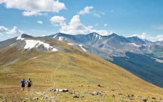
This is one of the best trail running opportunities near Denver. 18 miles from downtown and easy access from I-70. Once in this area, be sure to explore Red Rock Park.
Some great options within 20 miles of Denver: The Mount Falcon Trail in Morrison; Waterton Canyon and the 6-mile wide gravel trail along the South Platte River in Littleton; White Ranch Open Space in Golden; Peaks to Plains Trail in Golden.
Englewood is one of Denver’s major southern suburbs and home to lots of businesses. A great option for running here is Cherry Creek State Park, which is the southeastern terminus of the Cherry Creek Trail that starts in Denver.
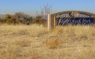
Our favorite run in this city of 400,000 east of Denver is a linear park route from Sand Creek Park to Fred Thomas Park. Other good options are the Sand Creek Greenway and High Line Canal multi-use trails.
Good running options near DIA include a route combining several parks; 20 miles of trails in the Rocky Mountain Arsenal National Wildlife Refuge; and several good routes in nearby Aurora.
Share your feedback on this route and see that of other Great Runs users. Click on the image icon to upload a photo. And please let us know if there are notes or changes we should incorporate!
Subscribe
0 Comments
Oldest
Newest
Inline Feedbacks
View all comments
Essentials
Mary Carter Greenway: 7.3 miles (13.8 km) one-way; Chatfield State Park: 26 miles of trails; Hildebrand Ranch Park: 5-mile loop
Greenway: 137 feet (41m), one-way; At Chatfield SP, there more moderate trails are rolling hills
Greenway: North end is off River Point Parkway in Englewood. Numerous other start/access points along the way
The Greenway has numerous access points & parking areas; Ample parking at Chatfield State Park (fee required)


Review or Comment on This Route/Share a Photo!
Share your feedback on this route and see that of other Great Runs users. Click on the image icon to upload a photo. And please let us know if there are notes or changes we should incorporate!