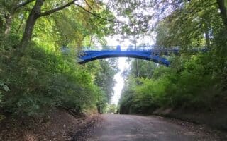
Our other favorite route in St. Andrews is along Lade Braes Walk, a historic public footpath that runs past several parks and skirts several golf courses. The path starts in central St. Andrews and heads south for 3.5 miles to Craigtoun Country Park. Note: the southern direction is a gradual uphill.
University of St Andrews. Oliverkeenan
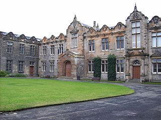
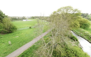
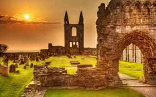
Start at the University of St. Andrews, and run south through the campus on a path called The Long Walk, picking up Lade Braes Walk at Queen’s Terrace & Wesvtview. Run south on Lade Braes Walk, which follows the Kinness Burn (narrow river), passing Cockshaugh Public Park and the 18-acre St Andrews Botanic Garden. At the ~2-mile mark is Hallow Hill, where you can get the lungs going with its hilly paths and fields. Continue south for ~1 mile along a partially wooded section, passing the St Andrews for Golf club. You’ll reach Craigtoun Country Park, where there are additional paths and an amusement park.
Add-Ons: Additional paths within the University, and in the parks. Can also connect to our St. Andrews Waterfront route at the University.
Our other favorite route in St. Andrews is along Lade Braes Walk, a historic public footpath that runs past several parks and skirts several golf courses. The path starts in central St. Andrews and heads south for 3.5 miles to Craigtoun Country Park. Note: the southern direction is a gradual uphill.
University of St Andrews. Oliverkeenan
Start at the University of St. Andrews, and run south through the campus on a path called The Long Walk, picking up Lade Braes Walk at Queen’s Terrace & Wesvtview. Run south on Lade Braes Walk, which follows the Kinness Burn (narrow river), passing Cockshaugh Public Park and the 18-acre St Andrews Botanic Garden. At the ~2-mile mark is Hallow Hill, where you can get the lungs going with its hilly paths and fields. Continue south for ~1 mile along a partially wooded section, passing the St Andrews for Golf club. You’ll reach Craigtoun Country Park, where there are additional paths and an amusement park.
Add-Ons: Additional paths within the University, and in the parks. Can also connect to our St. Andrews Waterfront route at the University.
A scenic path along the River Tay, called the Green Circular, extends for many miles east and west of the center of Dundee. This 5.3 mile western route features nice water views, passing the V&A Museum, Dundee University, and the airport.
A route exploring the waterfront area east of the marina. We've mapped a route of up to 6.5 miles one-way, in three sections. Favorite is the ~3 miles starting at Broughty Castle, then along the Esplanade, and the southern part of the Mighty Durn path.
One can put together a nice 2-3 miles around Balgay Park/Victoria Park/Lochee Park, including paths to forested Mills Observatory. Extend further on paths to the Change Centre Dundee sports complex, or do our full 9.3 mile loop!
A nice ribbon of green on this linear park path, which runs along the Dighty Burn tributary of the River Tay. Combination of open park land and some forested sections. Up to 4.3 miles between Claypotts Castle and just west of Trottick Ponds.
Tayport is a commuter suburb of Dundee, located just across the Tay Road Bridge. One can put together a nice run 5.5 mile run featuring Tayport Common, marina, and path put to the Tayport Lighthouse.
Very scenic running on the trails around this area of massive sand dunes, near Tayport. Trails and footpaths passing by the dunes. and through grassland, heathland, forestland, and some runnable beach sections.
Run a 10k scenic waterfront route past the world’s oldest public golf course, and then along the beach where the iconic 'Chariots of Fire' was filmed. A unique and historic route in the seaside town of St. Andrews on Scotland’s east coast.
Share your feedback on this route and see that of other Great Runs users. Click on the image icon to upload a photo. And please let us know if there are notes or changes we should incorporate!
Review or Comment on This Route/Share a Photo!
Share your feedback on this route and see that of other Great Runs users. Click on the image icon to upload a photo. And please let us know if there are notes or changes we should incorporate!