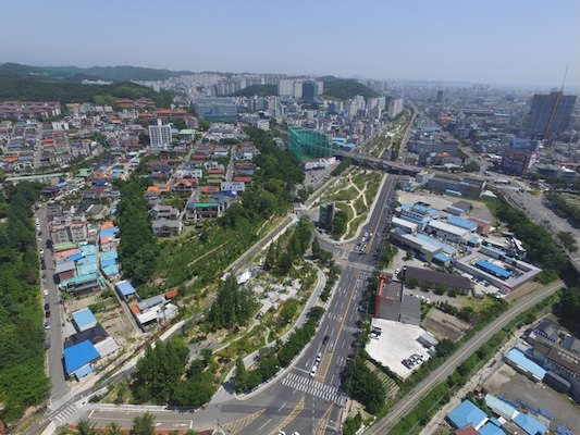
The Railway Forest Greenway is another great opportunity for a longer off-road run in Pohang. Completed in 2022, this paved, 6.6 km multi-use trail runs along a former rail line and is a Green Flag Award winner. Often referred to as Pohang’s version of New York City’s Highline Trail (and winner of a Green Flag Award), this linear route park route features separate pedestrian and cycle paths and includes numerous designed areas along the way, such as seating areas, outdoor gym stations, and cultural additions such as libraries, cafes and public art. Bonus: lit at night!
The north end is at Yongheung-ro, adjacent to Highway 7. From there, the path cuts through five sections of the city, paralleling Saecheonnyeon-daero, ending near the Yugang Bridge. It’s a pleasantly green space, nicely landscaped. Very popular! Just past the 5 km mark, there’s a pedestrian bridge that leads to the Hyeongsan River path.
Note: Our map is an approximation, as the route does not show up on maps. There are kiosks with maps & information along the way.
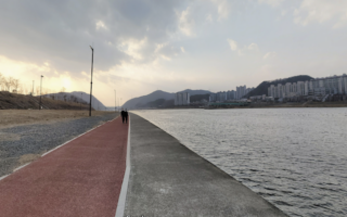
Add-Ons: Connect to our Hyeongsan River route, toward the southern end of the Greenway.
The Railway Forest Greenway is another great opportunity for a longer off-road run in Pohang. Completed in 2022, this paved, 6.6 km multi-use trail runs along a former rail line and is a Green Flag Award winner. Often referred to as Pohang’s version of New York City’s Highline Trail (and winner of a Green Flag Award), this linear route park route features separate pedestrian and cycle paths and includes numerous designed areas along the way, such as seating areas, outdoor gym stations, and cultural additions such as libraries, cafes and public art. Bonus: lit at night!
The north end is at Yongheung-ro, adjacent to Highway 7. From there, the path cuts through five sections of the city, paralleling Saecheonnyeon-daero, ending near the Yugang Bridge. It’s a pleasantly green space, nicely landscaped. Very popular! Just past the 5 km mark, there’s a pedestrian bridge that leads to the Hyeongsan River path.
Note: Our map is an approximation, as the route does not show up on maps. There are kiosks with maps & information along the way.
Add-Ons: Connect to our Hyeongsan River route, toward the southern end of the Greenway.

Review or Comment on This Route/Share a Photo!
Share your feedback on this route and see that of other Great Runs users. Click on the image icon to upload a photo. And please let us know if there are notes or changes we should incorporate!