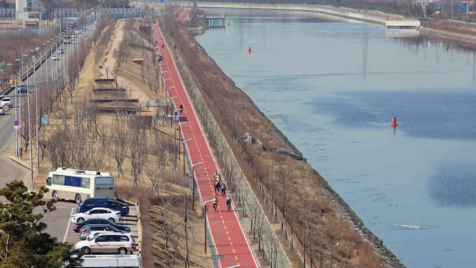
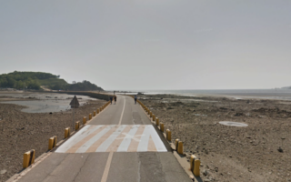
For a long, scenic off-road run in Incheon, the paths along the Ara Canal are a great option. Located in the northern part of Incheon in the large Seo-Gu district, the Ara Canal links the Han River to the Yellow Sea. There are parks along the way and paved cycle paths along both banks, extending for 16 km east to Gochon. There are water & mountain views most of the way. Restrooms & other facilities. Our map is along the South Bank in part because there’s also a separate pedestrian path along much of the way. However, the North Bank is a bit more park-like, and lacks the busy road alongside. Note: there aren’t particularly good crossing options, as the bridges are super high and not that pedestrian-friendly, so you sort of have to commit to one side.
South Bank. We’ve mapped the whole 16 km route from west to east. Run as much as you like, then turn around! The western terminus of the path is at the Araeseohae Rest Area near the Yeongjong Bridge. It’s 3.3 km to the Sicheongyo Bridge, 6.7 km to the Gyeyang Bridge. The east end of the path is near the Gimpo Ara Bridge in Gochon (train station there).
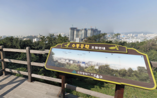
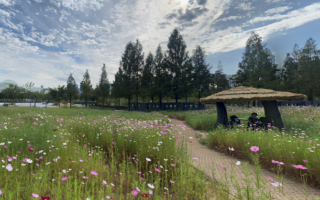
North Bank. There’s also a cycle path along the north bank, which is also scenic and has several attractions. The north bank path has less of a busy road alongside. The first 3.3 km to Ara Canal Sicheon Garam Place pass by parks and golf courses. At the ~5 km mark is the AraMaru Skywalk (very high up, great views!) & AraMaru Circular Glass Floor, which sits 45m high.
For a long, scenic off-road run in Incheon, the paths along the Ara Canal are a great option. Located in the northern part of Incheon in the large Seo-Gu district, the Ara Canal links the Han River to the Yellow Sea. There are parks along the way and paved cycle paths along both banks, extending for 16 km east to Gochon. There are water & mountain views most of the way. Restrooms & other facilities. Our map is along the South Bank in part because there’s also a separate pedestrian path along much of the way. However, the North Bank is a bit more park-like, and lacks the busy road alongside. Note: there aren’t particularly good crossing options, as the bridges are super high and not that pedestrian-friendly, so you sort of have to commit to one side.
South Bank. We’ve mapped the whole 16 km route from west to east. Run as much as you like, then turn around! The western terminus of the path is at the Araeseohae Rest Area near the Yeongjong Bridge. It’s 3.3 km to the Sicheongyo Bridge, 6.7 km to the Gyeyang Bridge. The east end of the path is near the Gimpo Ara Bridge in Gochon (train station there).
North Bank. There’s also a cycle path along the north bank, which is also scenic and has several attractions. The north bank path has less of a busy road alongside. The first 3.3 km to Ara Canal Sicheon Garam Place pass by parks and golf courses. At the ~5 km mark is the AraMaru Skywalk (very high up, great views!) & AraMaru Circular Glass Floor, which sits 45m high.


Review or Comment on This Route/Share a Photo!
Share your feedback on this route and see that of other Great Runs users. Click on the image icon to upload a photo. And please let us know if there are notes or changes we should incorporate!