The Traboulay PoCo Trail is an extensive trail system in Port Coquitlam, a city just south of Coquitlam. Overall, there are 25 km of paths, featuring a nice variety: woodland, riverfront, meadows, & marshes. The trails are mainly unpaved, but generally have good footing. Choosing which section of Traboulay PoCo Trail to run depends on the season, your mood, and what you’d like to see. This trail map has excellent information on the options, and segment distances. Some sections we particularly like:
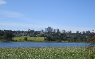
Coquitlam River, Port Coquitlam Section. Trails on both sides of the river, though mainly wooded with occasional water views. It is 8 km from Patricia Ave. south to Shaughnessey St. on the Fraser River, on the east bank of the Coquitlam River. The trail is paved between Prairie Ave. & Red Bridge. South of Red Bridge, the trail is part of ƛ̓éxətəm Regional Park (formerly Colony Farm Park), and is a lovely section of marsh & wetlands.
Coquitlam River, Coquitlam Section. The trail also extends north into Coquitlam. It’s 2.25 km from Patricia Ave. north to David Ave. We’ve mapped a 10.6 km loop between David Ave. & Gates Park, on both sides of the river. North of David Ave., the Crystal Falls Trail continues along the east bank of the Coquitlam River for another 5.2 km. It’s more rugged and a gradual uphill headed north. (ROUTE MAP)
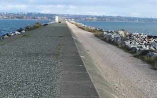
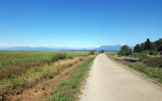
Pitt River Trails. Also considered part of the Pitt Meadows Dyke Trail system, this is a very scenic section of the PoCo Trail, featuring wetland, farm, river, and mountain views! It is nearly 12 km along the west bank of the Pitt River between De Bouville Slough and Shaughnessy St. at the Fraser River. Ambitious runners can do a long loop, circling back along the Coquitlam River (see the trail map).
The Traboulay PoCo Trail is an extensive trail system in Port Coquitlam, a city just south of Coquitlam. Overall, there are 25 km of paths, featuring a nice variety: woodland, riverfront, meadows, & marshes. The trails are mainly unpaved, but generally have good footing. Choosing which section of Traboulay PoCo Trail to run depends on the season, your mood, and what you’d like to see. This trail map has excellent information on the options, and segment distances. Some sections we particularly like:
Coquitlam River, Port Coquitlam Section. Trails on both sides of the river, though mainly wooded with occasional water views. It is 8 km from Patricia Ave. south to Shaughnessey St. on the Fraser River, on the east bank of the Coquitlam River. The trail is paved between Prairie Ave. & Red Bridge. South of Red Bridge, the trail is part of ƛ̓éxətəm Regional Park (formerly Colony Farm Park), and is a lovely section of marsh & wetlands.
Coquitlam River, Coquitlam Section. The trail also extends north into Coquitlam. It’s 2.25 km from Patricia Ave. north to David Ave. We’ve mapped a 10.6 km loop between David Ave. & Gates Park, on both sides of the river. North of David Ave., the Crystal Falls Trail continues along the east bank of the Coquitlam River for another 5.2 km. It’s more rugged and a gradual uphill headed north. (ROUTE MAP)
Pitt River Trails. Also considered part of the Pitt Meadows Dyke Trail system, this is a very scenic section of the PoCo Trail, featuring wetland, farm, river, and mountain views! It is nearly 12 km along the west bank of the Pitt River between De Bouville Slough and Shaughnessy St. at the Fraser River. Ambitious runners can do a long loop, circling back along the Coquitlam River (see the trail map).


Review or Comment on This Route/Share a Photo!
Share your feedback on this route and see that of other Great Runs users. Click on the image icon to upload a photo. And please let us know if there are notes or changes we should incorporate!