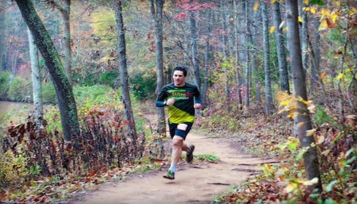
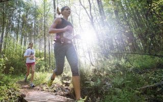
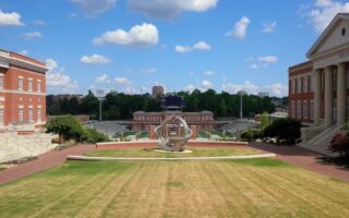
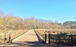
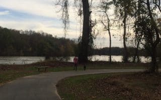
The ASC Greenway is home to 2,300 acres of hardwood forests, prairies, creeks, streams, lakes and ponds protected by a conservation easement in perpetuity. The Greenway has over 30 miles of hiking, biking, and horseback riding trails, historical cabins, a grist mill with working waterwheel, and a nature center filled with wildlife and historical exhibits. Located in Fort Mills, great trail running is only about 30 minutes South of Uptown. Our map has information on loop options of various lengths and topographies.
Features:
Scroll Down For Route Maps
Essentials
- Multiple Distance Options
- Fort Mills is only 30 minutes south of Uptown
Current Weather & Forecast

Charlotte, US
10:41 pm,
Jul 20, 2026
L: 26°
H: 29°
Daily ForecastHourly Forecast
Tomorrow
5:00 pm
26° / 29°°C
0.31 mm
31%
7 mph
95 %
1022 mb
0 mm/h
Wednesday
5:00 pm
15° / 28°°C
1 mm
100%
8 mph
92 %
1018 mb
0 mm/h
Thursday
5:00 pm
15° / 30°°C
0.2 mm
20%
8 mph
87 %
1012 mb
0 mm/h
Friday
5:00 pm
19° / 30°°C
0 mm
0%
13 mph
57 %
1003 mb
0 mm/h
Saturday
5:00 pm
15° / 30°°C
0 mm
0%
14 mph
82 %
1006 mb
0 mm/h
Today
11:00 pm
19° / 19°°C
0.31 mm
31%
5 mph
72 %
1022 mb
0 mm/h
Tomorrow
2:00 am
19° / 19°°C
0 mm
0%
2 mph
77 %
1022 mb
0 mm/h
Tomorrow
5:00 am
17° / 18°°C
0 mm
0%
2 mph
87 %
1022 mb
0 mm/h
Tomorrow
8:00 am
14° / 14°°C
0 mm
0%
3 mph
95 %
1021 mb
0 mm/h
Tomorrow
11:00 am
19° / 19°°C
0 mm
0%
5 mph
79 %
1020 mb
0 mm/h
Tomorrow
2:00 pm
22° / 22°°C
0 mm
0%
7 mph
66 %
1019 mb
0 mm/h
Tomorrow
5:00 pm
24° / 24°°C
0 mm
0%
7 mph
56 %
1017 mb
0 mm/h
Other Routes in Charlotte, NC
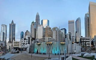
Downtown in Charlotte is ‘Uptown’. This route features a variety of urban green spaces as well as numerous Charlotte landmarks (Stadiums, Convention Center, Museums).
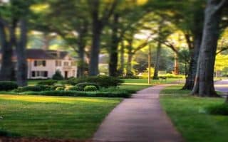
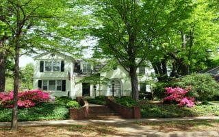
The most well-known running loop in Charlotte, featuring the idyllic Myers Park neighborhood with its tall oaks, and lovely homes, and hilly roads. Nice Add-On: Freedom Park trails

This 4-mile mile paved path runs along the Lynx Blue Line Light Rail, winding from Uptown Charlotte to the South End, passing breweries, art galleries, and hip eateries and bars. Can run way and take the trolley back!


The longest continuous off-road trail in Charlotte. Paved multi-use trail runs for up to 16 miles from the NoDa district to the South Carolina state line. Follows the stream and passes through several parks. We've divided into three sections.
This 5.5 mile route features the lovely streets and homes of Dilworth, beginning Uptown in Marshall Park and runs down Little Sugar Creek Greenway to Freedom Park.


A pleasant linear park route in northwest Charlotte combining paved multi-use trails for up to 3.3 miles through Martin Luther King, Jr. Park, Seversville Park, and Frazier Park.
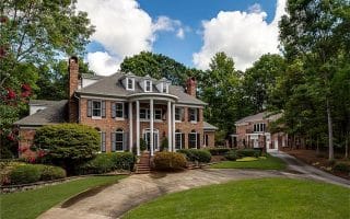
About 10 miles south of downtown, one of the more pleasant ‘straight shot” running areas through pleasant residential neighborhoods is to take Sharon Rd. West to Gleneagles Rd.
Explore some 40 miles of woodland trails extending along the Catawba River at the U.S. National Whitewater Center about 20 minutes West of Uptown.
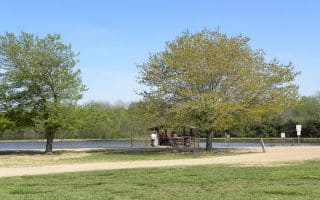
Local runners recommend the marked 5K championship cross-county course at McAlpine Creek Park, 15 minutes southeast from Uptown.
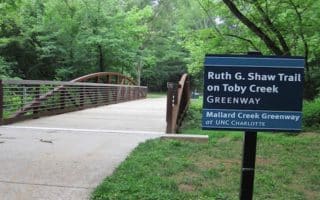
In northeast Charlotte, several greenway trails that run along their namesake creeks can be run separately or combined: 5-mile Mallard Creek Greenway, 2.5 mile Clarks Creek Greenway, & 2.8 mile Toby Creek Greenway.
A fabulous run nearly all off-road, combining the attractive UNCC campus, botanical gardens, running track, lake loop, and three area greenways. Full route is 10k, but good options for longer & shorter.
A 5.8 mile, well-shaded escape from the nearby population center that’s grown up along the south end of 485, about 10 miles south of the city.
Pleasant 4.4-mile out and back trail along the Catawba River in the Rock Hill/Riverwalk area. Nice water views and shade. Near the cluster of hotels off I-77/Highway 21. Connects to other trails around nearby River Park.
User Ratings
Leave A Review or Comment
Review or Comment on This Route/Share a Photo!
Share your feedback on this route and see that of other Great Runs users. Click on the image icon to upload a photo. And please let us know if there are notes or changes we should incorporate!