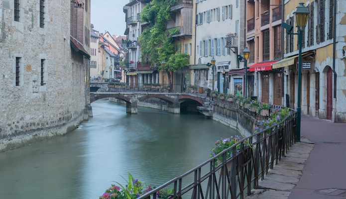
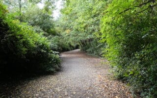
Lac d’Annecy is not the only waterfront running in Annecy. The Le Thiou river, which flows into the northwest corner of the lake, is lined with mostly paved promenades leading from the center of the city. Close to the old town, the paths are congested with pedestrians and cafe seating, but the lanes open up as the river becomes more rural. To run the whole promenade loop, start on Quai du Semnoz and head west along the waterfront. Soon after crossing the Rue de la Republique bridge, the path becomes Prom. Louis Lachenal, which leads to a pedestrian bridge. Cross the bridge to the south bank on Prom. du Thiou, then turn left (east). Prom. du Saint Sepulchre returns to old town, where runners can cross back over a pedestrian bridge to finish the route. It’s a short 3.5 km out and back, but there are good add-on options. Bonus: Divert onto the pedestrian-only streets of Old Town for some lovely runseeing. Rue Grenette, Passage de la Cathédrale, and Rue Notre Dame are some favorites.
Quai de la Tournette. Google Street View
Add-Ons: For a nice 2 km add-on, do a loop around the Jardins de l’ Europe (Gardens of Europe) and the . Runners can continue on the the west side of the lake on the Voie Verte, or the east side of the lake on our Lac d’Annecy Waterfront route for more mileage.
Scroll Down For Route Maps
Essentials
3.5 km (2.2 miles); Optional 2 km add-on or other add-ons
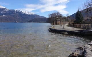
The most accessible running route in Annecy is along the northern waterfront of Lac d’Annecy. Great views, and scenic highlights like the Pont des Amours.
The best long distance running in Annecy is the Voie Verte, a paved cycling path stretching 35 km between Annecy and Ugine. Combination of along the water and inland. The first 5 km is mostly along the water, so that would be a nice 10k out and back.
A network of wooded, gravel paths between the Parcours Sportif de Meythet and the Centre Sportif Marcel Dassault in the northeast reaches of Annecy. Good running track in the adjacent Parc des Sports.
The waterfront of Saint Jorioz is another scenic running option, with pretty concrete and gravel paths lining the lakeside. Run a 5 km out and back, or combine with the Voie Verte for a loop.
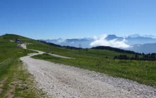
Find easygoing trail running on the smooth dirt paths leading through the meadows and ridgelines of Semnoz, just west of Saint Jorioz. We’ve mapped a 6.5 km route.
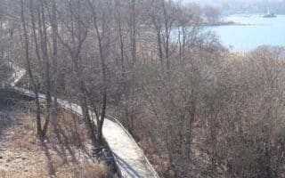
This nature park on the south shore of Lac d'Annecy boasts great views from its meandering boardwalks. A loop is 3 km, but the Voie Verte is nearby for more mileage.
Share your feedback on this route and see that of other Great Runs users. Click on the image icon to upload a photo. And please let us know if there are notes or changes we should incorporate!
Subscribe
0 Comments
Oldest
Newest
Inline Feedbacks
View all comments
Essentials
3.5 km (2.2 miles); Optional 2 km add-on or other add-ons

Review or Comment on This Route/Share a Photo!
Share your feedback on this route and see that of other Great Runs users. Click on the image icon to upload a photo. And please let us know if there are notes or changes we should incorporate!