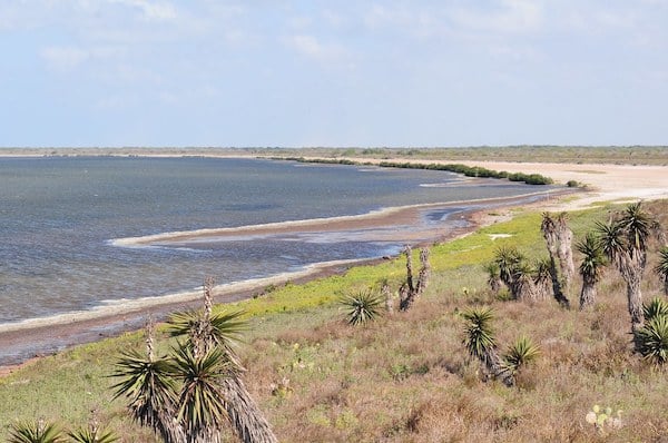
The Laguna Atascosa National Wildlife Refuge is the most scenic spot in Brownsville for a run. Located 30 miles north of Brownsville, the 97,000-acre refuge has diverse terrain featuring wetlands, tidal flats, desert & prairie habitats for birds & wildlife. There are 70 miles of trails, and running is permitted — although we urge visitors to read the guidelines regarding wildlife. Note: Some trails are only open during certain seasons.The best bets for running, detailed in this brochure and map are:
U.S. Fish & Wildlife Service
Road Running. From the Visitor Center area, run the 1.5 mile Lakeside Drive, or choose a section of the paved, 14-mile Bayside Drive. These are less remote and used by bikers too.
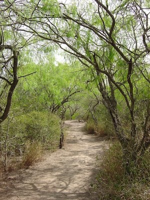
Trail Running. We recommend the Lower West Lake Trail. It’s up to 6 miles (one-way) and features coastal prairie, shoreline, and wetlands (during wet years). If you want to run through prairie land, enjoy the 4.1-mile Prairie Trail. Also good for running are the 3.3 mile Gator Trail and the 5.75 mile Country Trail which passes through thornscrub, savanna, prairie and former agricultural lands.
The Laguna Atascosa National Wildlife Refuge is the most scenic spot in Brownsville for a run. Located 30 miles north of Brownsville, the 97,000-acre refuge has diverse terrain featuring wetlands, tidal flats, desert & prairie habitats for birds & wildlife. There are 70 miles of trails, and running is permitted — although we urge visitors to read the guidelines regarding wildlife. Note: Some trails are only open during certain seasons.The best bets for running, detailed in this brochure and map are:
U.S. Fish & Wildlife Service
Road Running. From the Visitor Center area, run the 1.5 mile Lakeside Drive, or choose a section of the paved, 14-mile Bayside Drive. These are less remote and used by bikers too.
Trail Running. We recommend the Lower West Lake Trail. It’s up to 6 miles (one-way) and features coastal prairie, shoreline, and wetlands (during wet years). If you want to run through prairie land, enjoy the 4.1-mile Prairie Trail. Also good for running are the 3.3 mile Gator Trail and the 5.75 mile Country Trail which passes through thornscrub, savanna, prairie and former agricultural lands.
Scroll Down For Route Maps
Essentials
Parking at Visitor Center and at some other designated trailheads
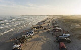
10+ miles of excellent beach running on this barrier island located 25 miles east of Brownsville. Also some decent running in the Isla Blanca Area at the southern end. Gulf Blvd. is 3+ miles and has sidewalks/bike lane but isn't very scenic.
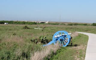
Run 1.5 miles of paved paths in Palo Alto Battlefield National Historical Park, site of the first major battle of the U.S.-Mexican War. From the park, access the Battlefield Trail, an 8-mile multi-use path that runs between the Park and Brownsville's cultural district.
The Event Center Running Trail is the other principal off-road path in Brownsville. The trail runs along a small river through sort of a linear park in one of the city's more upscale neighborhoods. Up to 6.5 miles. Also connects with the Brownsville Historic Battlefield Trail.
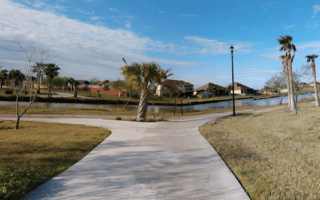
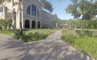
A good way to see a good number of Brownsville's highlights. Most scenic sections are ~1.5 miles along the Belden West Trail to Riverside Park, and the ~2 mile loop around the campuses of the adjoining Texas Southmost College and UTRGV University.
An oasis of green and a popular birding area, located in south Brownsville on the Rio Grande near the Mexican border. The 557-acre Sanctuary, run by Audubon, is home to many native species of plants and animals. 3 miles of nature trails -- OK to run if you tread lightly.
Share your feedback on this route and see that of other Great Runs users. Click on the image icon to upload a photo. And please let us know if there are notes or changes we should incorporate!
Subscribe
0 Comments
Oldest
Newest
Inline Feedbacks
View all comments
Essentials
Parking at Visitor Center and at some other designated trailheads
Review or Comment on This Route/Share a Photo!
Share your feedback on this route and see that of other Great Runs users. Click on the image icon to upload a photo. And please let us know if there are notes or changes we should incorporate!