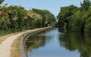
In the northeast part of Coventry, there’s a series of green spaces — sort of a linear park — anchored by the River Sowe. There are parks, meadows, sloughs, and footpaths along the narrow River Sowe. We’ve put together two routes, which can be combined! It’s a mix of paved & natural surfaces.
River Sowe Footpaths, Longford Park, Wyken Slough
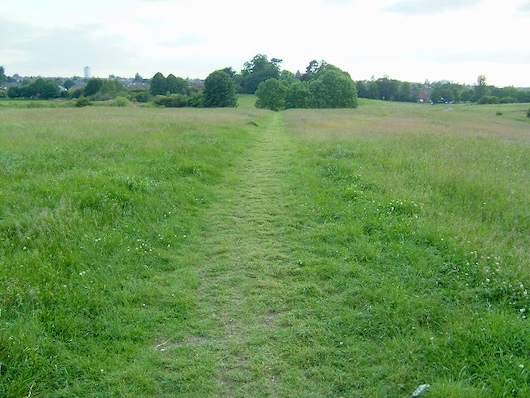
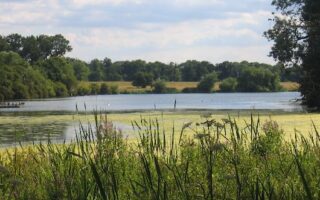
This is a 5.6 mile loop combining several green spaces, anchored by footpaths along the the River Sowe. The map starts at the small footbridge connecting to the Coventry Canal route, in case you’d like to combine with that! Run east through Longford Park, a nice open space with several paths. Then head south for 1 mile on footpaths along the River Sowe, mainly on the east bank, to Henley Rd. Double back, then heading north on the River Sowe footpath, into Wyken Slough — another nice green space with a small pond. Do a ~1 mile loop of Wyken Slough, then head east, returning to Longford Park. There’s an ~0.4 mile road section, along shady Eburne Rd., which has a nice sidewalk.
Lower River Sowe Footpath, Wyken Croft, Potters Green, Moat House Park
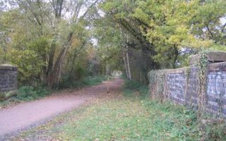
 This is a separate 2.5 mile linear park route in the Wyken part of Coventry. Start at Henley Rd., where you can connect with the route above. Take Henley Rd. east, connecting to the Sowe Valley Footpath. Run south on the paved path into Wyken Croft Nature Park, a scenic conservation area built on a former mining site. You can run on meadow paths or on the River Sowe footpath. Then head north along the Potters Green Corridor, a linear park with paths passing through open & wooded terrain. It’s 1 mile north through Woodway Walk & Moat House Park.
- For a longer run or a loop, you can connect from Moat House Park to River Soar Paths on paths west through the Castlewood School, using Winston Ave./Petitor Cresc.


Review or Comment on This Route/Share a Photo!
Share your feedback on this route and see that of other Great Runs users. Click on the image icon to upload a photo. And please let us know if there are notes or changes we should incorporate!