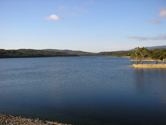
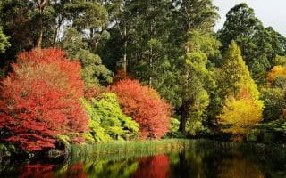
Lysterfield State Park is famous for being one of Victoria’s best places to ride a mountain bike, with 20 km (12 miles) of trails (and location of the 2006 Commonwealth Games mountain bike course). There are three good options for running here: a quick, flat loop around the lake; a series of fire trails throughout the park that are gentler and less technical; or more challenging technical options using the mountain bike tracks. Most of these tracks are technically the territory of the cyclists so as a courtesy, give the music a miss and let them have the right of way. Click here for a useful guide and map, provided by Parks Victoria.
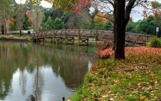
Lake Loop: A quick and relatively easy loop, primarily following the fire trails around the lake, popular with walkers and families. There are small rolling hills on the back section of the loop which increases the difficulty factor. Starting from the main car park, heading anti-clockwise, follow the Lake Walk/Track, then Short Cut Walk, then first left onto Casuarina Track, then finally left onto Snipe Track across the dam back to the car park/picnic area. There are also toilet, water, picnic and BBQ facilities at the start/finish area.
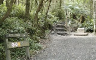
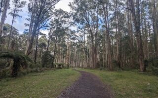
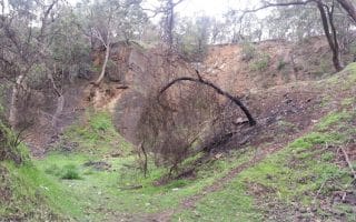
Lysterfield Alternative: There is plenty of room to explore at Lysterfield, however if you are looking for ideas, the following provides a solid run which utilises a mixture of single track and fire trails. Starting at the main carpark and heading along Lake Track, turn right onto Mahogany track and join Thompson Track at the Y intersection. Cross Lamberts Track to join Boys Farm Track. At the four-way intersection around the 4 km (2.5 miles) mark, go left onto the East West Fire Break. Join Quarry Track at the 5km (3 miles) mark after crossing Donelan Track and join Wallaby Track at the five-way intersection at around the 7.5 km (4.7 miles) mark. Follow this down until you join Cloverdale track and a quick left onto Casuaina track which runs alongside the lake. Simply keep the lake to your left and follow the track around and across the dam to arrive back at the main carpark/picnic area.
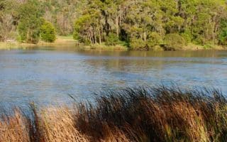
Add-Ons: By following the unpaved Logan Park Road (no public use so it’s quiet) and crossing Wellington Road, you will enter the Birdsland area (see our route there). Can also follow the Lysterfield Hills Track across the hill and down into the Churchill National Park (see our route there).
Lysterfield State Park is famous for being one of Victoria’s best places to ride a mountain bike, with 20 km (12 miles) of trails (and location of the 2006 Commonwealth Games mountain bike course). There are three good options for running here: a quick, flat loop around the lake; a series of fire trails throughout the park that are gentler and less technical; or more challenging technical options using the mountain bike tracks. Most of these tracks are technically the territory of the cyclists so as a courtesy, give the music a miss and let them have the right of way. Click here for a useful guide and map, provided by Parks Victoria.
Lake Loop: A quick and relatively easy loop, primarily following the fire trails around the lake, popular with walkers and families. There are small rolling hills on the back section of the loop which increases the difficulty factor. Starting from the main car park, heading anti-clockwise, follow the Lake Walk/Track, then Short Cut Walk, then first left onto Casuarina Track, then finally left onto Snipe Track across the dam back to the car park/picnic area. There are also toilet, water, picnic and BBQ facilities at the start/finish area.
Lysterfield Alternative: There is plenty of room to explore at Lysterfield, however if you are looking for ideas, the following provides a solid run which utilises a mixture of single track and fire trails. Starting at the main carpark and heading along Lake Track, turn right onto Mahogany track and join Thompson Track at the Y intersection. Cross Lamberts Track to join Boys Farm Track. At the four-way intersection around the 4 km (2.5 miles) mark, go left onto the East West Fire Break. Join Quarry Track at the 5km (3 miles) mark after crossing Donelan Track and join Wallaby Track at the five-way intersection at around the 7.5 km (4.7 miles) mark. Follow this down until you join Cloverdale track and a quick left onto Casuaina track which runs alongside the lake. Simply keep the lake to your left and follow the track around and across the dam to arrive back at the main carpark/picnic area.
Add-Ons: By following the unpaved Logan Park Road (no public use so it’s quiet) and crossing Wellington Road, you will enter the Birdsland area (see our route there). Can also follow the Lysterfield Hills Track across the hill and down into the Churchill National Park (see our route there).

Review or Comment on This Route/Share a Photo!
Share your feedback on this route and see that of other Great Runs users. Click on the image icon to upload a photo. And please let us know if there are notes or changes we should incorporate!