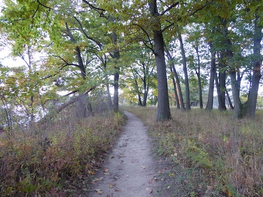
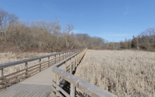
For a fairly easy and scenic trail run featuring a variety of terrain, we recommend the area around Princess Point and Cootes Paradise. Princess Point is a park on a peninsula in Cootes Paradise Nature Sanctuary, featuring trails & a canoe launch. It’s a popular skating area in winter. We’ve mapped a route of up to 7 km one-way, including a section of the Spencer Creek Trail. The trail is mainly packed earth, a bit narrow in parts.
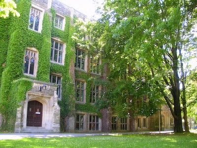
McMaster University. Flickr: Tom Flemming
Start at the Princess Point Canoe launch (parking area), on the Princess Point Trail, and head east. Continue along the mainly wooded Ginger Valley Trail. Just shy of the 2 km mark, turns into the Ravine Road Trail (optional 1.4 km out and back to the Sassafrass Point Lookout). At 4 km, the route leaves the preserve and joins pedestrian paths through McMaster University. Option to continue east for another 2 km along the Cootes Dr./Spencer Creek Trail to the end
Add-On: This can also be combined with our Waterfront Trail route, just east of Princess Point.
For a fairly easy and scenic trail run featuring a variety of terrain, we recommend the area around Princess Point and Cootes Paradise. Princess Point is a park on a peninsula in Cootes Paradise Nature Sanctuary, featuring trails & a canoe launch. It’s a popular skating area in winter. We’ve mapped a route of up to 7 km one-way, including a section of the Spencer Creek Trail. The trail is mainly packed earth, a bit narrow in parts.
McMaster University. Flickr: Tom Flemming
Start at the Princess Point Canoe launch (parking area), on the Princess Point Trail, and head east. Continue along the mainly wooded Ginger Valley Trail. Just shy of the 2 km mark, turns into the Ravine Road Trail (optional 1.4 km out and back to the Sassafrass Point Lookout). At 4 km, the route leaves the preserve and joins pedestrian paths through McMaster University. Option to continue east for another 2 km along the Cootes Dr./Spencer Creek Trail to the end
Add-On: This can also be combined with our Waterfront Trail route, just east of Princess Point.
Scroll Down For Route Maps
Essentials
Up to 7 km one-way, or 14 km (8.6 miles) out and back, with options for longer/shorter
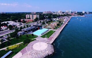
The signature run trail in Hamilton. A gorgeous, paved multi-use path runs right along Lake Ontario, with unimpeded views of the water, incorporating multiple waterfront parks. The full route, east to Pier 7 and west to Princess Point, is 12.8 km.
Scenic waterfront path that runs for 13 km between Burlington and eastern Hamilton. The paved mult-use trail is mainly along Hamilton Beach and Burlington Beach, with uninterrupted views of the water. Choose a section!
A scenic, off-road run in Burlington's Hendrie Valley -- a combination botanical garden, arboretum, and preserve. Our 8 km out and back is on trails leading through featuring forested slopes with towering trees, marsh, and four creeks.
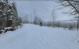
A unique running experience in Hamilton! Run on a path along the Niagara Escarpment and get the heart rate up on a series of stair paths that connect to Hamilton's Upper and Lower sections. If you do all the stair paths, it's 2,800 total steps!
A scenic escarpment path, four waterfalls, and stair paths with 623 steps all in one run! The western section of the Escarpment path uses the Bruce Trail and Chedoke Radial Trail, passing waterfalls, and the Dundurn and Chedoke Stairs, for an 11.3 km loop.
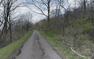
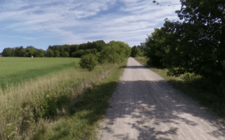
Choose a section of the Hamilton-Brantford Rail Trail for an off-road run of any length. The gravel multi-use path starts near McMaster University and heads for up to 37 km west to Brantford. Farmland type terrain, and a nice tree canopy in sections.
Share your feedback on this route and see that of other Great Runs users. Click on the image icon to upload a photo. And please let us know if there are notes or changes we should incorporate!
Subscribe
0 Comments
Oldest
Newest
Inline Feedbacks
View all comments
Essentials
Up to 7 km one-way, or 14 km (8.6 miles) out and back, with options for longer/shorter

Review or Comment on This Route/Share a Photo!
Share your feedback on this route and see that of other Great Runs users. Click on the image icon to upload a photo. And please let us know if there are notes or changes we should incorporate!