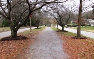
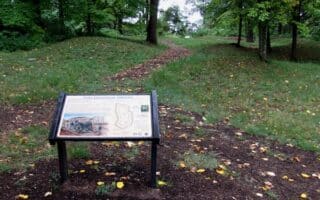
Just east of downtown and on the south side of the Tennessee River, a series of several parks, preserves, and quarries offer many miles of scenic trails for running. The centerpiece is the Forks of the River Wildlife Management Area, which has 50 miles of natural trails and gravel roads winding through fields and woods. The area is also famous for its 70 acres of sunflower fields, which bloom in July. A popular route is the 6.5 mile Perimeter Trail. TRAIL MAP The paved Will Skelton Greenway binds these areas, running for 3.5 miles from Island Home Park, connecting to Ijams Nature Center and Forks of the River WMA.
Outdoorknowxville.com
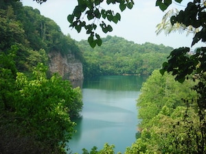
Just west of Forks of the River WMA is the Ijams Nature Center, an urban park with 10 miles of trails passing wetlands & rock formations. This area also includes trails around Ross Marble Quarry and Meads Quarry.
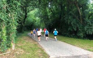
Just south of there, continue to Marie Myers Park, and the William Hastie Natural Area, which has 3.5 miles of more rugged, wooded running trails.
Just east of downtown and on the south side of the Tennessee River, a series of several parks, preserves, and quarries offer many miles of scenic trails for running. The centerpiece is the Forks of the River Wildlife Management Area, which has 50 miles of natural trails and gravel roads winding through fields and woods. The area is also famous for its 70 acres of sunflower fields, which bloom in July. A popular route is the 6.5 mile Perimeter Trail. TRAIL MAP The paved Will Skelton Greenway binds these areas, running for 3.5 miles from Island Home Park, connecting to Ijams Nature Center and Forks of the River WMA.
Outdoorknowxville.com
Just west of Forks of the River WMA is the Ijams Nature Center, an urban park with 10 miles of trails passing wetlands & rock formations. This area also includes trails around Ross Marble Quarry and Meads Quarry.
Just south of there, continue to Marie Myers Park, and the William Hastie Natural Area, which has 3.5 miles of more rugged, wooded running trails.
Scroll Down For Route Maps
Essentials
Many miles of trails
Some of the terrain is hilly
Parking area at southern end of Forks of the River WMA off Burnett Creek Rd.
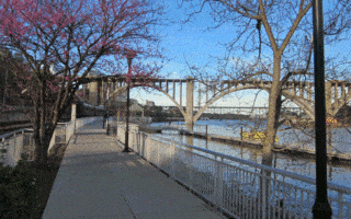
Neyland Greenway is the principal path along the Tennessee River, running for 3.8 miles from the University of Tennessee Campus to Riverside Landing Park. Nicest section is from Second Creek to the eastern end.
A nearly 5-mile loop showcasing Knoxville's historic downtown and the adjacent University of Tennessee campus, with a return on the riverfront Neyland Greenway. Make sure to do a loop around the Tom Black Track!
A nice run through the western part of Knoxville, featuring the lively Marble City neighborhood and multi-use paths through the long, narrow Third Creek Greenway Park. Good add-on options.
One of of our favorite runs in Knoxville, combining a pretty path, parks, and a bucolic residential area. The Sequoyah Greenway runs along the median of leafy Cherokee Blvd. Options for out and back or a loop.
Large park on the southern side of the Tennessee River built around a Civil War fort and a quarry lake. 4 miles of multi-use trails that are popular for running. Can add with Mary Vestal Park and High Ground Park.
Share your feedback on this route and see that of other Great Runs users. Click on the image icon to upload a photo. And please let us know if there are notes or changes we should incorporate!
Subscribe
0 Comments
Oldest
Newest
Inline Feedbacks
View all comments
Essentials
Many miles of trails
Some of the terrain is hilly
Parking area at southern end of Forks of the River WMA off Burnett Creek Rd.

 Just east of downtown and on the south side of the Tennessee River, a series of several parks, preserves, and quarries offer many miles of scenic trails for running. The centerpiece is the Forks of the River Wildlife Management Area, which has 50 miles of natural trails and gravel roads winding through fields and woods. The area is also famous for its 70 acres of sunflower fields, which bloom in July. A popular route is the 6.5 mile Perimeter Trail. TRAIL MAP The paved Will Skelton Greenway binds these areas, running for 3.5 miles from Island Home Park, connecting to Ijams Nature Center and Forks of the River WMA.
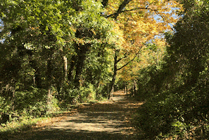


Review or Comment on This Route/Share a Photo!
Share your feedback on this route and see that of other Great Runs users. Click on the image icon to upload a photo. And please let us know if there are notes or changes we should incorporate!