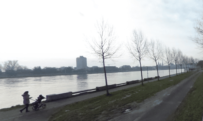
Some of the best running in Linz is along the Danube River, with extensive paths on the north and south banks. This post is focused on the north side of the river, where there are ~8 km of paths right along the water. We’ve mapped a couple of options that can be combined.
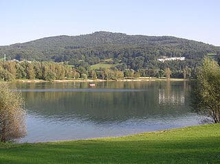
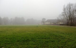
Pleschinger Lake. CC: NeoUrfahraner
Headed East to Alex-Felsen. This route is up to 11.5 km out and back, using riverside paths headed east to Alex-Felsen. From the Nibelungenbrücke (bridge), head east along the Donauradweg (weg=path). There are both paved and gravel options along the river. Nice views of the water and the old city across the river. It’s 5 km to Pleschinger Lake (see=lake). Here, there’s an option to do the 1.5 km loop around the lake, and then use some of the park paths or return to the river. It’s very pastoral & green, with some views of the surrounding hills.
Headed West from Nibelungenbrücke. One can also run west of the Nibelungenbrücke for nearly 3 km. Part of it is dedicated path and part is on a sidewalk along the riverside Obere Donaustraße. One can continue even further west on a bike path alongside the Rohrbacher Str., which is more of a major road — there are nice water views but the path is on the north side of the road rather than the river side.
Add-Ons: Can combine with our south side Danube route.
Some of the best running in Linz is along the Danube River, with extensive paths on the north and south banks. This post is focused on the north side of the river, where there are ~8 km of paths right along the water. We’ve mapped a couple of options that can be combined.
Pleschinger Lake. CC: NeoUrfahraner
Headed East to Alex-Felsen. This route is up to 11.5 km out and back, using riverside paths headed east to Alex-Felsen. From the Nibelungenbrücke (bridge), head east along the Donauradweg (weg=path). There are both paved and gravel options along the river. Nice views of the water and the old city across the river. It’s 5 km to Pleschinger Lake (see=lake). Here, there’s an option to do the 1.5 km loop around the lake, and then use some of the park paths or return to the river. It’s very pastoral & green, with some views of the surrounding hills.
Headed West from Nibelungenbrücke. One can also run west of the Nibelungenbrücke for nearly 3 km. Part of it is dedicated path and part is on a sidewalk along the riverside Obere Donaustraße. One can continue even further west on a bike path alongside the Rohrbacher Str., which is more of a major road — there are nice water views but the path is on the north side of the road rather than the river side.
Add-Ons: Can combine with our south side Danube route.
Scroll Down For Route Maps
Essentials
Up to 11.5 km (7.1 miles), includes 1.5 km loop around the lake
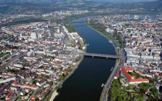
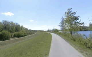
There are terrific paths on both sides of the Danube in Linz. This route is focused on the south side, combining the path east from central Linz along the water to the end of Winterhafen, including paths in Donaulände Park.
A terrific 5k route combining the grounds of the Schlosspark castle park and the wooded paths of Freinberg Park, which features several observation decks. A longer option includes additional small parks and a jaunt through central Linz.
This 'water forest park' located 6 km south of Linz City Center is a great spot for a run. Several km of paths, including a 2.1 km 'running course'. Combination of woods & open fields. Good transport access
For some pleasant countryside running, head to Ebelesberg, ~10 km south of Linz. There's a long path along the Traun River to the Asten Locks, and loops around Ausee Lake, Weikerlseen Lake, & Pichlinger Lake.
Share your feedback on this route and see that of other Great Runs users. Click on the image icon to upload a photo. And please let us know if there are notes or changes we should incorporate!
Subscribe
0 Comments
Oldest
Newest
Inline Feedbacks
View all comments
Essentials
Up to 11.5 km (7.1 miles), includes 1.5 km loop around the lake

Review or Comment on This Route/Share a Photo!
Share your feedback on this route and see that of other Great Runs users. Click on the image icon to upload a photo. And please let us know if there are notes or changes we should incorporate!