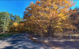
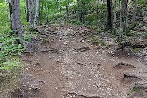
The Iron Ore Heritage Trail is a good bet for a longer distance off-road running option in Marquette. The 47-mile multi-use trail follows mostly abandoned railroad corridors that were used to bring lumber to furnaces and forges and iron ore to the Lake Superior Harbor. The surface is a combination of paved and “crushed aggregate”. Some of the sections west of Ishpeming are less improved, but still runnable. This trail map has excellent information on the trail, segment distance options, and key sites and access points.
The southern end of the trail starts at Kawbawgam Rd. just south of Marquette, and the western end is in Republic. A good section to do is the nearly 20 miles between Marquette Commons and Ishpeming. The terrain is a combination of open and wooded, as the trail follows US HWY 41 for much of its length.


Review or Comment on This Route/Share a Photo!
Share your feedback on this route and see that of other Great Runs users. Click on the image icon to upload a photo. And please let us know if there are notes or changes we should incorporate!