If in the Mobile area, it’s worth the 1/2 hour drive south to Fairhope to experience a couple runs featuring nice homes, water views, and live oaks. There are two areas we recommend:
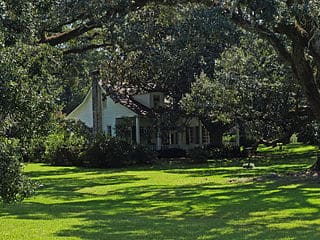
Chapman-Scott House, Montrose. CC: Chris Pruitt
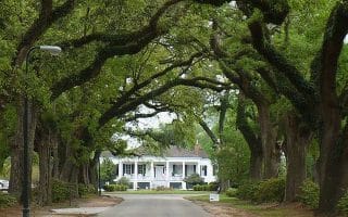
Montrose Historic District. A lovely residential area located 17 miles south of Mobile. The centerpiece is Main St., which is a wide road with gracious trees and historic homes set back from the road. There’s a good sidewalk for running. It’s ~2.5 miles, including an 0.5 mile jaunt down Sea Cliff Dr. to Fly Creek Marina to snag some nice water views. You can also enjoy running on some of the side streets off Main St., such as Sibley St.
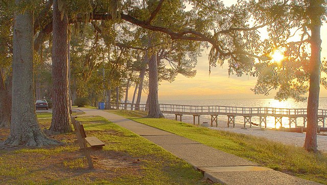
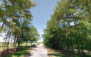
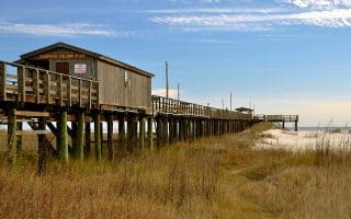
Fairhope: Scenic Hwy 98. It’s a pleasant run along a nearly 5-mile stretch of this old highway along Mobile Bay from North Beach Park to Point Clear. At North Point Park, there are waterside paths and a pleasant pier with great water views. Then, follow Scenic Hwy 98 south to Orange Street Beach. The road turns inland, but there there are lovely live oaks and nice homes, with a decent sidewalk for running. Thanks to Lauren for the route suggestion!
If in the Mobile area, it’s worth the 1/2 hour drive south to Fairhope to experience a couple runs featuring nice homes, water views, and live oaks. There are two areas we recommend:
Chapman-Scott House, Montrose. CC: Chris Pruitt
Montrose Historic District. A lovely residential area located 17 miles south of Mobile. The centerpiece is Main St., which is a wide road with gracious trees and historic homes set back from the road. There’s a good sidewalk for running. It’s ~2.5 miles, including an 0.5 mile jaunt down Sea Cliff Dr. to Fly Creek Marina to snag some nice water views. You can also enjoy running on some of the side streets off Main St., such as Sibley St.
Fairhope: Scenic Hwy 98. It’s a pleasant run along a nearly 5-mile stretch of this old highway along Mobile Bay from North Beach Park to Point Clear. At North Point Park, there are waterside paths and a pleasant pier with great water views. Then, follow Scenic Hwy 98 south to Orange Street Beach. The road turns inland, but there there are lovely live oaks and nice homes, with a decent sidewalk for running. Thanks to Lauren for the route suggestion!
Scroll Down For Route Maps
Essentials
Montrose Historic District: up to 2.5 miles one-way; Fairhope: 4.8 miles (7.7 km) from North Point Park to Point Clear
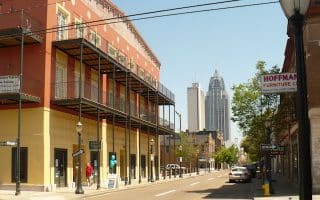
Explore Mobile’s historic neighborhoods on this 4.7 mile loop of Government Street, Dauphin Street, and Old Shell Road, or create-your-own run through shady, tree-lined neighborhoods.
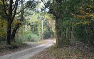
Run through this scenic tunnel of trees on the Spring Hill College campus then continue through the College Park neighborhood. Especially beautiful in spring.
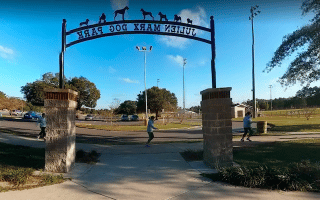
Substantial park located 7 miles west of downtown is a wonderful green space for running. Perimeter loop is 2.4 miles, and there are many interior roads and paths, and a couple of lakes. Also the location of several Mobile cultural institutions.
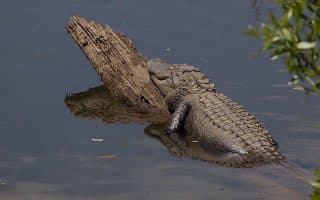
Search for alligators in the creek below this cool boardwalk section of the Eastern Shore Trail. It's a quick 2.5 mile (4 km) out and back. It's part of the longer Eastern Shore Trail, parts of which are nice for running.
Bordering the edge of the downtown airport, the 1.8 mile Airport Perimeter Trail runs from Doyle Park to Bayfront Road. Can be extended to Alligator Bayou via the Crepe Myrtle Trail, which follows Bayfront Rd. for 5.6 miles. Nice water views!
Take a day trip to Dauphin Island to run pristine white sand beaches or the paved bike path along Bienville Boulevard. Long, flat, and beach-y with classic water, sand, and beach shack views. 30 miles south of Mobile.
Share your feedback on this route and see that of other Great Runs users. Click on the image icon to upload a photo. And please let us know if there are notes or changes we should incorporate!
Subscribe
0 Comments
Oldest
Newest
Inline Feedbacks
View all comments
Essentials
Montrose Historic District: up to 2.5 miles one-way; Fairhope: 4.8 miles (7.7 km) from North Point Park to Point Clear


Review or Comment on This Route/Share a Photo!
Share your feedback on this route and see that of other Great Runs users. Click on the image icon to upload a photo. And please let us know if there are notes or changes we should incorporate!