Modesto is an inland empire city of 220,000, located 30 miles south of Stockton. These are the best places to run in Modesto:
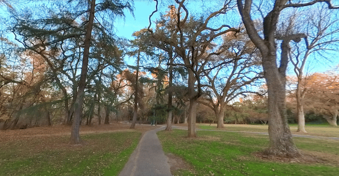
Parks Greenbelt. This is our favorite run in Modesto. A multi-use path connects several parks, for a total one-way distance of 3.6 miles. The west end is at Kevin Park off La Loma Ave. Continue through Thousand Oaks Park, East La Loma Park, and then on a path for ~1 mile along the north side of the Riverside Park & golf course. Some nice green and shaded spots. ROUTE MAP
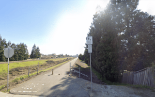
Standiford Trail. In the northwest part of Modesto, this multi-use path runs for 3.2 miles one-way. The west end is at Sisk Rd. (just east of the Golden State Highway), and the east end is at Semalton Dr., just east of Wesson Ranch Park. The route includes a loop around Chrysler 99 Park (a good place to park and start the route). ROUTE MAP
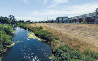
Tuolumne River Regional Park: In this riverside park, there’s a pleasant path that goes just inland from the river for nearly 2 miles one-way. A pleasant green space with a couple of water views. The trailhead is off Legion Park Dr. ROUTE MAP
Modesto is an inland empire city of 220,000, located 30 miles south of Stockton. These are the best places to run in Modesto:
Parks Greenbelt. This is our favorite run in Modesto. A multi-use path connects several parks, for a total one-way distance of 3.6 miles. The west end is at Kevin Park off La Loma Ave. Continue through Thousand Oaks Park, East La Loma Park, and then on a path for ~1 mile along the north side of the Riverside Park & golf course. Some nice green and shaded spots. ROUTE MAP
Standiford Trail. In the northwest part of Modesto, this multi-use path runs for 3.2 miles one-way. The west end is at Sisk Rd. (just east of the Golden State Highway), and the east end is at Semalton Dr., just east of Wesson Ranch Park. The route includes a loop around Chrysler 99 Park (a good place to park and start the route). ROUTE MAP
Tuolumne River Regional Park: In this riverside park, there’s a pleasant path that goes just inland from the river for nearly 2 miles one-way. A pleasant green space with a couple of water views. The trailhead is off Legion Park Dr. ROUTE MAP
Review or Comment on This Route/Share a Photo!
Share your feedback on this route and see that of other Great Runs users. Click on the image icon to upload a photo. And please let us know if there are notes or changes we should incorporate!