In the southern part of Stockton, one can put together a quite nice run combining a ‘Greenbelt’ path and and paths along the San Joaquin River. We’ve mapped nearly 10 miles — choose a section!
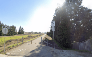
The Greenbelt path goes for 1.4 miles between French Camp Rd. and DeCarli St. Add on another ~1 mile east to Paul Weston Park and to Manthey Rd.
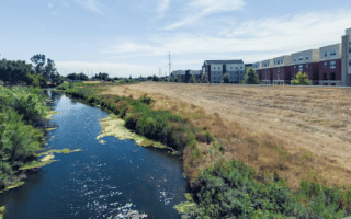
You can also head west of DeCarli St. on a path along the French Camp Slough for 0.8 miles to connect to a trail that runs south along the east side of the San Joaquin River for 7+ miles. There are some nice views of the river along the way.
In the southern part of Stockton, one can put together a quite nice run combining a ‘Greenbelt’ path and and paths along the San Joaquin River. We’ve mapped nearly 10 miles — choose a section!
The Greenbelt path goes for 1.4 miles between French Camp Rd. and DeCarli St. Add on another ~1 mile east to Paul Weston Park and to Manthey Rd.
You can also head west of DeCarli St. on a path along the French Camp Slough for 0.8 miles to connect to a trail that runs south along the east side of the San Joaquin River for 7+ miles. There are some nice views of the river along the way.
Review or Comment on This Route/Share a Photo!
Share your feedback on this route and see that of other Great Runs users. Click on the image icon to upload a photo. And please let us know if there are notes or changes we should incorporate!