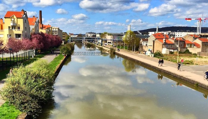
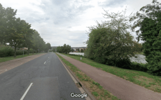
More waterfront running can be found along the Marne–Rhine Canal that runs through Nancy parallel to the Meurthe River. Overall there are some 20 km of paths from Maxévillen north of Nancy to Messein. The highlight is the area surrounding the marina and Jardin d’Eau, just east of the city center. From central Nancy, the paved paths runs for ~4 km north to Rue Lafayette in Maxéville, and for ~5 km south to the intersection with the Canal de Jonction de Nancy, where more paths continue inland. We’ve mapped a 17 km out and back run between Maxévillen and Sainte-Valdrée, with a southern extension to Messein. There are pedestrian bridges along the way that allow for loops, but the route also pairs well with a tour of Parc de la Pépinière or the La Meurthe paths.
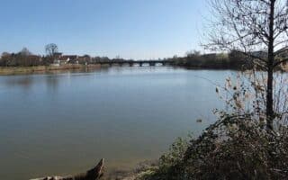
Southern Route. The Canal de Jonction de Nancy is a fair distance away from the city center, but it offers some more pleasant waterside running. Starting from the southern end of our main mapped canal route in Sainte-Valdrée, ~5 km south of Nancy, the path stretches for 10 kilometers west to the Jonction canal de l’Est in Messein. MAP.
More waterfront running can be found along the Marne–Rhine Canal that runs through Nancy parallel to the Meurthe River. Overall there are some 20 km of paths from Maxévillen north of Nancy to Messein. The highlight is the area surrounding the marina and Jardin d’Eau, just east of the city center. From central Nancy, the paved paths runs for ~4 km north to Rue Lafayette in Maxéville, and for ~5 km south to the intersection with the Canal de Jonction de Nancy, where more paths continue inland. We’ve mapped a 17 km out and back run between Maxévillen and Sainte-Valdrée, with a southern extension to Messein. There are pedestrian bridges along the way that allow for loops, but the route also pairs well with a tour of Parc de la Pépinière or the La Meurthe paths.
Southern Route. The Canal de Jonction de Nancy is a fair distance away from the city center, but it offers some more pleasant waterside running. Starting from the southern end of our main mapped canal route in Sainte-Valdrée, ~5 km south of Nancy, the path stretches for 10 kilometers west to the Jonction canal de l’Est in Messein. MAP.


Review or Comment on This Route/Share a Photo!
Share your feedback on this route and see that of other Great Runs users. Click on the image icon to upload a photo. And please let us know if there are notes or changes we should incorporate!