The Rising Sun Countryside Centre park and the WaggonWays Trail are two good running options in the northeast section of Newcastle upon Tyne, which can be combined for a longer run!
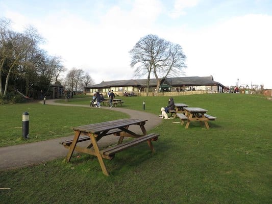
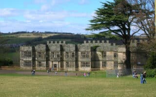
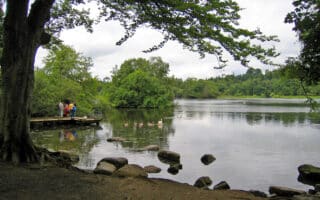
Rising Sun Countryside Centre. This lovely park has 400 acres of open space. One can put together a 3-4 mile run on its trails and paths, through a combination of nature reserve, grassland, and woodland areas. There’s also a small lake.
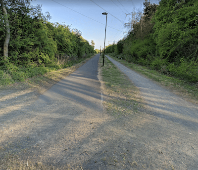
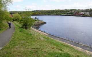
WaggonWays. Google Street View
WaggonWays Trail. This 3-mile multi-use trail is a good off-road running option in Newcastle upon Tyne’s eastern suburbs. It runs from Shiremoor (just south of the A186) south to the A193, near the Percy Main subway station. The trail skirts the eastern end of West Allotment Country Park, which has ~1 mile of pleasant trails, and including a nice hill to the Sun Dial, which is worth seeing!
Combination Run: A connector trail runs between the WaggonWays Trail just north of Coast Rd., heading west for 1 mile to Rising Sun Countryside Park. For a nice run combining the two areas, we’ve mapped an 8.7 mile route, with loops of the West Allotment Country Park & Rising Sun Countryside Park paths, using a 1-mile section of the WaggonWays trail and the connector trail between the two parks.
The Rising Sun Countryside Centre park and the WaggonWays Trail are two good running options in the northeast section of Newcastle upon Tyne, which can be combined for a longer run!
Rising Sun Countryside Centre. This lovely park has 400 acres of open space. One can put together a 3-4 mile run on its trails and paths, through a combination of nature reserve, grassland, and woodland areas. There’s also a small lake.
WaggonWays. Google Street View
WaggonWays Trail. This 3-mile multi-use trail is a good off-road running option in Newcastle upon Tyne’s eastern suburbs. It runs from Shiremoor (just south of the A186) south to the A193, near the Percy Main subway station. The trail skirts the eastern end of West Allotment Country Park, which has ~1 mile of pleasant trails, and including a nice hill to the Sun Dial, which is worth seeing!
Combination Run: A connector trail runs between the WaggonWays Trail just north of Coast Rd., heading west for 1 mile to Rising Sun Countryside Park. For a nice run combining the two areas, we’ve mapped an 8.7 mile route, with loops of the West Allotment Country Park & Rising Sun Countryside Park paths, using a 1-mile section of the WaggonWays trail and the connector trail between the two parks.
Scroll Down For Route Maps
Essentials
WaggonWays Trail: 3.1 miles (one-way); Route combining the two areas: 8.7 miles (14 km)
Generally flat
Depends on route chosen
Depends on route chosen. Can start in either park for combo run
We've put together several lovely routes in nearby Sunderland, including paths along the River Wear, Roker Beach, and several parks along the sea and south of the city.
Nice waterside running along the miles of paths and seven bridges along the River Tyne. On the north bank, paths extend ~3 miles east or west from the centre. Also some nice paths on the south bank, to Riverside Park.
Running the several miles of paths around Exhibition Park, Town Moor, & Nuns Moor is a highlight. Great views and some fun hills on this classic English common, right near town.
Fantastic running options in the Derwent Valley. Enjoy several miles of trails around landscaped Georgian Gardens and woodlands at the Gibside estate, plus the 12+ mile Derwent Walk through woodlands, meadows, wetlands, & riverside.
Some nice parks and trails in Wallsend, just east of Newcastle upon Tyne. Head north to combine Richardson Dees Park & Rising Sun Countryside Centre, or southeast into Walker Riverside Park.
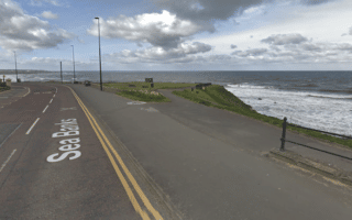
A worth-it destination for a run that has it all: fort, pier, lighthouses, parks, seafront promenade, and coastal bluffs! Easy footing, fairly flat, great views! This can be a 10-15 mile run, so might want to do in sections. Beach also runnable.
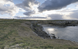
Some 8 miles of gorgeous seafront running along and above the water. Lighthouses, piers, seafront paths, coastal bluffs, parks, and runnable beaches! Choose a section!
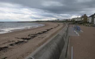
Some nice running in this seaside town 16 miles northeast of Newcastle upon Tyne. 1.5 miles of seafront promenade, and a multi-use path that extends west to QE2 Park, where there are additional trails.
A nice opportunity for some running in the Northumberland countryside. This park has several miles of trails around lakeside, woodland and open grassed areas. Located 16 miles northeast of Newcastle.
Share your feedback on this route and see that of other Great Runs users. Click on the image icon to upload a photo. And please let us know if there are notes or changes we should incorporate!
Subscribe
0 Comments
Oldest
Newest
Inline Feedbacks
View all comments
Essentials
WaggonWays Trail: 3.1 miles (one-way); Route combining the two areas: 8.7 miles (14 km)
Generally flat
Depends on route chosen
Depends on route chosen. Can start in either park for combo run


Review or Comment on This Route/Share a Photo!
Share your feedback on this route and see that of other Great Runs users. Click on the image icon to upload a photo. And please let us know if there are notes or changes we should incorporate!