Oyster Bay is one of the prettiest spots on Long Island, and there’s some attractive running here. There’s also a train station in town. Our recommendations on the best places to run in Oyster Bay:
Google Street View
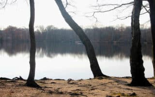
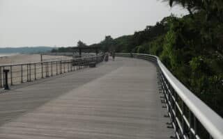
Roosevelt Park & West Shore Rd. Waterfront. Very pretty running along the water with views of Oyster Bay. Follow Main St. headed west, and then run along W Shore Rd. for as much as 3.7 miles, to Bayville Bridge and then a short section along W Harbor Dr. There’s a sidewalk with a guardrail separating the road along W Shore Rd., so it’s safe for running. You can also add ~ 1 mile of running in Theodore Roosevelt Memorial Park. ROUTE MAP
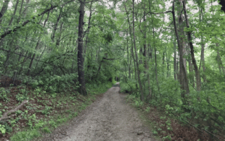
Cove Neck Rd. & Sagamore Hill. Sagamore Hill is the former summer home of Theodore Roosevelt, known as the ‘Summer White House’. It’s run by the National Park Service. There are pretty grounds, and a ~1 mile runnable nature trail that leads to Eeel Creek (pretty boardwalk). We also recommend running a section of Cove Neck Rd. There’s a sidewalk and pretty water views from just south of Tennis Court Rd. to Sagamore Hill (~1.3 miles, 168 foot gain). It’s possible to run run from Main St. in Oyster Bay, though part of the road lacks a sidewalk/shoulder. ROUTE MAP
Oyster Bay is one of the prettiest spots on Long Island, and there’s some attractive running here. There’s also a train station in town. Our recommendations on the best places to run in Oyster Bay:
Google Street View
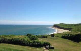
Roosevelt Park & West Shore Rd. Waterfront. Very pretty running along the water with views of Oyster Bay. Follow Main St. headed west, and then run along W Shore Rd. for as much as 3.7 miles, to Bayville Bridge and then a short section along W Harbor Dr. There’s a sidewalk with a guardrail separating the road along W Shore Rd., so it’s safe for running. You can also add ~ 1 mile of running in Theodore Roosevelt Memorial Park. ROUTE MAP
Cove Neck Rd. & Sagamore Hill. Sagamore Hill is the former summer home of Theodore Roosevelt, known as the ‘Summer White House’. It’s run by the National Park Service. There are pretty grounds, and a ~1 mile runnable nature trail that leads to Eeel Creek (pretty boardwalk). We also recommend running a section of Cove Neck Rd. There’s a sidewalk and pretty water views from just south of Tennis Court Rd. to Sagamore Hill (~1.3 miles, 168 foot gain). It’s possible to run run from Main St. in Oyster Bay, though part of the road lacks a sidewalk/shoulder. ROUTE MAP
Hempstead Lake State Park is a great spot for running, with scenic trails around the namesake lake and three ponds. Trail runners will enjoy the 3-mile Bridle Path around the lake. There's also a paved, 2.4-mile bike path.
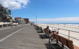
Wonderful beach and boardwalk running. At Long Beach, a festive boardwalk runs for 2.2 miles along the beach. At Jones Beach, there are miles of running, including the Jones Boardwalk and two longer multi-use paths. Beach also runnable.
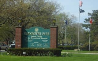
Eisenhower Park is one of the larger parks on Long Island and has numerous fitness/recreational facilities, including 3-4 miles of jogging trails. There's attractive residential running near Westbury Ctr., in Old Westbury, and some sections of Roslyn.
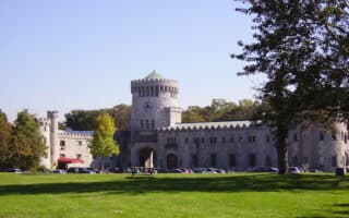
Run the lawns of the former Guggenheim estate in Sands Point Preserve, or enjoy pleasant residential neighborhood running near the Port Washington train station and around the Plandome/Manhasset neighborhoods.
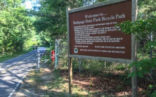
Run a section of Long Island's longest paved multi-use trail, which passes through several parks and wetlands preserves. The 11.3 mile path runs between Plainview/Old Bethpage and Massapequa. Additional paths and trails in the parks.
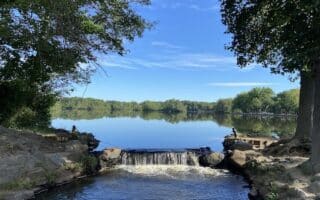
A multi-use path passing through three parks and around two lakes in Babylon: Belmont Lake State Park, Southards Pond Park, and Argyle Park. The full out and back route is 8 miles, including the lake loops. Mainly wooded, with some water views.
Pleasant running in the Great River/East Islip area. Heckscher State Park has 4 miles of paved, multi-use trails, and with excellent bay views. Also, nice running on the pleasant residential streets and the trails in Bayard Cutting Arboretum.
3,400 acre preserve features 50+ miles of trails, with something for runners of all abilities. It's at the midway point of Long Island, between the Sunrise Highway and the L.I. Expressway. Five color-coated trails. More trail running than road running.
The mainly residential town of Smithtown has some pleasant running. Several miles of wooded trails in Blydenburgh County Park and Caleb Smith State Park. The leafy residential streets west of the parks are quiet and good for running.
The highlights of running in Kings County are Sunken Meadows State Park, which has an attractive Boardwalk Trail with views of Long Island Sound and some nice interior trails; the 1.5 mile Kings Park Hike & Bike Trail; and some nice neighborhood streets.
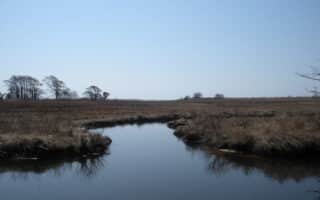
Southhaven County Park has some narrow, wooded paths that are good for trail running. A good road running option is the separated bike lane on River Rd. (2.6 miles). The Wertheim National Wildlife Refuge has some pretty trails for running.
On Long Island's North Fork, there's pretty running in the seaport village of Greenport. Explore the attractive residential side streets, and then out to Youngs Point. Also nice running on country roads in Orient, past farms and vineyards.
Our dedicated Hamptons Running Guide features 1-2 iconic routes in each of the major towns, from west to east: Westhampton, Southampton, Bridgehampton, East Hampton, and Montauk. Includes Fire Island.
Share your feedback on this route and see that of other Great Runs users. Click on the image icon to upload a photo. And please let us know if there are notes or changes we should incorporate!


Review or Comment on This Route/Share a Photo!
Share your feedback on this route and see that of other Great Runs users. Click on the image icon to upload a photo. And please let us know if there are notes or changes we should incorporate!