A great destination run! Combine a run around the Boyce Thompson Arboretum with the nearby Legends of Superior Trails, a scenic trail through Superior and the Sonoran desert. NOTE: there’s no direct connection between the Arboretum & Superior trail.
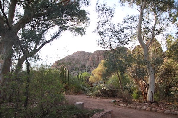
Boyce Arboretum. Located an hour from Phoenix and 30 minutes from Mesa, the Boyce Thompson Arboretum is known for its miles of trails through plant collections from the world’s deserts. In spring, there are great colors as wildflowers, aloe, yucca and cacti are in bloom. In summer, saguaro and cardon cacti bloom. A loop of the trails is 1.5 miles. Notes: Set opening hours & admission fees.
Arnett Canyon Trail. Google Street View
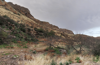
Legends of Superior Trails. This is an 11.65 mile recreational trail trough Superior and the Sonoran desert. The trail is divided into five segments, each with their own character. This TRAIL MAP has excellent information and segment distances. Generally, these trails have a decent surface for running. The best for an easy-to-moderate run is the Arnett Canyon segment, up to 6.5 miles one-way. For a challenge, climb 1,000 feet over 2.25 miles in the Queen Creek Canyon segment, near Superior.
A great destination run! Combine a run around the Boyce Thompson Arboretum with the nearby Legends of Superior Trails, a scenic trail through Superior and the Sonoran desert. NOTE: there’s no direct connection between the Arboretum & Superior trail.
Boyce Arboretum. Located an hour from Phoenix and 30 minutes from Mesa, the Boyce Thompson Arboretum is known for its miles of trails through plant collections from the world’s deserts. In spring, there are great colors as wildflowers, aloe, yucca and cacti are in bloom. In summer, saguaro and cardon cacti bloom. A loop of the trails is 1.5 miles. Notes: Set opening hours & admission fees.
Arnett Canyon Trail. Google Street View
Legends of Superior Trails. This is an 11.65 mile recreational trail trough Superior and the Sonoran desert. The trail is divided into five segments, each with their own character. This TRAIL MAP has excellent information and segment distances. Generally, these trails have a decent surface for running. The best for an easy-to-moderate run is the Arnett Canyon segment, up to 6.5 miles one-way. For a challenge, climb 1,000 feet over 2.25 miles in the Queen Creek Canyon segment, near Superior.
Scroll Down For Route Maps
Essentials
Arboretum Loop: ~1.5 miles. Legends of Superior Trails: 11.65 miles one-way, though divided into segments
The city of Mesa sits east of Phoenix and Tempe. It’s the gateway to some of the Phoenix metro area’s top trail running spots. We love running in Red Mountain Park, Pioneer Park, the Usery Mountain trails, and around Saguaro Lake.
There's excellent running in this city southeast of Phoenix. Veterans Oasis Park has a Sonoran desert feel. San Tan Mountain Regional Park has miles of desert trails. There are also three longer, paved multi-use trails that are great for running.
There's some excellent running in Gilbert, located southeast of Phoenix, including a large network of paved multi-use trails and the wetland trail at Riparian Preserve. The Hieroglyphics Trail is a good spot for a scenic, gentle trail run.
Glendale and Peoria make up the majority of the suburbs northeast of Phoenix. Favorite running spots include Thunderbird Paseo Park, the Arrowhead Lakes residential area, New River/Skunk Creek multi-use trails, and White Tank Mountain Regional Park.
Share your feedback on this route and see that of other Great Runs users. Click on the image icon to upload a photo. And please let us know if there are notes or changes we should incorporate!
Subscribe
0 Comments
Oldest
Newest
Inline Feedbacks
View all comments
Essentials
Arboretum Loop: ~1.5 miles. Legends of Superior Trails: 11.65 miles one-way, though divided into segments


Review or Comment on This Route/Share a Photo!
Share your feedback on this route and see that of other Great Runs users. Click on the image icon to upload a photo. And please let us know if there are notes or changes we should incorporate!