Parc Urbain Ennahli is a national park 10 km north of Tunis, and a good spot to escape the city for some green space and an off-road, hilly run. There’s a series of run-friendly paths and trails around Nahli Mountain, combination of open and wooded, and some great views of the city. A good shade option when hot! A couple of options for running:
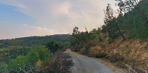
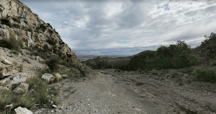
Sent. de randonnée pédestre: This is french for pedestrian walking trail. It’s old road, now a wide paved/gravel path that reaches the top of the mountain. From the parking lot, take the road to the trail, which leads to the randonnée after 1.5 km. Once on the randonnée, it’s 2.5 km to the end of the path. Overall, this involves ~200m of climbing, with some sections of 7-8% grade. Return option: retrace your steps to the start, or take the north-south trail, which shortens the return by ~1 km.
North-South Trail. A slightly more rugged trail runs north-south through the park for 3.75 km. Some of the park’s roads near the car park are needed to connect the 1 km ‘north’ section of the trail with the 2.5 km ‘south’ section. Note the south section is a hillier, about ~100m climb. Can combine with the Randonnée route above.


Review or Comment on This Route/Share a Photo!
Share your feedback on this route and see that of other Great Runs users. Click on the image icon to upload a photo. And please let us know if there are notes or changes we should incorporate!