The locals in Aarhus have done some of our work for us by mapping out seven fantastic trails, radiating out from the center of Aarhus like “sunbeams.” It’s a partnership between the Aarhus Natural History Museum, Nature and Environment, The Outdoor Council, and the Municipality of Aarhus. Each of the trails has a unique aspect — coastal, forest, mountains — but almost all of them are suitable for running. Terrain varies from trails to gravel paths to paved roads and distances range anywhere from 3.3 to 25 km. Those closest to the city center are the Coasta, Pulse, and Park routes. More info here and here.
Mountain Route: This 8km route begins at the Hasle Bakker hills on the western edge of Aarhus and continues west through Skjoldhøjkilen to True Forest. The beam combines gravel and paved roads for some nice tough hill climbs and great views. 8 km, 44m gain. Mountain Route MAP.
Blue Route: The “Blue Route” is named for the waterways it passes by, including the Aarhus River, Brabrand Lake, and Meadow Lake. The 24 km course starts from The City Museum of Aarhus and wraps southwest along the river and around the lakes. There are many shorter options as well: runners can follow marked 3 km (green), 5 km (gold), 7 km (red), and 10 km (black) courses around the lakes. Long distance runners take note, the route continues west on the 64 km Aarhus to Silkeborg path. Brabrand is also home to Parkrun, a free 5k, every Saturday morning at 9 am. Full Blue Route MAP. Loop Options Map. (Courtesy Aarhus Kommune).
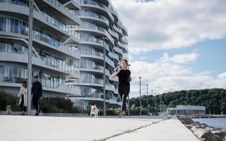
Coastal Route: Aarhus’ Coastal Route is a 17 km loop that starts out near the Tangkrogen fairgrounds and winds south through the forested coastal paths of Marselisborg (Havreballe) to Skovmøllen. The route is designed as a cycling path, but most of the lanes are runnable. If the route is heavy with bike traffic, there is a dirt side trail runners can bail onto. Whichever path you choose, don’t miss a jaunt across the Den uendelige bro infinity bridge just south of Marselisborg Strand (2 km mark). For a shorter route, there is a nice 2.5 km running track through Havreballe forest. Coastal Route MAP.
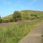
Countryside Route: The inland “Countryside Route” of the Sunbeams travels mainly on the edge of rural farm fields. It uses both dirt and paved roads with little to no traffic. Starting from Vestereng, this 18 km route goes through the former military area to Kasted. Countryside Route MAP.
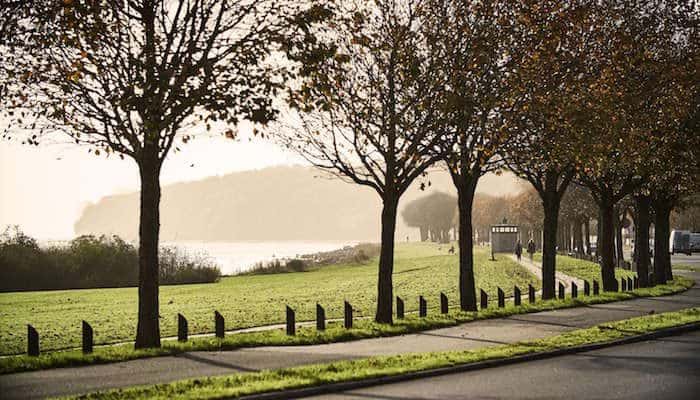
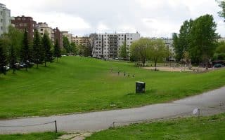
Park Route: Linking three of Aarhus’ main parks, the 5.4 km Park Route begins at University Park, loops south into Vennelystparken, then back west through the Botanisk Have (Botanical Gardens). This route is mostly paved and close to the center of the city for easy access. Park Route MAP.
—RUNI Photopop, Visit Aarhus
Pulse Route: The pulse route is a 3.3 km stretch (marked in red) through the scenic Riis forest on well-kempt dirt carriage roads. For a slightly longer option, follow the 4.7 km gold track around the forest. There is also stationary strength equipment in the park — perfect for rounding out a short run. Pulse Route MAP.
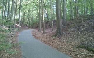
Forest Route: The shady and lush “Forest Route” can be accessed either from Mollerup Skov or Viengevej. The first option carries runners through the forest to Kirkestien while the second heads south around Meadow Lake (Egå Engsø) to Terp. Depending on which way one runs, an out and back is either 6 or 11 km. Other options in this area include a 5.2 km circuit around the gravel paths of Egå Engsø or a loop around Mollerup Forest, which has 2.7 and 3.5 km marked routes. All routes in this area are easily combined. Forest Route MAP. Mollerup Skov MAP (Courtesy Aarhus Kommune).
The locals in Aarhus have done some of our work for us by mapping out seven fantastic trails, radiating out from the center of Aarhus like “sunbeams.” It’s a partnership between the Aarhus Natural History Museum, Nature and Environment, The Outdoor Council, and the Municipality of Aarhus. Each of the trails has a unique aspect — coastal, forest, mountains — but almost all of them are suitable for running. Terrain varies from trails to gravel paths to paved roads and distances range anywhere from 3.3 to 25 km. Those closest to the city center are the Coasta, Pulse, and Park routes. More info here and here.
Mountain Route: This 8km route begins at the Hasle Bakker hills on the western edge of Aarhus and continues west through Skjoldhøjkilen to True Forest. The beam combines gravel and paved roads for some nice tough hill climbs and great views. 8 km, 44m gain. Mountain Route MAP.
Blue Route: The “Blue Route” is named for the waterways it passes by, including the Aarhus River, Brabrand Lake, and Meadow Lake. The 24 km course starts from The City Museum of Aarhus and wraps southwest along the river and around the lakes. There are many shorter options as well: runners can follow marked 3 km (green), 5 km (gold), 7 km (red), and 10 km (black) courses around the lakes. Long distance runners take note, the route continues west on the 64 km Aarhus to Silkeborg path. Brabrand is also home to Parkrun, a free 5k, every Saturday morning at 9 am. Full Blue Route MAP. Loop Options Map. (Courtesy Aarhus Kommune).
Coastal Route: Aarhus’ Coastal Route is a 17 km loop that starts out near the Tangkrogen fairgrounds and winds south through the forested coastal paths of Marselisborg (Havreballe) to Skovmøllen. The route is designed as a cycling path, but most of the lanes are runnable. If the route is heavy with bike traffic, there is a dirt side trail runners can bail onto. Whichever path you choose, don’t miss a jaunt across the Den uendelige bro infinity bridge just south of Marselisborg Strand (2 km mark). For a shorter route, there is a nice 2.5 km running track through Havreballe forest. Coastal Route MAP.
Countryside Route: The inland “Countryside Route” of the Sunbeams travels mainly on the edge of rural farm fields. It uses both dirt and paved roads with little to no traffic. Starting from Vestereng, this 18 km route goes through the former military area to Kasted. Countryside Route MAP.
Park Route: Linking three of Aarhus’ main parks, the 5.4 km Park Route begins at University Park, loops south into Vennelystparken, then back west through the Botanisk Have (Botanical Gardens). This route is mostly paved and close to the center of the city for easy access. Park Route MAP.
—RUNI Photopop, Visit Aarhus
Pulse Route: The pulse route is a 3.3 km stretch (marked in red) through the scenic Riis forest on well-kempt dirt carriage roads. For a slightly longer option, follow the 4.7 km gold track around the forest. There is also stationary strength equipment in the park — perfect for rounding out a short run. Pulse Route MAP.
Forest Route: The shady and lush “Forest Route” can be accessed either from Mollerup Skov or Viengevej. The first option carries runners through the forest to Kirkestien while the second heads south around Meadow Lake (Egå Engsø) to Terp. Depending on which way one runs, an out and back is either 6 or 11 km. Other options in this area include a 5.2 km circuit around the gravel paths of Egå Engsø or a loop around Mollerup Forest, which has 2.7 and 3.5 km marked routes. All routes in this area are easily combined. Forest Route MAP. Mollerup Skov MAP (Courtesy Aarhus Kommune).
Scroll Down For Route Maps
Essentials
Paths range from 3 km to 25 km, but most have options for longer/shorter
Take a tour of Aarhus’ top architectural and cultural sites on the pedestrian-friendly streets of downtown. Our ~6 km ‘runseeing’ route explores the waterfront, Aarhus River, the Mollestein and Vestergade areas, and more.
Large forest area south of Aarhus that extends for 7 km along the coast. Mainly wooded, with strands of 200-300 year old beech trees. Marked running loops of 6k & 10k. Part of Sunbeam Coast route.
Watch boats bob in the bay from this scenic gravel path along the coast and around Egå Marina. The trail stretches south to Åkrogen Strandpark and north to Skæring Beach where it connects with the Skoødstrup Trail.
Runners can find a 1500 meter track as well as 2, 3, and 5 km marked routes throughout the green knolls of Marienlyst park. Connect to the paths around Aarhus University Hospital and the Countryside Route for longer runs.
Follow the Laurel Trail through the center of Tranbjerg J village. This short but sweet 5k is marked with red signposts, and is a pleasant quick option in this suburb southwest of Aarhus and accessible via light rail.
A roughly 5 km (one way) route from the Skødstrup Church to Kaløvig harbor marina, this combination of bike paths, service roads, and pedestrian walkways is a nice quiet tour of Aarhus’ less populated suburbs.
Share your feedback on this route and see that of other Great Runs users. Click on the image icon to upload a photo. And please let us know if there are notes or changes we should incorporate!
Subscribe
0 Comments
Oldest
Newest
Inline Feedbacks
View all comments
Essentials
Paths range from 3 km to 25 km, but most have options for longer/shorter
 Mountain Route: This 8km route begins at the Hasle Bakker hills on the western edge of Aarhus and continues west through Skjoldhøjkilen to True Forest. The beam combines gravel and paved roads for some nice tough hill climbs and great views. 8 km, 44m gain. Mountain Route MAP.
 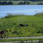 Blue Route: The “Blue Route” is named for the waterways it passes by, including the Aarhus River, Brabrand Lake, and Meadow Lake. The 24 km course starts from The City Museum of Aarhus and wraps southwest along the river and around the lakes. There are many shorter options as well: runners can follow marked 3 km (green), 5 km (gold), 7 km (red), and 10 km (black) courses around the lakes. Long distance runners take note, the route continues west on the 64 km Aarhus to Silkeborg path. Brabrand is also home to Parkrun, a free 5k, every Saturday morning at 9 am. Full Blue Route MAP. Loop Options Map. (Courtesy Aarhus Kommune).
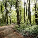 Coastal Route: Aarhus’ Coastal Route is a 17 km loop that starts out near the Tangkrogen fairgrounds and winds south through the forested coastal paths of Marselisborg (Havreballe) to Skovmøllen. The route is designed as a cycling path, but most of the lanes are runnable. If the route is heavy with bike traffic, there is a dirt side trail runners can bail onto. Whichever path you choose, don’t miss a jaunt across the Den uendelige bro infinity bridge just south of Marselisborg Strand (2 km mark). For a shorter route, there is a nice 2.5 km running track through Havreballe forest. Coastal Route MAP.
 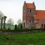 Countryside Route: The inland “Countryside Route” of the Sunbeams travels mainly on the edge of rural farm fields. It uses both dirt and paved roads with little to no traffic. Starting from Vestereng, this 18 km route goes through the former military area to Kasted. Countryside Route MAP.
  Park Route: Linking three of Aarhus’ main parks, the 5.4 km Park Route begins at University Park, loops south into Vennelystparken, then back west through the Botanisk Have (Botanical Gardens). This route is mostly paved and close to the center of the city for easy access. Park Route MAP.
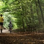


Review or Comment on This Route/Share a Photo!
Share your feedback on this route and see that of other Great Runs users. Click on the image icon to upload a photo. And please let us know if there are notes or changes we should incorporate!