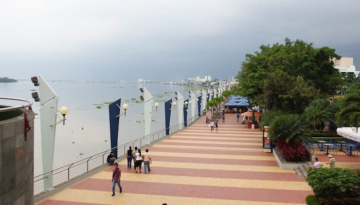
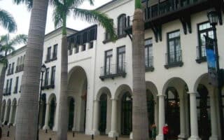
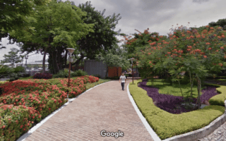
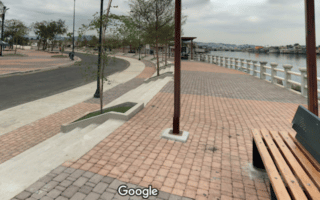
Malecón 2000 (also known as Simón Bolívar promenade) is a much-celebrated urban renewal project, not only in Guayaquil, but worldwide. This scenic brick-paved walkway stretches for 2.4 km in between the Simon Bolivar road (Avenida 12) and the Rio Guayas. The south end starts from the Criminalistica Guayas building off of Leon de Febres Cordero. Then, the path runs north along the waterfront cafes and shops, through the Jardines del Malecón, to the Museo Antropologico y de Arte Contemporaneo. Runners will pass several of Guayaquil’s best landmarks along the way, including the Moorish Tower, La Rotunda, and other monuments. It’s also an easy detour to the Catedral Metropolitana De Guayaquil and other architecturally intriguing buildings. If a ~5 km run is too short for your liking, continue your run towards Cerro Santa Ana or run across the pedestrian bridge to Isla Santay.
Features:
Scroll Down For Route Maps
Essentials
- 2.4 km (one way)
- 23 meters (75 feet)
- Simon Bolivar
- Malecon Y 10 de Agosto Bus Stop
Current Weather & Forecast

Guayaquil, EC
10:33 am,
Jun 12, 2026
L: 27°
H: 27°
Daily ForecastHourly Forecast
Today
4:00 pm
28° / 29°°C
0 mm
0%
21 mph
84 %
1002 mb
0 mm/h
Tomorrow
4:00 pm
28° / 33°°C
0 mm
0%
26 mph
87 %
1004 mb
0 mm/h
Sunday
4:00 pm
28° / 33°°C
0 mm
0%
24 mph
78 %
1005 mb
0 mm/h
Monday
4:00 pm
29° / 33°°C
0 mm
0%
22 mph
77 %
1004 mb
0 mm/h
Tuesday
4:00 pm
29° / 33°°C
0 mm
0%
20 mph
77 %
1004 mb
0 mm/h
Today
1:00 pm
29° / 29°°C
0 mm
0%
18 mph
82 %
1002 mb
0 mm/h
Today
4:00 pm
28° / 29°°C
0 mm
0%
21 mph
84 %
1002 mb
0 mm/h
Today
7:00 pm
28° / 28°°C
0 mm
0%
22 mph
87 %
1002 mb
0 mm/h
Today
10:00 pm
29° / 29°°C
0 mm
0%
25 mph
78 %
1004 mb
0 mm/h
Tomorrow
1:00 am
32° / 32°°C
0 mm
0%
26 mph
66 %
1004 mb
0 mm/h
Tomorrow
4:00 am
33° / 33°°C
0 mm
0%
26 mph
60 %
1002 mb
0 mm/h
Tomorrow
7:00 am
31° / 31°°C
0 mm
0%
25 mph
68 %
1001 mb
0 mm/h
Other Routes in Guayaquil, Ecuador
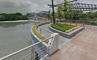
Run the boardwalks of the Isla Santay National Recreation Area, accessible via pedestrian bridges from Guayaquil. The highlight is the 6 km “ciclovia.” Pairs well with Malecón 2000.

Enjoy some hill work on the steps of Cerro Santa Ana, then extend your route on the waterfront of the Las Penas neighborhood, where you can look back on the colorful rows of houses and shops.
This large park in north Guayaquil has over 4 km of lovely brick paths around the perimeter. Runners can also cross the street into Reserva Senderos and run along the dirt bike path.
There are great routes on the west side of Guayaquil, where runners can seek out the waterfront paths of the Parque Lineal del Estero Salado. We’ve mapped an 8 km loop starting from the university.
Plaza Lagos is a shopping center in north Guayaquil, but it’s also a community of nicely developed promenades and residential streets. We’ve mapped a 3 km loop.
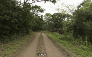
This forest area on the western outskirts of Guayaquil features numerous trails, including a wide, flat, dirt bike path around the park perimeter. It’s a 2.5 km loop. The terrain is mainly wooded.
The Parque Lineal Kennedy Norte is a great option in north-central Guayaquil, especially for those located near the airport. There is a 1 km promenade along the estuary, with runnable residential street options nearby.
There are some more waterfront paths in the Cisne/Ximena/Isla Trinitaria area of southwest Guayaquil. Not the most scenic, but they can be combined for a run in the southwest of Guayaquil.
User Ratings
Leave A Review or Comment
Review or Comment on This Route/Share a Photo!
Share your feedback on this route and see that of other Great Runs users. Click on the image icon to upload a photo. And please let us know if there are notes or changes we should incorporate!