The Crystal Bridges Museum is Bentonville’e centerpiece — not only does it have a renowned collection in a striking structure, but it features miles of trails on its 120 lush acres. There’s a terrific combination of paved multi-use paths and more rugged trails for trail running. There are also connections to other trails for longer run opportunities. NEW 2026: A major expansion of the museum is underway, including an Elevated Bridge.
Here are a few suggestions.
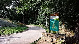
Crystal Bridges Trails. There’s a nice mix of generally wooded trails on the site of the museum. Use this trail map to create your own route! There are outdoor sculptures and other features making for a unique run! TRAIL MAP
Brandonrush
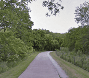
Crystal Bridges Trail to North Bentonville Trail. This is a run of up to 8.5 miles out and back on a paved path. Use the Slaughter Pen Trail from Compton Gardens, and continue north on the paved North Bentonville Trail through Crystal Bridges to North Skills Park. The trail then heads south for 1.2 miles to Bark Park. There are lots of additional trails for those who would like to add-on or for variety — they’re more for trail running (also popular with mountain bikers.
N. Bentonville Trail. Google Street View
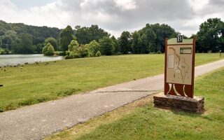
Crystal Bridges to Orchards Park & Memorial Park. This is a terrific, ~5 mile run starting at Compton Gardens. Use the Slaughter Pen Trail, then the paved trail through Crystal Bridges, and run on Museum Way toward Orchards Park. Then do a ~2 mile loop of scenic Orchards Park & Memorial Park, then coming back to the start.
Add-On: Razorback Regional Trail. For even more, connect to the Razorback Regional Trail. This is a 44-mile regional trail between Fayetteville and Bella Vista that combines numerous other area trails. From our Crystal Bridges trailhead, you can continue north to Bella Vista for up to 10 miles, or south toward Rogers & Fayetteville. ROUTE MAP
The Crystal Bridges Museum is Bentonville’e centerpiece — not only does it have a renowned collection in a striking structure, but it features miles of trails on its 120 lush acres. There’s a terrific combination of paved multi-use paths and more rugged trails for trail running. There are also connections to other trails for longer run opportunities. NEW 2026: A major expansion of the museum is underway, including an Elevated Bridge.
Here are a few suggestions.
Crystal Bridges Trails. There’s a nice mix of generally wooded trails on the site of the museum. Use this trail map to create your own route! There are outdoor sculptures and other features making for a unique run! TRAIL MAP
Brandonrush
Crystal Bridges Trail to North Bentonville Trail. This is a run of up to 8.5 miles out and back on a paved path. Use the Slaughter Pen Trail from Compton Gardens, and continue north on the paved North Bentonville Trail through Crystal Bridges to North Skills Park. The trail then heads south for 1.2 miles to Bark Park. There are lots of additional trails for those who would like to add-on or for variety — they’re more for trail running (also popular with mountain bikers.
N. Bentonville Trail. Google Street View
Crystal Bridges to Orchards Park & Memorial Park. This is a terrific, ~5 mile run starting at Compton Gardens. Use the Slaughter Pen Trail, then the paved trail through Crystal Bridges, and run on Museum Way toward Orchards Park. Then do a ~2 mile loop of scenic Orchards Park & Memorial Park, then coming back to the start.
Add-On: Razorback Regional Trail. For even more, connect to the Razorback Regional Trail. This is a 44-mile regional trail between Fayetteville and Bella Vista that combines numerous other area trails. From our Crystal Bridges trailhead, you can continue north to Bella Vista for up to 10 miles, or south toward Rogers & Fayetteville. ROUTE MAP
Some great running options in Fayetteville, located 25 miles south of Bentonville. An extensive network of multi-use paths, the iconic loop around Lake Fayetteville, and some great trail running opportunities.
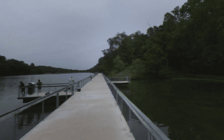
Lovely loop around the lake at Bella Vista Lake Park on paved paths. It's 1.7 miles, or add on with the ~1 mile Wishing Springs Trail. Just north are more rugged trails at Blowing Springs Park, very popular with mountain bikers.
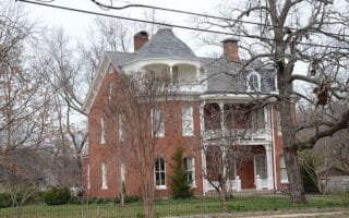
Create your own route in Bentonville's downtown historic district, which has some nice, tree-lined streets that are pleasant for running. For more, connect to the Razorback Greenway or our Crystal Bridge Trail route.
This holds the distinction of being one of the best routes around a corporate campus! Some 7 miles of trails around & adjacent to this college-like campus. We've mapped a 5k loop. Connections to miles of additional trails.
Pleasant 2-mile loop around Lake Atalanta on a paved path. The lake is located in Rogers, 9 miles southwest of Bentonville. Nice water views the whole way. Optional add-on is hilly, 0.8 mile path through Rock Spring Park.
Fantastic spot for trail running. Arkansas’s largest state park, spanning a 12,054-acre tract of Ozark landscape along the southern shore of Beaver Lake. There are 54 miles of trails, fairly rugged & hilly. 20 miles southeast of Bentonville.
Share your feedback on this route and see that of other Great Runs users. Click on the image icon to upload a photo. And please let us know if there are notes or changes we should incorporate!


Review or Comment on This Route/Share a Photo!
Share your feedback on this route and see that of other Great Runs users. Click on the image icon to upload a photo. And please let us know if there are notes or changes we should incorporate!