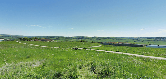
This is a nice run in the southeastern part of Aalborg that combines three elements: Bundgårdsparken; paths around Aalborg University; and the small Gug Alper hiking area. Run them separately or combine for a longer run. We’ve mapped a one-way route using the good network of pedestrian and cycle paths to connect these areas.
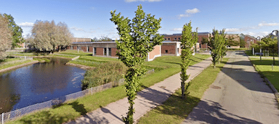
Bundgårdsparken. Google Street ViewAalborg University. Google Street View
Start at Bundgårdsparken, a narrow park with a nice, 1.1 km path passing the Fireworks wood sculpture. Cross the main road, continuing south into Aalborg University, and run on the paths around the campus. Connect to the main east-west path through the campus, and head 1 km west. Continue onto the Panstien path headed west for ~2 km into the Gug Alper, a small hiking area with some hilly trails around an open, grassy area. There are nice views.
Overall, it’s 6.6 km one-way, so the route can be modified for those who’d like a shorter run.
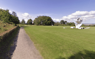
This is a nice run in the southeastern part of Aalborg that combines three elements: Bundgårdsparken; paths around Aalborg University; and the small Gug Alper hiking area. Run them separately or combine for a longer run. We’ve mapped a one-way route using the good network of pedestrian and cycle paths to connect these areas.
Bundgårdsparken. Google Street ViewAalborg University. Google Street View
Start at Bundgårdsparken, a narrow park with a nice, 1.1 km path passing the Fireworks wood sculpture. Cross the main road, continuing south into Aalborg University, and run on the paths around the campus. Connect to the main east-west path through the campus, and head 1 km west. Continue onto the Panstien path headed west for ~2 km into the Gug Alper, a small hiking area with some hilly trails around an open, grassy area. There are nice views.
Overall, it’s 6.6 km one-way, so the route can be modified for those who’d like a shorter run.
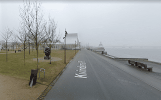
The 7-8 km of waterfront paths along Limfjord Sound are among the highlights of running in Aalborg. We've put together a route that can be used as a guideline, includes a section across the water in Lindhom.
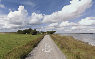
Scenic running on lovely gravel roads along the water and past farm fields. Egholm Island is reachable via a ferry, located 2 km west of Aalborg centre, that takes 5 minutes and runs every 1/2 hour. And very few cars!
A pleasant run in central Aalborg combining two parks, Kildeparken & Mølleparken. Optional 8 km loop includes Kridtgraven Lake. Mølleparken features a 2.5 km jogging track with a special Lysløjpen, a 45m gradient!
A short, scenic run in Østerådalen, a wetlands park in the southern part of Aalborg. A series of trails and some boardwalks wind around several bodies of water, with nice views of the wetlands and grasses.
Paths & lawns surround an 1800s manor house in a park famed for its many varieties of apple tree. 5-6 km of nice gravel trails wind around green, open terrain. Located in the Vejgård area in southern Aalborg.
Share your feedback on this route and see that of other Great Runs users. Click on the image icon to upload a photo. And please let us know if there are notes or changes we should incorporate!


Review or Comment on This Route/Share a Photo!
Share your feedback on this route and see that of other Great Runs users. Click on the image icon to upload a photo. And please let us know if there are notes or changes we should incorporate!