The best running in downtown Springfield is just east of the central business district. We’ve mapped a ~10k route that includes a few key Springfield sights, the campus of Missouri State University, and the lovely Rountree neighborhood. Use the map as a guideline to create your own route.
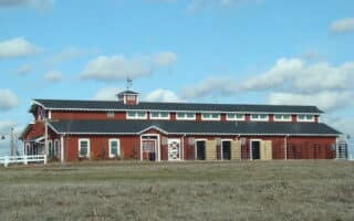
Missouri State University campus. Creative Commons
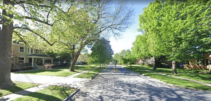
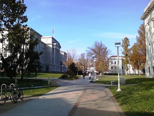
Start in downtown Springfield on N Jefferson Ave. Use it to access the pedestrian path headed east for 1 mile through Jordan Valley Park. Continue briefly on Trafficway, then use National Ave. or Kickapoo Ave. to head south into the campus of Missouri State University. This is a pleasant campus for running! Use the main east-west paths between National Ave. & Strong Hall. Just north of the library is a running track at the Betty and Bobby Allison South Stadium. Exit the University, headed south on Dollison Ave. into the small & leafy Phelps Grove Park. The final part of the route is around the Rountree neighborhood, with its leafy streets and grand homes. Use S Fremont Ave. as an anchor to explore the area. At the north end, use Elm St. or Walnut St. to return to downtown.
Alternative/Add-On: After exploring Rountree, you can take E Bennett St. headed west to Fassnight Park, where there’s a short multi-use path and a running track at JFK Stadium. You can use S Missouri Ave. back north to downtown.
Add-On: Just north of downtown, the campus of Drury University is fun to explore, and there’s a running track at Harrison stadium.
The best running in downtown Springfield is just east of the central business district. We’ve mapped a ~10k route that includes a few key Springfield sights, the campus of Missouri State University, and the lovely Rountree neighborhood. Use the map as a guideline to create your own route.
Missouri State University campus. Creative Commons
Start in downtown Springfield on N Jefferson Ave. Use it to access the pedestrian path headed east for 1 mile through Jordan Valley Park. Continue briefly on Trafficway, then use National Ave. or Kickapoo Ave. to head south into the campus of Missouri State University. This is a pleasant campus for running! Use the main east-west paths between National Ave. & Strong Hall. Just north of the library is a running track at the Betty and Bobby Allison South Stadium. Exit the University, headed south on Dollison Ave. into the small & leafy Phelps Grove Park. The final part of the route is around the Rountree neighborhood, with its leafy streets and grand homes. Use S Fremont Ave. as an anchor to explore the area. At the north end, use Elm St. or Walnut St. to return to downtown.
Alternative/Add-On: After exploring Rountree, you can take E Bennett St. headed west to Fassnight Park, where there’s a short multi-use path and a running track at JFK Stadium. You can use S Missouri Ave. back north to downtown.
Add-On: Just north of downtown, the campus of Drury University is fun to explore, and there’s a running track at Harrison stadium.
Scroll Down For Route Maps
Essentials
Mapped route is 6.7 miles (10.8 km) -- but create your own of longer or shorter!
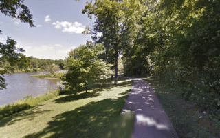
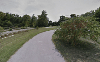
A pleasant, paved 8-mile greenway path in southern Springfield. Mainly open, neighborhood-ey, with some wooded sections. Passes through the lovely Nathanael Greene Park, which has ~2 miles of trails & botanical gardens.
Popular paved trail in Southeast Springfield runs for 5 miles from Lone Hills Bike Park south to the Lake Springfield area, following Galloway Creek. Wooded & open terrain, & several parks. Connect to Springfield Conservation Nature Center for more.
A paved multi-use trail in southern Springfield that runs for nearly 5 miles along Wilson's Creek. Starts with a nice 1.5 section in Rutledge-Wilson Farm Park, then heads south through mainly open terrain and some farmland to Tal's Trailhead.
A paved 2.5 mile multi-use trail in the West Central part of Springfield. It's mainly a residential neighborhood connector trail, running along Jordan Creek and passing through the Ewing Sports complex. Connect to Wilson's Creek Greenway 1 mile west.
A rails-to-trails trail that runs for 37 miles between Springfield and Bolivar. The trail is a mix of residential neighborhoods near Springfield, and then a mix of open farmland and some wooded sections. About 1/3 paved and 2/3 gravel.
A good option in the northern part of Springfield. This paved, mainly wooded multi-use trail follows the South Dry Sac River for 5 miles between Greenlawn Cemetery and the David C. Murray Park Trailhead at Highway 13, passing through Fulbright Spring Park.
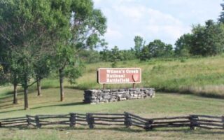
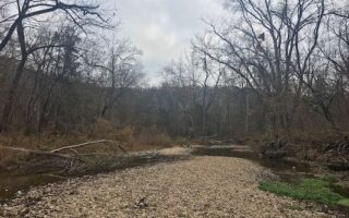
Scenic running at the site of the first major battle of the Civil War fought west of the Mississippi. There's a lane for pedestrians along the 4.9-mile paved tour loop road and 4-5 miles of rolling hill trails. Some great views!
Busiek State Forest is a 2700-acre recreation area located 30 miles south of Springfield. There are 18 miles of mainly wooded, rolling hill trails that are good for trail running.
Share your feedback on this route and see that of other Great Runs users. Click on the image icon to upload a photo. And please let us know if there are notes or changes we should incorporate!
Subscribe
0 Comments
Oldest
Newest
Inline Feedbacks
View all comments
Essentials
Mapped route is 6.7 miles (10.8 km) -- but create your own of longer or shorter!

Review or Comment on This Route/Share a Photo!
Share your feedback on this route and see that of other Great Runs users. Click on the image icon to upload a photo. And please let us know if there are notes or changes we should incorporate!