The 18-mile Lakefront Trail is one of the most spectacular urban runs in the country. This route has it all: gorgeous views of Lake Michigan and the Chicago skyline, urban beaches, marinas, and beautiful parks, passing by some of the city’s famous cultural institutions. In addition to the trail itself, there are several fantastic spots just off the trail that make for add-on running options or for variety in an ‘out and back’ run. Note also that metro stations are usually within a mile of the trail throughout its entire length, allowing for some creative one-way options! Note that access from Lakeshore Dr. is at specific intersections, using underground tunnels and pedestrian bridges in some cases. A recent project has improved the trail and there are now separate pedestrian and bicycle paths along most of the trail — with the pedestrian sections closest to the water! Note also that much of the trail is lit at night.
We’ve included several links to trail maps and a table with some recommended loops. Below, we’ve divided the trail into three sections, with the northern terminus at Edgewater Beach being Mile 0 and headed south. If starting from the heart of downtown, say around Navy Pier, we generally prefer the heading south, toward Museum Campus and then south of there.
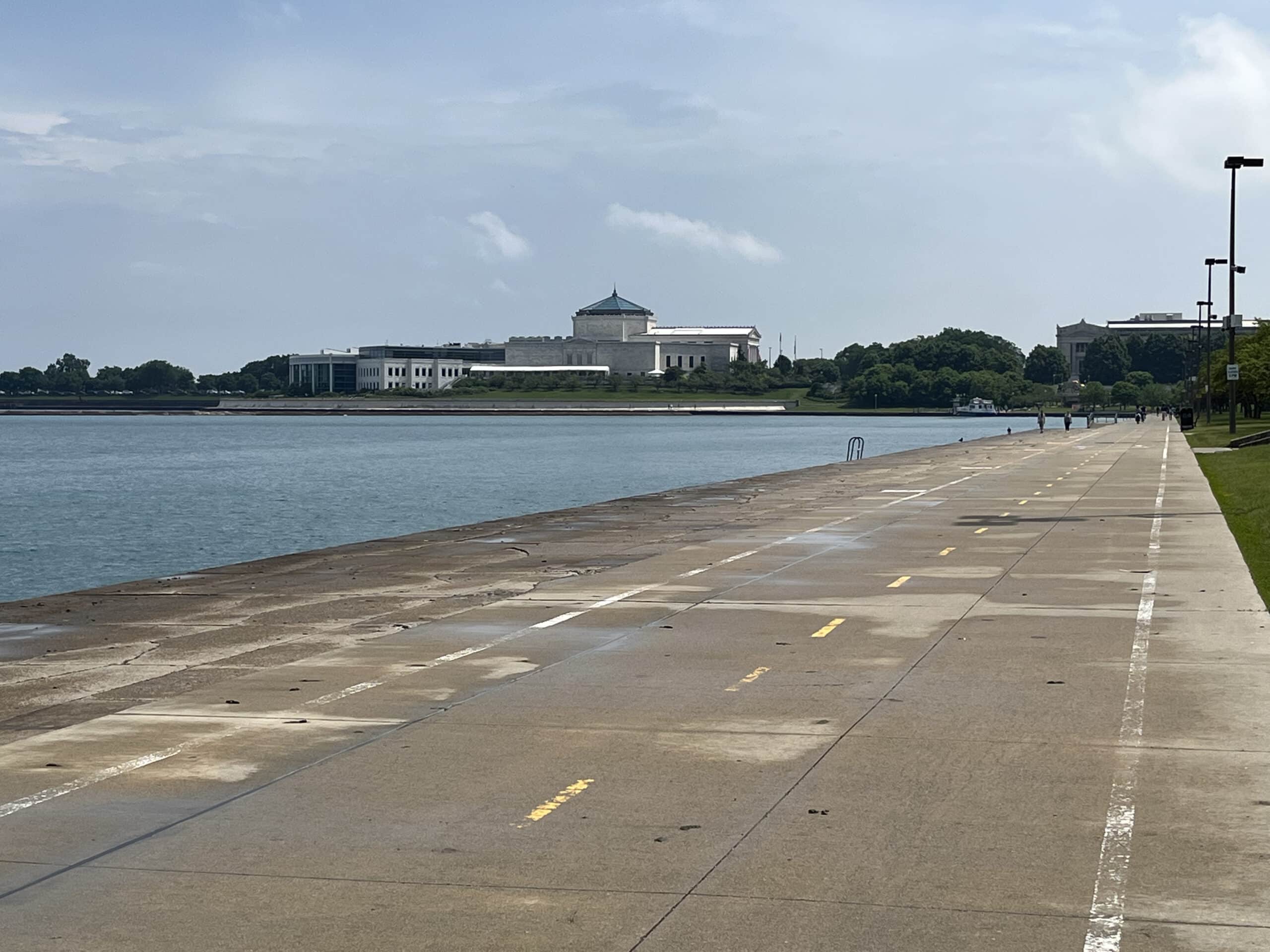
View to Museum Campus Mark Lowenstein
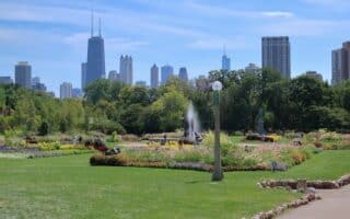
North Section. Miles 0-7. Edgewater Beach to Navy Pier. The northern terminus is at Edgewater Beach, and runs along the water passing Foster Beach, Montrose Beach, and Lincoln Park. This section is less crowded, a little more bucolic, and features a gravel running path in parts. Additional Options:Lincoln Park (North Ave. to Fullerton Ave.)
Skyline View from Burnham Park, Headed North
Middle/Downtown Section: Chicago St. at Navy Pier to McCormick Place Convention Center, Miles 7-11. Parallels the heart of downtown and the Magnificent Mile, and includes sights such as Navy Pier, Grant Park, the Museum Campus, and Soldier Field. Lots of great sights, but can be crowded on a nice day. Particularly spectacular around the Museum Campus, where you should pop off the main trail and do a spectacular loop around the tip to Adler Planetarium and even additional trails along Northerly Island Park. Additional Options: Loop around Navy Pier,Grant Park, additional trails around the Museum Campus, Northerly Island Park, & Soldier Field.
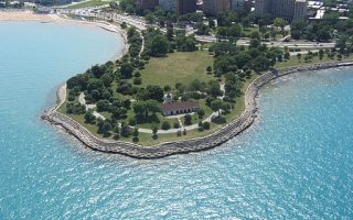
SouthSection. McCormick Place to Rainbow Beach Park, Miles 11-18. South of the Convention Center area are several gorgeous miles with wonderful waterfront views, featuring Prairie Shores, Burnham Park, and Promontory Point. Note that there are fantastic skyline views headed north from Promontory Point. Additional options: Trails in Jackson Park, paths around the U Chicago Campus, Midway Plaisance (59th St.) west to Washington Park.
Video Highlights: Lakeshore Path, Chicago River, Downtown (21 min.)
The 18-mile Lakefront Trail is one of the most spectacular urban runs in the country. This route has it all: gorgeous views of Lake Michigan and the Chicago skyline, urban beaches, marinas, and beautiful parks, passing by some of the city’s famous cultural institutions. In addition to the trail itself, there are several fantastic spots just off the trail that make for add-on running options or for variety in an ‘out and back’ run. Note also that metro stations are usually within a mile of the trail throughout its entire length, allowing for some creative one-way options! Note that access from Lakeshore Dr. is at specific intersections, using underground tunnels and pedestrian bridges in some cases. A recent project has improved the trail and there are now separate pedestrian and bicycle paths along most of the trail — with the pedestrian sections closest to the water! Note also that much of the trail is lit at night.
We’ve included several links to trail maps and a table with some recommended loops. Below, we’ve divided the trail into three sections, with the northern terminus at Edgewater Beach being Mile 0 and headed south. If starting from the heart of downtown, say around Navy Pier, we generally prefer the heading south, toward Museum Campus and then south of there.
View to Museum Campus Mark Lowenstein
North Section. Miles 0-7. Edgewater Beach to Navy Pier. The northern terminus is at Edgewater Beach, and runs along the water passing Foster Beach, Montrose Beach, and Lincoln Park. This section is less crowded, a little more bucolic, and features a gravel running path in parts. Additional Options:Lincoln Park (North Ave. to Fullerton Ave.)
Skyline View from Burnham Park, Headed North
Middle/Downtown Section: Chicago St. at Navy Pier to McCormick Place Convention Center, Miles 7-11. Parallels the heart of downtown and the Magnificent Mile, and includes sights such as Navy Pier, Grant Park, the Museum Campus, and Soldier Field. Lots of great sights, but can be crowded on a nice day. Particularly spectacular around the Museum Campus, where you should pop off the main trail and do a spectacular loop around the tip to Adler Planetarium and even additional trails along Northerly Island Park. Additional Options: Loop around Navy Pier,Grant Park, additional trails around the Museum Campus, Northerly Island Park, & Soldier Field.
SouthSection. McCormick Place to Rainbow Beach Park, Miles 11-18. South of the Convention Center area are several gorgeous miles with wonderful waterfront views, featuring Prairie Shores, Burnham Park, and Promontory Point. Note that there are fantastic skyline views headed north from Promontory Point. Additional options: Trails in Jackson Park, paths around the U Chicago Campus, Midway Plaisance (59th St.) west to Washington Park.
Video Highlights: Lakeshore Path, Chicago River, Downtown (21 min.)
Scroll Down For Route Maps
Essentials
The Lakefront Path is 18 miles. Numuerous spurs & additional options
Flat
Any point along path
Accessible from downtown. There are access points along the way, via underground paddes & pedestrian bridges. Also, CTA stations nearby, allowing for one-way run options
A classic urban park with several miles of beautiful paths and other attractions. We've mapped a 4 mile loop incorporating Lincoln Park out and the Lakefront Path for the return.
The Loop incorporates some of Chicago’s most impressive architecture. A “light jog” architectural tour of the Loop can be very enjoyable, especially if you do it early in the morning or in the evening.
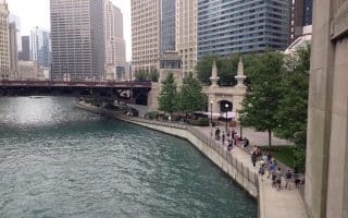
The 4-mile loop of the Chicago Riverwalk is a great way to do an off-road run combining views of the water, the Chicago skyline, and some of the city's architectural highlights. Path is mainly on the south side of the river.
Fabulous running about 5 miles south of the Loop. Highlights include Promontory Point, Jackson Park, the University of Chicago, and Washington Park, and the 'Midway Pleasance',-- a European-style allée.
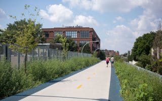
A brand new elevated urban trail built along a former rail line in Chicago's west side. The wonderful 2.7-mile greenway features separate pedestrian & bike paths, public art, and lovely landscaping. Humboldt Park a nice add-on.
As a standalone run or an add-on to the 606 Trail, we've put together a nice run incorporating these two extensive city parks, which have their own self-contained loops of ~2 miles. It's 1.5 miles between the parks.
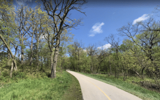
A nice option in the northwest part of the city. Paved greenway path goes for 8.4 miles from the North Park area into Cook County and even further to Glencoe, passing through several parks and forest preserves. Good shade on a hot day!
Outside the Loop, these are our top recommendations for running in Chicago's terrific neighborhoods, where you can create your own run combining leafy residential streets, neighborhood parks, and Chicago's historic grand boulevards.
Some excellent running options near O'Hare Airport and the major office park areas in the vicinity such as Schaumberg, Rosemont, Arlington Heights, Hoffman Estates. Many trails and paths in the large network of Forest Preserves, and the Des Plaines River Trail.
Share your feedback on this route and see that of other Great Runs users. Click on the image icon to upload a photo. And please let us know if there are notes or changes we should incorporate!
Subscribe
1 Comment
Oldest
Newest
Inline Feedbacks
View all comments
Essentials
The Lakefront Path is 18 miles. Numuerous spurs & additional options
Flat
Any point along path
Accessible from downtown. There are access points along the way, via underground paddes & pedestrian bridges. Also, CTA stations nearby, allowing for one-way run options


Review or Comment on This Route/Share a Photo!
Share your feedback on this route and see that of other Great Runs users. Click on the image icon to upload a photo. And please let us know if there are notes or changes we should incorporate!