This is a 5-6 km tour of the historic center of Stavanger, some paths along the water, and a loop around a small lake in Byparken. There are good options to add on.
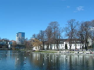
Byparken. Creative Commons 2.5
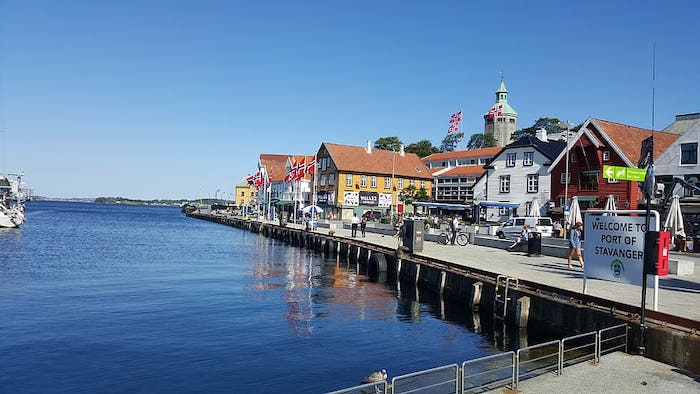
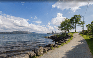
Start in the area near the ferry terminal & Petroleum Museum. This first 2.4 km section is a run along the waterfront roads, which change names several times. It’s part sidewalk and part dedicated path. Just north of Bjergstedparken, retrace your steps for 1.4 km to Byparken, and enjoy the ~1 km loop around the lake. Then, take Skaken through old town to the hilltop Valberg Tower scenic point, which features great views! Conclude the route by running through a few of the narrow streets of Old Town — be sure to take Øvre Holmegate, known for its colorful houses.
This is a 5-6 km tour of the historic center of Stavanger, some paths along the water, and a loop around a small lake in Byparken. There are good options to add on.
Byparken. Creative Commons 2.5
Start in the area near the ferry terminal & Petroleum Museum. This first 2.4 km section is a run along the waterfront roads, which change names several times. It’s part sidewalk and part dedicated path. Just north of Bjergstedparken, retrace your steps for 1.4 km to Byparken, and enjoy the ~1 km loop around the lake. Then, take Skaken through old town to the hilltop Valberg Tower scenic point, which features great views! Conclude the route by running through a few of the narrow streets of Old Town — be sure to take Øvre Holmegate, known for its colorful houses.
Scroll Down For Route Maps
Essentials
Mapped route is 5.4 km, add with a bit more in Old Town
A dramatic run over the 1 km Stavanger City Bridge on a wide multi-use path. Great views of the water & surrounding geography. Then, enjoy 1.2 km along the eastern waterfront. Combine with our Stavanger Centre route for a longer run.
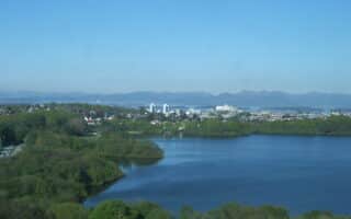
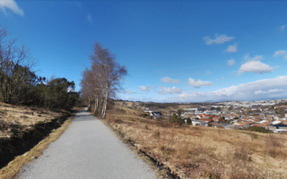
A pleasant loop around Mosvatnet Lake, with the option to add some paths in adjacent Vålandsparken. All on wide gravel paths. Combination of open & wooded, with some water views.
A popular running spot in western Stavanger. Paths on both sides of the lake, with some lovely water views. Full lake loop is 8.6 km. Can combine with linear park paths headed south of the lake.
A lovely series of waterfront paths around a series of small harbors and marinas, including Golden Strand Beach. Lovely views and scenic running. It's a 7.2 km out and back. Combine with a dip in the Strømvik public pool!
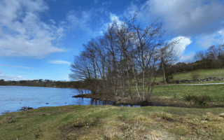
The largest contiguous green space in Stavanger is a good spot for an easy to moderate trail run. 8 km of trails over 370 acres. Mostly wooded and fairly hilly. Great views from the Ullandhaugstårnet Tower!
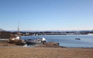
Two nice routes on Hundvåg, an island located 6 km north of Stavanger. The east end route combines waterfront paths with interior paths through farmland. The northern route is on paths around the northern tip. Can be combined with a 1 km road connection.
Share your feedback on this route and see that of other Great Runs users. Click on the image icon to upload a photo. And please let us know if there are notes or changes we should incorporate!
Subscribe
0 Comments
Oldest
Newest
Inline Feedbacks
View all comments
Essentials
Mapped route is 5.4 km, add with a bit more in Old Town


Review or Comment on This Route/Share a Photo!
Share your feedback on this route and see that of other Great Runs users. Click on the image icon to upload a photo. And please let us know if there are notes or changes we should incorporate!