This is a guide to the best places to run in Goshen, a city 25 miles east of South Bend and part of the South Bend–Elkhart–Mishawaka Combined Statistical Area. From the center of town, there’s some pleasant running on a couple of multi-use paths.
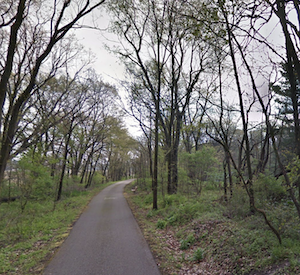
Pumpkinvine Trail. Google Street View
Maple City Greenway/Pumpkinvine Nature Trail. Run up to 12 miles between Goshen and Middlebury! The trail starts at Dickerson Landing and goes for 1 mile before turning into the Pumpkinvine Nature Trail. The trail is mainly paved, except for a 1.75 mile gravel section, and the terrain is a mix of residential (near the beginning), woods, and some open farmland. There’s a ~1 mile on-road section between miles 8-9. TRAIL INFORMATIONROUTE MAP
At the 1.7 mile mark, just past E Lincoln Rd., a spur heads south for 0.5 miles to Fidler Pond, which features a scenic 1.5 mile perimeter path.
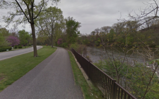
Milltrace Canal Trail. Our favorite run in Goshen. This gravel trail runs along the Milltrace Canal for 2 miles, passing through Shanklin Park & Milltrace Park, ending at the northern end of Goshen Dam Pond. There are lovely views of the narrow canal. A nice 1.5 mile spur in Shanklin Park goes west to Mullet Park, adding 1.5 miles out & back. Route is 4 miles out & back or 5.5 miles with the Shanklin Spur. Pro tip: post-run brew at Goshen Brewing Company. ROUTE MAP
Add-Ons:Nice residential streets in the area just east of the trail, especially in Historic Southside.
MapleHeart Trail to Elkhart. Not the most scenic run, but a good way to clock in some flat, off-road miles. This paved trail is more of a sidewalk alongside busy County Road 45, and runs for 6.3 miles between Goshen and Elkhart. ROUTE MAP
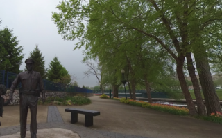
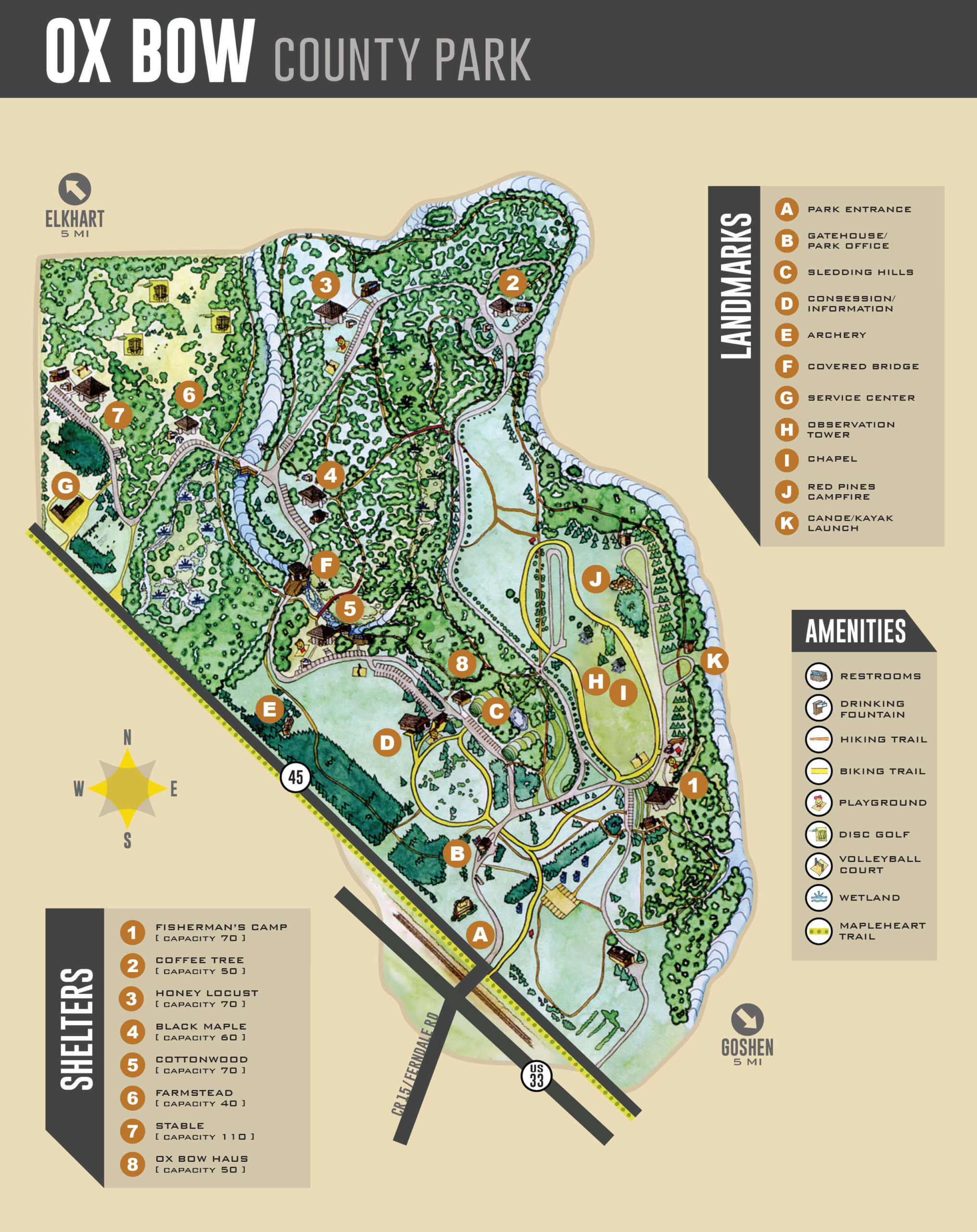
Ox Bow County Park. Pleasant park between Goshen & Elkhart with 2-3 miles of trails, including hiking trails & a bicycle trail. PARK MAP
This is a guide to the best places to run in Goshen, a city 25 miles east of South Bend and part of the South Bend–Elkhart–Mishawaka Combined Statistical Area. From the center of town, there’s some pleasant running on a couple of multi-use paths.
Pumpkinvine Trail. Google Street View
Maple City Greenway/Pumpkinvine Nature Trail. Run up to 12 miles between Goshen and Middlebury! The trail starts at Dickerson Landing and goes for 1 mile before turning into the Pumpkinvine Nature Trail. The trail is mainly paved, except for a 1.75 mile gravel section, and the terrain is a mix of residential (near the beginning), woods, and some open farmland. There’s a ~1 mile on-road section between miles 8-9. TRAIL INFORMATIONROUTE MAP
At the 1.7 mile mark, just past E Lincoln Rd., a spur heads south for 0.5 miles to Fidler Pond, which features a scenic 1.5 mile perimeter path.
Milltrace Canal Trail. Our favorite run in Goshen. This gravel trail runs along the Milltrace Canal for 2 miles, passing through Shanklin Park & Milltrace Park, ending at the northern end of Goshen Dam Pond. There are lovely views of the narrow canal. A nice 1.5 mile spur in Shanklin Park goes west to Mullet Park, adding 1.5 miles out & back. Route is 4 miles out & back or 5.5 miles with the Shanklin Spur. Pro tip: post-run brew at Goshen Brewing Company. ROUTE MAP
Add-Ons:Nice residential streets in the area just east of the trail, especially in Historic Southside.
MapleHeart Trail to Elkhart. Not the most scenic run, but a good way to clock in some flat, off-road miles. This paved trail is more of a sidewalk alongside busy County Road 45, and runs for 6.3 miles between Goshen and Elkhart. ROUTE MAP
Ox Bow County Park. Pleasant park between Goshen & Elkhart with 2-3 miles of trails, including hiking trails & a bicycle trail. PARK MAP
Up to 9 miles of paved multi-use paths along the St. Joseph River, which we've divided the route into three sections: North (Riverside Trail), Central (E-Bank/Northside Trail), South (Mishawaka RiverWalk). Numerous parks & lovely river views.
A lovely 4.4 mile loop in South Bend's downtown area, focused on paths along both banks of the St. Joseph River. There are several parks and some nice river views. A great bet if you're staying downtown! Can add w/additional riverside paths.
Create your own route or use our 5 mile loop to enjoy a run around this historic & attractive campus. Large network of pedestrian paths around academic & residential quads, impressive buildings, two lake loops, and a running track.
A good option to clock in some miles on this paved multi-use path that runs for up to 6.4 miles north to Niles, Michigan. Mainly flat, passing through residential communities.
This 3800-acre state park located 15 miles south of South Bend has something for every runner. 20+ miles of trails, ranging from an easy to more rugged, on a nice variety of terrain, including woods, fields, wetlands, & restored prairie.
In Elkhart, some scenic running on trails along the Elkhart River, including several riverfront parks. We've mapped two routes which can be combined for a 10-miler! We also like running in Ox Bow County Park.
Share your feedback on this route and see that of other Great Runs users. Click on the image icon to upload a photo. And please let us know if there are notes or changes we should incorporate!


Review or Comment on This Route/Share a Photo!
Share your feedback on this route and see that of other Great Runs users. Click on the image icon to upload a photo. And please let us know if there are notes or changes we should incorporate!