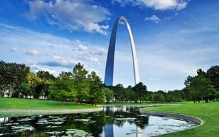
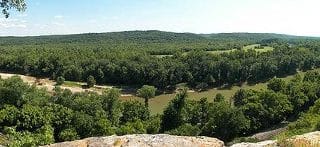
This is a lovely run with excellent variety in St. Charles, a northwestern suburb of St. Louis situated on the Missouri River. St. Charles is the site of the first permanent European settlement on the Missouri River and of the embarkation of Lewis and Clark’s journey of exploration along the Missouri. This route features a section of the Katy Trail, the St. Charles Historic District, several parks, and two running tracks! The full route is 7 miles, with good options for longer or shorter. Pro Tip: The bike cafe is a great spot for a drink or a bite, with outdoor tables & a good vibe.
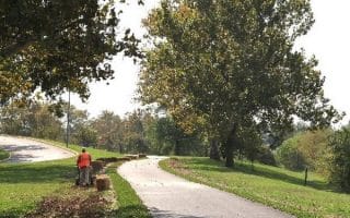
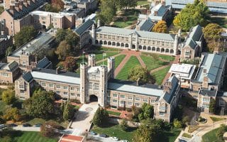
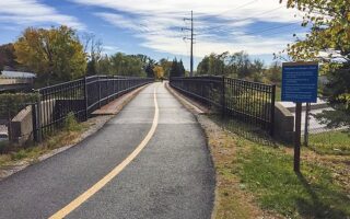
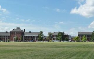
The anchor of this route is the Katy Trail. A section of this 264-mile multi-use trail that runs between Clinton, MO & Machens, MO passes through St. Charles. Start at the Lewis & Clark Monument on the Katy Trail at Frontier Park. Run east along the trail through the park for 1.5 miles to the Blanchette Viewpoint in DuSable Park, enjoying the green park paths and views of the Missouri. Use Olive St. & Randolph St. to head inland, crossing Kingshighway into Blanchette Park, where there’s a nice 0.5 mile loop path. Then, head east on Pine St. & Lindenwood Ave. for 1.7 miles to Lindwood University, passing the running track at St. Charles High School. Lindenwood University has some nice paths around campus, and a terrific running track at the Lou Brock Sports Complex.
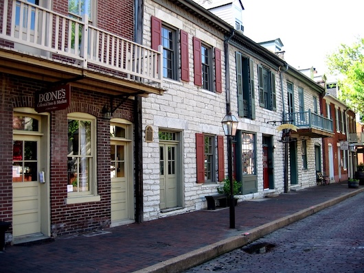
Exit the university and run east along the pleasant, residential Jefferson St. for nearly 1 mile, completing the route with a jaunt down St. Main St. It’s a National Historic District, with shops & restaurants in lovely older buildings.
Longer Option: Add miles on the Katy Trail. Shorter Option: Can just to the Katy from Frontier Park to DuSable Park and then the Main St. Historic District — that would be a ~4 mile run.
This is a lovely run with excellent variety in St. Charles, a northwestern suburb of St. Louis situated on the Missouri River. St. Charles is the site of the first permanent European settlement on the Missouri River and of the embarkation of Lewis and Clark’s journey of exploration along the Missouri. This route features a section of the Katy Trail, the St. Charles Historic District, several parks, and two running tracks! The full route is 7 miles, with good options for longer or shorter. Pro Tip: The bike cafe is a great spot for a drink or a bite, with outdoor tables & a good vibe.
The anchor of this route is the Katy Trail. A section of this 264-mile multi-use trail that runs between Clinton, MO & Machens, MO passes through St. Charles. Start at the Lewis & Clark Monument on the Katy Trail at Frontier Park. Run east along the trail through the park for 1.5 miles to the Blanchette Viewpoint in DuSable Park, enjoying the green park paths and views of the Missouri. Use Olive St. & Randolph St. to head inland, crossing Kingshighway into Blanchette Park, where there’s a nice 0.5 mile loop path. Then, head east on Pine St. & Lindenwood Ave. for 1.7 miles to Lindwood University, passing the running track at St. Charles High School. Lindenwood University has some nice paths around campus, and a terrific running track at the Lou Brock Sports Complex.
Exit the university and run east along the pleasant, residential Jefferson St. for nearly 1 mile, completing the route with a jaunt down St. Main St. It’s a National Historic District, with shops & restaurants in lovely older buildings.
Longer Option: Add miles on the Katy Trail. Shorter Option: Can just to the Katy from Frontier Park to DuSable Park and then the Main St. Historic District — that would be a ~4 mile run.


Review or Comment on This Route/Share a Photo!
Share your feedback on this route and see that of other Great Runs users. Click on the image icon to upload a photo. And please let us know if there are notes or changes we should incorporate!