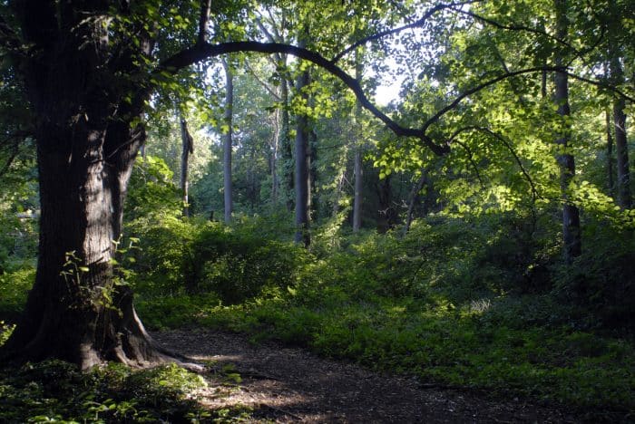
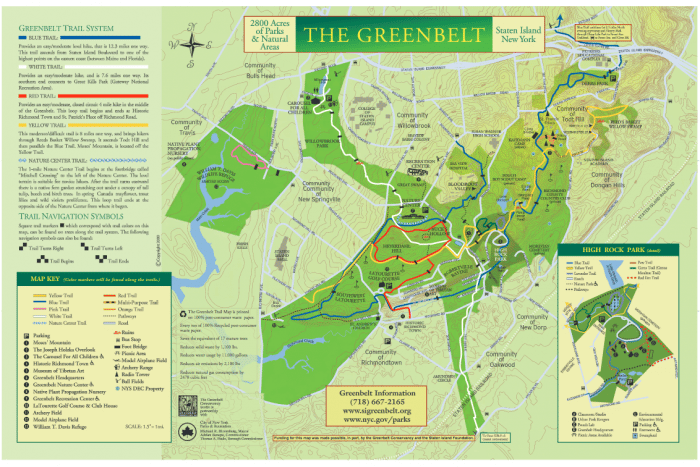
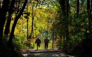
In the heart of Staten Island is 2,800-acres of nature’s rugged beauty — the Greenbelt. The Greenbelt features mature forests, wetlands, meadows, wildlife, over 35-miles of well marked hiking trails and a multipurpose trail. The mostly flat 2.6 mile circuit, multipurpose trail, has a crushed gravel surface and six-foot wide walkways. It extends westward from Rockland Avenue along Forest Hill Road hugging the perimeter of LaTourette golf course toward Richmond Avenue. The Yellow and Blue trails intersect the multipurpose trail here (see trail map). About midway, a leg of the trail branches off toward Historic Richmond Town/St. Andrews Church at Old Mill Road at the base of Richmond Hill Road (aka Snake Hill). To make a loop, take the Blue and Red trails or follow Rockland Ave and Richmond Ave to Old Mill Road. There are numerous bus routes that access the Greenbelt Nature Center. For access from the ferry, take the SIR to New Dorp then take the S57 to the Rockland Ave./Brielle Ave. stop.
In the heart of Staten Island is 2,800-acres of nature’s rugged beauty — the Greenbelt. The Greenbelt features mature forests, wetlands, meadows, wildlife, over 35-miles of well marked hiking trails and a multipurpose trail. The mostly flat 2.6 mile circuit, multipurpose trail, has a crushed gravel surface and six-foot wide walkways. It extends westward from Rockland Avenue along Forest Hill Road hugging the perimeter of LaTourette golf course toward Richmond Avenue. The Yellow and Blue trails intersect the multipurpose trail here (see trail map). About midway, a leg of the trail branches off toward Historic Richmond Town/St. Andrews Church at Old Mill Road at the base of Richmond Hill Road (aka Snake Hill). To make a loop, take the Blue and Red trails or follow Rockland Ave and Richmond Ave to Old Mill Road. There are numerous bus routes that access the Greenbelt Nature Center. For access from the ferry, take the SIR to New Dorp then take the S57 to the Rockland Ave./Brielle Ave. stop.
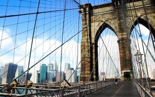
Incorporating one New York’s iconic bridges is an integral part of the running experience in New York City. Brooklyn Bridge is a ‘must do’. This nearly 4-mile run features the Brooklyn and Manhattan bridges.
Sort of a mini Central Park, this is the best green space option for running in Brooklyn. Many lovely paths and runner-friendly roads. Nice detour options into the brownstone-lined streets of Park Slope.
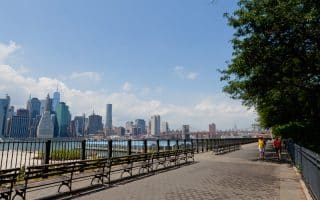
Fantastic 5k loop showcasing views of the East River, Manhattan skyline, the Statue of Liberty, and the Brooklyn Bridge! There's a section along the Brooklyn waterfront between Pier 6 and the Dumbo, and then along the Brooklyn Heights Promenade. Good add-on options.
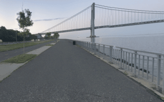
In the Bay Ridge part of Brooklyn, there's a terrific multi-use path that goes along the water for 4.5 miles from Owl's Head Park to Bensonhurst Park. There are great views of the Upper Bay, city skyline, and the Verrazano–Narrows Bridge.
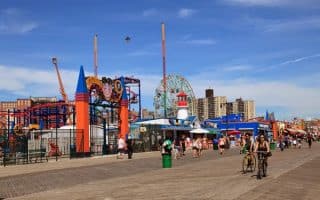
Coney Island is the quintessential New York attraction, from the beach to the boardwalk to the rides at Luna Park. The boardwalk is approximately 2.5 miles from end to end. For a longer run, extend east along the water to Sheepshead Bay.
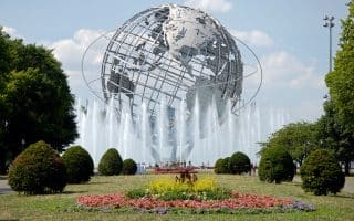
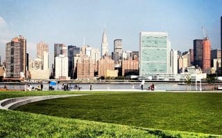
This loop features Citipark (NY Mets), the Queens Art Museum, Arthur Ashe Stadium (US Open — Tennis), and an array of art pieces left over from the World’s Fair. Extension option of 2.4 miles around Meadow Lake.
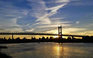
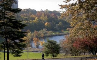
A wonderful resource for Queens runners and those Manhattanites willing to cross the Triborough Bridge. Wonderful view of the city skyline and the Triborough Bridge, in this lovely park. Add w/Randall's Island.
This route is perfect if you’re staying at a JFK Airport area hotel. One can put together a lovely 3-mile mile perimeter loop, including Baisley Pond Park and its lovely pond.
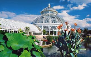
One of the most spectacular botanical gardens in the country. It is possible to run in here, especially the outer loop, which we’ve mapped out. We have also included a map of the botanical gardens.
NYC’s fourth largest park. Great options for runners, with trails and marked cross-country courses, through the park’s ridges, valleys, forests, wetlands, aqueducts, and lake. Includes the new Putnam Greenway, which runs the length of the park
Paved multi-use path is a good option for a centrally located off-road run in the Bronx. We like the 3 miles between Starlight Park & Soundview Park, adding Crotona Park for a longer option.
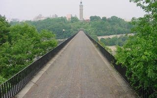
Recently re-opened after being closed for decades, NYC’s oldest standing bridge connects Manhattan to the Bronx at the Harlem River. The run includes lovely Highbridge Park on the Manhattan side.
NYC’s largest park! Overlooking Pelham Bay on Long Island Sound, There's a good variety of running options here, including multi-use paths, fields, a beachside promenade, and a more rugged loop around Hunters Island.
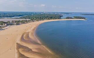
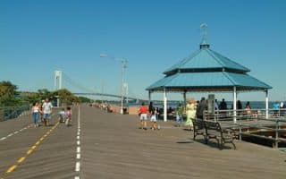
The 2.5-mile Staten Island Boardwalk runs along Staten Island’s own South Beach at the base of the Verrazano-Narrows Bridge, providing views of ships coming into the harbor, and the Atlantic. Great running, great views.
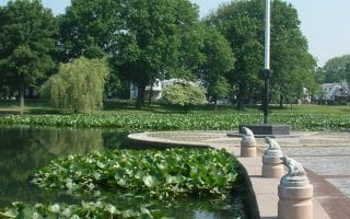
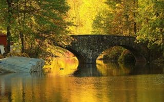
Site of the 6-Hour Ultramarathon, a 2 mile loop that the winner usually completes around 25 times. Park highlights include multiple lakes and ponds, outcroppings of serpentine rocks, and a 300 yr. old tulip tree.
Staten Island’s response to Manhattan’s Central Park and Brooklyn’s Prospect Park. Abundant recreational activities amidst plenty of trails and open space. 2 mile lake loop, can combine w/Cloves Lake Park & Staten Island Greenbelt.
Share your feedback on this route and see that of other Great Runs users. Click on the image icon to upload a photo. And please let us know if there are notes or changes we should incorporate!


Review or Comment on This Route/Share a Photo!
Share your feedback on this route and see that of other Great Runs users. Click on the image icon to upload a photo. And please let us know if there are notes or changes we should incorporate!